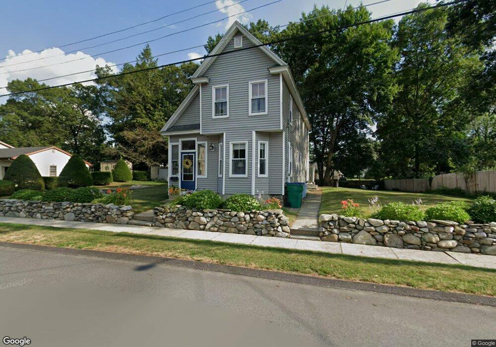
27 Dayton St Lowell, MA 01852
South Lowell NeighborhoodEstimated Value: $567,000 - $588,000
3
Beds
2
Baths
1,516
Sq Ft
$381/Sq Ft
Est. Value
About This Home
This home is located at 27 Dayton St, Lowell, MA 01852 and is currently estimated at $578,203, approximately $381 per square foot. 27 Dayton St is a home located in Middlesex County with nearby schools including Moody Elementary School, Abraham Lincoln Elementary School, and Greenhalge Elementary School.
Ownership History
Date
Name
Owned For
Owner Type
Purchase Details
Closed on
Jun 7, 1994
Sold by
Est Gary J Slavin and Mccarthy Kathleen
Bought by
Duttweiler Russell and Duttweiler Babette
Current Estimated Value
Home Financials for this Owner
Home Financials are based on the most recent Mortgage that was taken out on this home.
Original Mortgage
$74,949
Interest Rate
8.49%
Mortgage Type
Purchase Money Mortgage
Create a Home Valuation Report for This Property
The Home Valuation Report is an in-depth analysis detailing your home's value as well as a comparison with similar homes in the area
Home Values in the Area
Average Home Value in this Area
Purchase History
| Date | Buyer | Sale Price | Title Company |
|---|---|---|---|
| Duttweiler Russell | $75,000 | -- | |
| Duttweiler Russell | $75,000 | -- |
Source: Public Records
Mortgage History
| Date | Status | Borrower | Loan Amount |
|---|---|---|---|
| Open | Duttweiler Russell | $140,000 | |
| Closed | Duttweiler Russell | $88,000 | |
| Closed | Duttweiler Russell | $82,500 | |
| Closed | Duttweiler Russell | $74,949 |
Source: Public Records
Tax History Compared to Growth
Tax History
| Year | Tax Paid | Tax Assessment Tax Assessment Total Assessment is a certain percentage of the fair market value that is determined by local assessors to be the total taxable value of land and additions on the property. | Land | Improvement |
|---|---|---|---|---|
| 2025 | $5,832 | $508,000 | $231,200 | $276,800 |
| 2024 | $5,683 | $477,200 | $216,200 | $261,000 |
| 2023 | $5,277 | $424,900 | $187,900 | $237,000 |
| 2022 | $4,938 | $389,100 | $170,900 | $218,200 |
| 2021 | $4,597 | $341,500 | $148,600 | $192,900 |
| 2020 | $4,339 | $324,800 | $141,500 | $183,300 |
| 2019 | $4,056 | $288,900 | $131,100 | $157,800 |
| 2018 | $3,963 | $275,400 | $124,800 | $150,600 |
| 2017 | $3,669 | $245,900 | $104,000 | $141,900 |
| 2016 | $3,441 | $227,000 | $97,300 | $129,700 |
| 2015 | $3,365 | $217,400 | $97,300 | $120,100 |
| 2013 | $3,326 | $221,600 | $115,800 | $105,800 |
Source: Public Records
Map
Nearby Homes
- 82 Boylston Ln Unit 16
- 90 Roper St Unit G
- 1199 Lawrence St
- 72 N Billerica Rd
- 51 Melim Dr
- 22 Juniper St
- 296 Astle St
- 64 Bolton St
- 56 Arnold Ave
- 70 Arnold Ave
- 18 Whitehead Ave
- 1081 Lawrence St
- 28 Greenwood Ave
- 164 Astle St
- 80 Sesame St
- 97 Hoyt Ave
- 11 Park Ave
- 197 Moore St
- 5 Lenox St Unit 2
- 31 Wells Dr