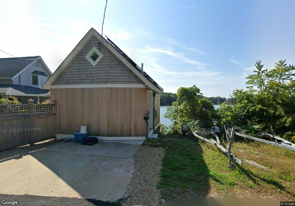
27 Dennison St Unit 29 Gloucester, MA 01930
3
Beds
2
Baths
1,910
Sq Ft
6,098
Sq Ft Lot Lot
About This Home
This home is located at 27 Dennison St Unit 29, Gloucester, MA 01930. 27 Dennison St Unit 29 is a home located in Essex County with nearby schools including Plum Cove School, Ralph B O'maley Middle School, and Gloucester High School.
Create a Home Valuation Report for This Property
The Home Valuation Report is an in-depth analysis detailing your home's value as well as a comparison with similar homes in the area
Tax History
| Year | Tax Paid | Tax Assessment Tax Assessment Total Assessment is a certain percentage of the fair market value that is determined by local assessors to be the total taxable value of land and additions on the property. | Land | Improvement |
|---|---|---|---|---|
| 2025 | $78 | $8,000 | $4,300 | $3,700 |
| 2024 | $78 | $8,000 | $4,300 | $3,700 |
| 2023 | $80 | $7,600 | $3,900 | $3,700 |
| 2022 | $83 | $7,100 | $3,400 | $3,700 |
| 2021 | $85 | $6,800 | $3,100 | $3,700 |
| 2020 | $84 | $6,800 | $3,100 | $3,700 |
| 2019 | $86 | $6,800 | $3,100 | $3,700 |
| 2018 | $88 | $6,800 | $3,100 | $3,700 |
| 2017 | $116 | $8,800 | $2,900 | $5,900 |
| 2016 | $120 | $8,800 | $2,900 | $5,900 |
| 2015 | $120 | $8,800 | $2,900 | $5,900 |
Source: Public Records
Map
Nearby Homes
- 672 Washington St
- 65 Leonard St
- 136 Leonard St
- 38 Revere St
- 498 Washington St
- 4 Ciaramitaro Ct
- 3 Colburn St Unit 1
- 226 Atlantic St
- 220 Atlantic St
- 457 Washington St Unit 2
- 31 Echo Ave
- 178 Atlantic St
- 167 Atlantic St
- 6 Corliss Ave
- 35 Reservoir Rd
- 6-8 Joppa Way
- 10 Riverview Way Unit A
- 43 High St Unit B
- 5R Brooks Rd
- 176 Main St Unit B
- 27 Dennison St
- 29 Dennison St
- 28 Dennison St
- 31 Dennison St
- 31 Dennison St
- 33 Dennison St
- 19 Dennison St
- 1 Youngs Rd
- 35 Dennison St
- 34 Dennison St
- 3 Youngs Rd
- 37 Dennison St
- 11 Dennison St
- 11 Dennison St Unit SUMMER
- 11 Dennison St Winter Rental
- 11 Dennison St Summer Rental
- 42 Dennison St
- 42 Dennison St
- 5 Youngs Rd
- 22 Dennison St
Your Personal Tour Guide
Ask me questions while you tour the home.