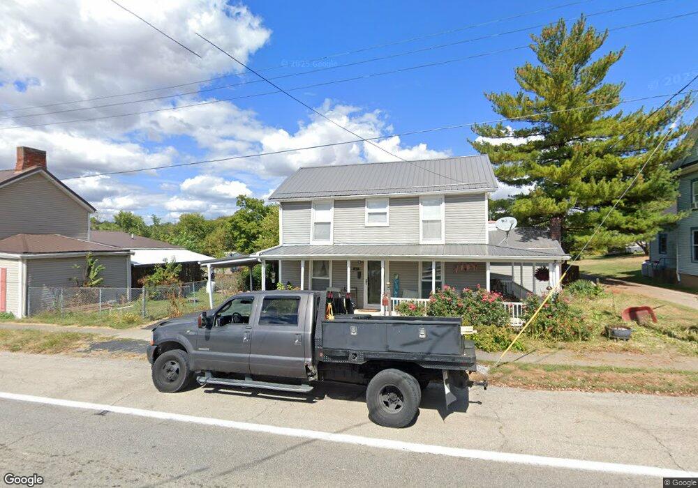
27 E Main St Clarksville, OH 45113
Estimated Value: $135,000 - $176,000
2
Beds
1
Bath
1,198
Sq Ft
$125/Sq Ft
Est. Value
About This Home
This home is located at 27 E Main St, Clarksville, OH 45113 and is currently estimated at $149,984, approximately $125 per square foot. 27 E Main St is a home located in Clinton County with nearby schools including Clinton-Massie Elementary School, Clinton-Massie Middle School, and Clinton-Massie High School.
Ownership History
Date
Name
Owned For
Owner Type
Purchase Details
Closed on
Oct 23, 2002
Sold by
Trst Ann Barham
Bought by
Starkey Kathryn L
Current Estimated Value
Home Financials for this Owner
Home Financials are based on the most recent Mortgage that was taken out on this home.
Original Mortgage
$47,000
Interest Rate
6.29%
Mortgage Type
New Conventional
Purchase Details
Closed on
Sep 21, 1998
Sold by
Barham Willard P and Barham Ann A
Bought by
Barham Willard P and Barham Ann A
Purchase Details
Closed on
Aug 20, 1998
Bought by
Barham Willard P and Barham Ann A
Purchase Details
Closed on
Jan 1, 1990
Bought by
Barham Bldg
Create a Home Valuation Report for This Property
The Home Valuation Report is an in-depth analysis detailing your home's value as well as a comparison with similar homes in the area
Purchase History
| Date | Buyer | Sale Price | Title Company |
|---|---|---|---|
| Starkey Kathryn L | $30,000 | -- | |
| Barham Willard P | -- | -- | |
| Barham Willard P | -- | -- | |
| Barham Bldg | -- | -- |
Source: Public Records
Mortgage History
| Date | Status | Borrower | Loan Amount |
|---|---|---|---|
| Closed | Starkey Kathryn L | $47,000 |
Source: Public Records
Tax History
| Year | Tax Paid | Tax Assessment Tax Assessment Total Assessment is a certain percentage of the fair market value that is determined by local assessors to be the total taxable value of land and additions on the property. | Land | Improvement |
|---|---|---|---|---|
| 2025 | $823 | $34,690 | $4,800 | $29,890 |
| 2024 | $823 | $34,690 | $4,800 | $29,890 |
| 2023 | $893 | $34,690 | $4,800 | $29,890 |
| 2022 | $472 | $20,730 | $3,890 | $16,840 |
| 2021 | $474 | $20,730 | $3,890 | $16,840 |
| 2020 | $792 | $20,730 | $3,890 | $16,840 |
| 2019 | $584 | $15,390 | $3,040 | $12,350 |
| 2018 | $575 | $15,390 | $3,040 | $12,350 |
| 2017 | $576 | $15,390 | $3,040 | $12,350 |
| 2016 | $624 | $16,700 | $2,910 | $13,790 |
| 2015 | $591 | $16,700 | $2,910 | $13,790 |
| 2013 | $626 | $16,420 | $2,910 | $13,510 |
Source: Public Records
Map
Nearby Homes
- 54 2nd St
- 181 Water St
- 185 Water St
- 0 State Route 22 3 Unit 1869234
- 620 State Route 132 Unit B
- 620 State Route 132
- 4269 Pansy Rd
- 852 State Route 132
- 3532 S Clarksville Rd
- 0 Gum Grove Rd Unit 941687
- 0 Gum Grove Rd Unit 1852123
- 955 Windsor Ave
- 420 Kensington Dr
- 712 Blazing Trail
- 0 Wilmington Rd Unit 1856534
- 9029 Arrowcreek Dr
- 9132 St Rt 730
- 9132 State Route 730
- Us Highway 22 and 3
- 11246 Ohio 730
- 43 E Main St
- 11 E Main St
- 36 N 1st St
- 7 Gum Grove Rd
- 58 N 1st St
- 8 State Route 350
- 8 Lot State Route 350
- 8 St Rt 350
- 0 Route 350 Unit 731262
- 0 Route 350 Unit 897138
- 4 St Rt 350
- 1 Ohio 350
- 0 State Route 132 Unit 583247
- 55 N 1st St
- 4 Route 350
- 4 State Rt 350
- 3 Ohio 350
- 11 W Main St
- 5 Ohio 350
- 15 St Rt 350
Your Personal Tour Guide
Ask me questions while you tour the home.