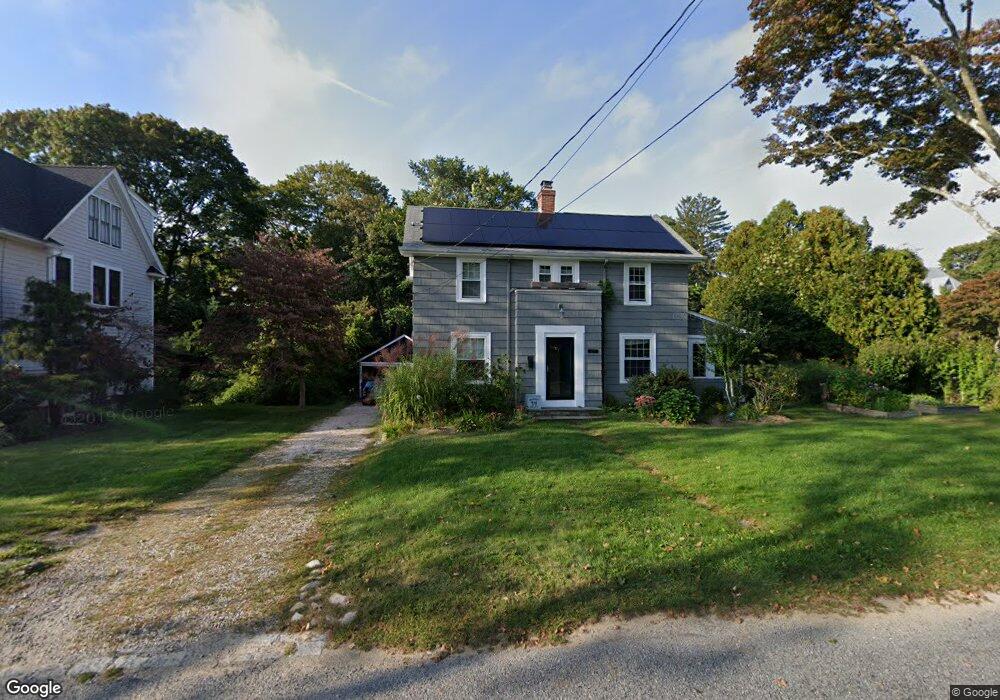
27 Eldred Ct Wakefield, RI 02879
Estimated Value: $617,000 - $708,000
2
Beds
2
Baths
1,536
Sq Ft
$427/Sq Ft
Est. Value
About This Home
This home is located at 27 Eldred Ct, Wakefield, RI 02879 and is currently estimated at $656,025, approximately $427 per square foot. 27 Eldred Ct is a home located in Washington County with nearby schools including South Kingstown High School and Monsignor Matthew Clarke Catholic Regional School.
Ownership History
Date
Name
Owned For
Owner Type
Purchase Details
Closed on
Jul 6, 2006
Sold by
Milstead William Brayan and May Catherine M
Bought by
Ray Rajan and Fox Kate A
Current Estimated Value
Purchase Details
Closed on
Jan 3, 2003
Sold by
Portugali Maria E and Portugali Roni A
Bought by
Milstead William Bryan and May Catherine M
Purchase Details
Closed on
Jun 3, 1999
Sold by
Tyler Dawn P and Graham Nye H
Bought by
Portugali Maria E and Portugali Roni A
Create a Home Valuation Report for This Property
The Home Valuation Report is an in-depth analysis detailing your home's value as well as a comparison with similar homes in the area
Home Values in the Area
Average Home Value in this Area
Purchase History
| Date | Buyer | Sale Price | Title Company |
|---|---|---|---|
| Ray Rajan | $350,000 | -- | |
| Milstead William Bryan | $270,000 | -- | |
| Portugali Maria E | $151,500 | -- |
Source: Public Records
Mortgage History
| Date | Status | Borrower | Loan Amount |
|---|---|---|---|
| Open | Portugali Maria E | $247,500 | |
| Closed | Portugali Maria E | $259,297 | |
| Closed | Portugali Maria E | $280,000 |
Source: Public Records
Tax History
| Year | Tax Paid | Tax Assessment Tax Assessment Total Assessment is a certain percentage of the fair market value that is determined by local assessors to be the total taxable value of land and additions on the property. | Land | Improvement |
|---|---|---|---|---|
| 2025 | $4,387 | $490,700 | $238,800 | $251,900 |
| 2024 | $4,409 | $399,000 | $183,700 | $215,300 |
| 2023 | $4,409 | $399,000 | $183,700 | $215,300 |
| 2022 | $4,369 | $399,000 | $183,700 | $215,300 |
| 2021 | $4,254 | $294,400 | $138,400 | $156,000 |
| 2020 | $4,254 | $294,400 | $138,400 | $156,000 |
| 2019 | $4,254 | $294,400 | $138,400 | $156,000 |
| 2018 | $4,075 | $259,900 | $127,700 | $132,200 |
| 2017 | $3,880 | $253,400 | $127,700 | $125,700 |
| 2016 | $3,824 | $253,400 | $127,700 | $125,700 |
| 2015 | $3,565 | $229,700 | $116,100 | $113,600 |
| 2014 | $3,556 | $229,700 | $116,100 | $113,600 |
Source: Public Records
Map
Nearby Homes
- 40 Northup St
- 50 Shadow Farm Way
- 35 Abbey Rd
- 302 Pond St
- 37 Columbia St
- 20 Cleveland St
- 39 Hazard Ave
- 45 Cherry Ln Unit C
- 131 Columbia St
- 23 Rockland Dr
- 100 Spartina Cove Way
- 48 Stone Bridge Dr
- 301 Church St Unit 103
- 47 Tuckertown Rd
- 15 Jessica Ln
- 39 Secluded Dr
- 262 Wood Hill Rd
- 143 Summit Ave
- 260 Sweet Allen Farm Rd Unit 3
- 57 Rocky Brook Way
Your Personal Tour Guide
Ask me questions while you tour the home.