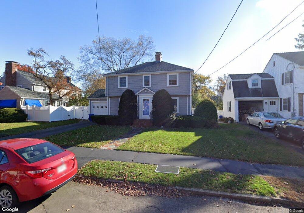
27 Eliot Rd Arlington, MA 02474
East Arlington NeighborhoodEstimated Value: $1,097,000 - $1,287,613
3
Beds
2
Baths
1,434
Sq Ft
$847/Sq Ft
Est. Value
About This Home
This home is located at 27 Eliot Rd, Arlington, MA 02474 and is currently estimated at $1,213,903, approximately $846 per square foot. 27 Eliot Rd is a home located in Middlesex County with nearby schools including Hardy Elementary School, Ottoson Middle School, and Arlington High School.
Ownership History
Date
Name
Owned For
Owner Type
Purchase Details
Closed on
Mar 11, 2021
Sold by
Ulrich Paul and Ulrich Nancy
Bought by
Paul J Ulrich 2020 Ret
Current Estimated Value
Purchase Details
Closed on
Dec 27, 2007
Sold by
Bateman Anna G and Phillips Eugene A
Bought by
Ulrich Nancy and Ulrich Paul
Home Financials for this Owner
Home Financials are based on the most recent Mortgage that was taken out on this home.
Original Mortgage
$340,000
Interest Rate
6.27%
Mortgage Type
Purchase Money Mortgage
Purchase Details
Closed on
Feb 28, 2006
Sold by
Muriel V Williams T
Bought by
Moloney Gerard T and Moloney Mary Ellen C
Home Financials for this Owner
Home Financials are based on the most recent Mortgage that was taken out on this home.
Original Mortgage
$1,000,000
Interest Rate
6.17%
Mortgage Type
Purchase Money Mortgage
Create a Home Valuation Report for This Property
The Home Valuation Report is an in-depth analysis detailing your home's value as well as a comparison with similar homes in the area
Home Values in the Area
Average Home Value in this Area
Purchase History
| Date | Buyer | Sale Price | Title Company |
|---|---|---|---|
| Paul J Ulrich 2020 Ret | -- | None Available | |
| Ulrich Nancy | $501,500 | -- | |
| Moloney Gerard T | $1,275,000 | -- |
Source: Public Records
Mortgage History
| Date | Status | Borrower | Loan Amount |
|---|---|---|---|
| Previous Owner | Ulrich Nancy | $340,000 | |
| Previous Owner | Moloney Gerard T | $1,000,000 |
Source: Public Records
Tax History
| Year | Tax Paid | Tax Assessment Tax Assessment Total Assessment is a certain percentage of the fair market value that is determined by local assessors to be the total taxable value of land and additions on the property. | Land | Improvement |
|---|---|---|---|---|
| 2025 | $11,004 | $1,021,700 | $640,200 | $381,500 |
| 2024 | $10,200 | $963,200 | $611,100 | $352,100 |
| 2023 | $9,279 | $827,700 | $506,300 | $321,400 |
| 2022 | $9,087 | $795,700 | $494,700 | $301,000 |
| 2021 | $8,927 | $787,200 | $494,700 | $292,500 |
| 2020 | $8,706 | $787,200 | $494,700 | $292,500 |
| 2019 | $9,724 | $863,600 | $640,200 | $223,400 |
| 2018 | $7,669 | $632,200 | $407,400 | $224,800 |
| 2017 | $7,502 | $597,300 | $372,500 | $224,800 |
| 2016 | $6,751 | $527,400 | $302,600 | $224,800 |
| 2015 | $7,026 | $518,500 | $302,600 | $215,900 |
Source: Public Records
Map
Nearby Homes
- 29 Mott St Unit 29
- 30 Elmhurst Rd
- 315 Lake St
- 454-460 Massachusetts Ave
- 9 Venner Rd
- 314 Channing Rd
- 31 Brunswick Rd
- 61-63 Foster St
- 23 Loomis St Unit 23
- 93 Griswold St Unit 93
- 95 Griswold St Unit 95
- 27-29 S Normandy Ave
- 52 Warren St
- 120 Broadway
- 35 Boulevard Rd Unit 37
- 53 Warren St Unit 53
- 3 Seagrave Rd
- 15 Medford St Unit 4
- 45 Teel St
- 89 Cleveland St Unit 89
Your Personal Tour Guide
Ask me questions while you tour the home.