Estimated Value: $770,000 - $864,000
3
Beds
3
Baths
1,540
Sq Ft
$538/Sq Ft
Est. Value
About This Home
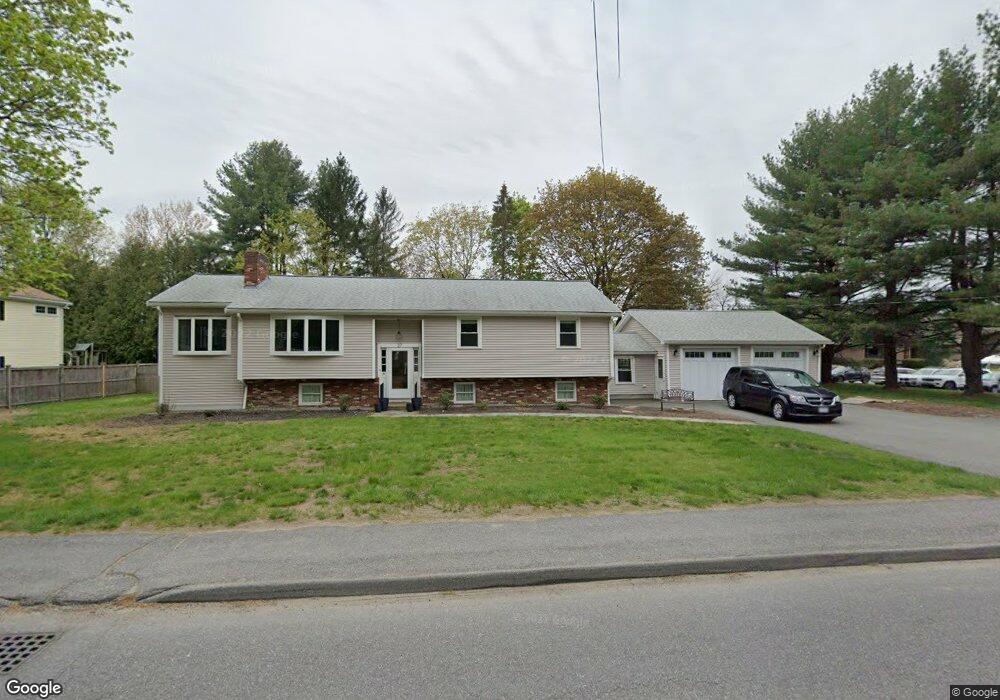
This home is located at 27 Elm St, Acton, MA 01720 and is currently estimated at $827,929, approximately $537 per square foot. 27 Elm St is a home located in Middlesex County with nearby schools including Acton-Boxborough Regional High School and The Imago School.
Ownership History
Date
Name
Owned For
Owner Type
Purchase Details
Closed on
Jun 10, 2011
Sold by
Prendivill 1996 Mary D
Bought by
Jennings Shawn and Jennings Kelly L
Current Estimated Value
Home Financials for this Owner
Home Financials are based on the most recent Mortgage that was taken out on this home.
Original Mortgage
$244,000
Outstanding Balance
$169,623
Interest Rate
4.81%
Mortgage Type
Purchase Money Mortgage
Estimated Equity
$658,306
Purchase Details
Closed on
Jan 27, 2010
Sold by
Prendiville John F
Bought by
Prendiville Mary D and Prendiville John F
Create a Home Valuation Report for This Property
The Home Valuation Report is an in-depth analysis detailing your home's value as well as a comparison with similar homes in the area
Home Values in the Area
Average Home Value in this Area
Purchase History
| Date | Buyer | Sale Price | Title Company |
|---|---|---|---|
| Jennings Shawn | $402,700 | -- | |
| Prendiville Mary D | -- | -- |
Source: Public Records
Mortgage History
| Date | Status | Borrower | Loan Amount |
|---|---|---|---|
| Open | Jennings Shawn | $244,000 |
Source: Public Records
Tax History Compared to Growth
Tax History
| Year | Tax Paid | Tax Assessment Tax Assessment Total Assessment is a certain percentage of the fair market value that is determined by local assessors to be the total taxable value of land and additions on the property. | Land | Improvement |
|---|---|---|---|---|
| 2025 | $13,761 | $802,400 | $272,500 | $529,900 |
| 2024 | $12,939 | $776,200 | $272,500 | $503,700 |
| 2023 | $10,964 | $624,400 | $247,900 | $376,500 |
| 2022 | $10,591 | $544,500 | $215,400 | $329,100 |
| 2021 | $9,907 | $489,700 | $199,300 | $290,400 |
| 2020 | $9,583 | $498,100 | $199,300 | $298,800 |
| 2019 | $9,028 | $466,100 | $199,300 | $266,800 |
| 2018 | $8,465 | $436,800 | $199,300 | $237,500 |
| 2017 | $7,794 | $408,900 | $199,300 | $209,600 |
| 2016 | $7,530 | $391,600 | $199,300 | $192,300 |
| 2015 | $7,647 | $401,400 | $199,300 | $202,100 |
| 2014 | $7,109 | $365,500 | $199,300 | $166,200 |
Source: Public Records
Map
Nearby Homes
- 9 Elm St Unit 1
- 5 Elm St Unit 1
- 285 Central St Unit 285
- 31 Mohawk Dr
- 89 Windsor Ave
- 4 Huron Rd
- 4,7,8 Crestwood Ln
- 92 Willow St Unit 3
- 92 Willow St Unit 2
- 90 Willow St Unit 1
- 68 Macintosh Ln
- 134 Russet Ln
- 169 Main St
- 12 Olde Lantern Rd
- 3 Heather Hill Rd
- 19 Railroad St Unit C2
- 129 Main St Unit 129
- 129 Main St
- 131 Main St
- 23 John Swift Rd