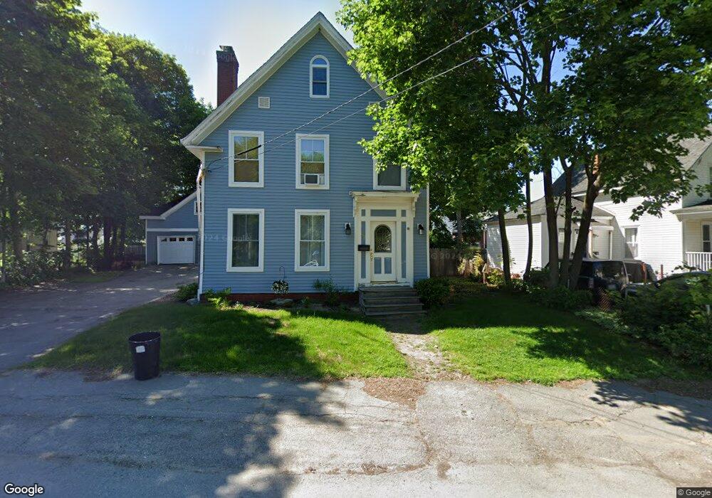
27 Fling St Brewer, ME 04412
Estimated Value: $257,000 - $302,000
4
Beds
2
Baths
2,220
Sq Ft
$129/Sq Ft
Est. Value
About This Home
This home is located at 27 Fling St, Brewer, ME 04412 and is currently estimated at $286,393, approximately $129 per square foot. 27 Fling St is a home with nearby schools including Brewer Community School, Brewer High School, and All Saints Catholic School St. Mary's campus PreK-3.
Ownership History
Date
Name
Owned For
Owner Type
Purchase Details
Closed on
Jun 8, 2021
Sold by
Cyr Leane
Bought by
Cyr Leane and Cyr Steven
Current Estimated Value
Home Financials for this Owner
Home Financials are based on the most recent Mortgage that was taken out on this home.
Original Mortgage
$203,500
Outstanding Balance
$184,244
Interest Rate
2.9%
Mortgage Type
FHA
Estimated Equity
$102,149
Purchase Details
Closed on
Apr 23, 2014
Sold by
Browning John R and Browning Roberta A
Bought by
Simpson Brian L and Simpson Sandra A
Create a Home Valuation Report for This Property
The Home Valuation Report is an in-depth analysis detailing your home's value as well as a comparison with similar homes in the area
Home Values in the Area
Average Home Value in this Area
Purchase History
| Date | Buyer | Sale Price | Title Company |
|---|---|---|---|
| Cyr Leane | -- | None Available | |
| Cyr Leane | -- | None Available | |
| Simpson Brian L | -- | -- | |
| Simpson Brian L | -- | -- |
Source: Public Records
Mortgage History
| Date | Status | Borrower | Loan Amount |
|---|---|---|---|
| Open | Cyr Leane | $203,500 | |
| Closed | Cyr Leane | $203,500 | |
| Previous Owner | Simpson Brian L | $158,730 |
Source: Public Records
Tax History Compared to Growth
Tax History
| Year | Tax Paid | Tax Assessment Tax Assessment Total Assessment is a certain percentage of the fair market value that is determined by local assessors to be the total taxable value of land and additions on the property. | Land | Improvement |
|---|---|---|---|---|
| 2024 | $4,211 | $224,000 | $27,900 | $196,100 |
| 2023 | $4,175 | $207,700 | $26,000 | $181,700 |
| 2021 | $3,820 | $171,300 | $25,700 | $145,600 |
| 2020 | $3,849 | $169,200 | $25,700 | $143,500 |
| 2019 | $3,499 | $169,200 | $25,700 | $143,500 |
| 2018 | $3,425 | $152,200 | $25,700 | $126,500 |
| 2017 | $3,425 | $152,200 | $25,700 | $126,500 |
| 2016 | $3,275 | $152,200 | $25,700 | $126,500 |
| 2015 | $3,275 | $152,200 | $25,700 | $126,500 |
| 2014 | $3,157 | $150,900 | $25,700 | $125,200 |
| 2013 | $3,577 | $171,000 | $13,400 | $157,600 |
Source: Public Records
Map
Nearby Homes