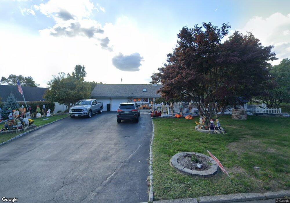
27 Forsythia Dr E Levittown, PA 19056
Forsythia Gate NeighborhoodEstimated Value: $502,825 - $545,000
3
Beds
2
Baths
2,289
Sq Ft
$225/Sq Ft
Est. Value
About This Home
This home is located at 27 Forsythia Dr E, Levittown, PA 19056 and is currently estimated at $515,706, approximately $225 per square foot. 27 Forsythia Dr E is a home located in Bucks County with nearby schools including Albert Schweitzer Elementary School, Sandburg Middle School, and Neshaminy High School.
Ownership History
Date
Name
Owned For
Owner Type
Purchase Details
Closed on
Feb 13, 2020
Sold by
Foley Louella and Hart Theresa
Bought by
Foley Louella and Foley Andrew
Current Estimated Value
Purchase Details
Closed on
Feb 17, 1998
Sold by
Reed Florence and Dickey Florence
Bought by
Foley Richard and Foley Louella
Home Financials for this Owner
Home Financials are based on the most recent Mortgage that was taken out on this home.
Original Mortgage
$119,250
Interest Rate
6.9%
Create a Home Valuation Report for This Property
The Home Valuation Report is an in-depth analysis detailing your home's value as well as a comparison with similar homes in the area
Home Values in the Area
Average Home Value in this Area
Purchase History
| Date | Buyer | Sale Price | Title Company |
|---|---|---|---|
| Foley Louella | -- | Equity One Abstract Llc | |
| Foley Richard | $132,500 | -- |
Source: Public Records
Mortgage History
| Date | Status | Borrower | Loan Amount |
|---|---|---|---|
| Previous Owner | Foley Richard | $119,250 |
Source: Public Records
Tax History Compared to Growth
Tax History
| Year | Tax Paid | Tax Assessment Tax Assessment Total Assessment is a certain percentage of the fair market value that is determined by local assessors to be the total taxable value of land and additions on the property. | Land | Improvement |
|---|---|---|---|---|
| 2025 | $6,183 | $28,400 | $6,440 | $21,960 |
| 2024 | $6,183 | $28,400 | $6,440 | $21,960 |
| 2023 | $6,085 | $28,400 | $6,440 | $21,960 |
| 2022 | $5,925 | $28,400 | $6,440 | $21,960 |
| 2021 | $5,925 | $28,400 | $6,440 | $21,960 |
| 2020 | $5,854 | $28,400 | $6,440 | $21,960 |
| 2019 | $5,723 | $28,400 | $6,440 | $21,960 |
| 2018 | $5,618 | $28,400 | $6,440 | $21,960 |
| 2017 | $5,475 | $28,400 | $6,440 | $21,960 |
| 2016 | $5,475 | $28,400 | $6,440 | $21,960 |
| 2015 | $5,871 | $28,400 | $6,440 | $21,960 |
| 2014 | $5,871 | $28,400 | $6,440 | $21,960 |
Source: Public Records
Map
Nearby Homes
- 114 Nursery Ave
- 169 Forsythia Dr N
- 212 Apple St
- 44 Cactus Rd
- 14 Cinnamon Rd
- 24 Rose Apple Rd
- 15 Cable Rd
- 46 Hydrangea Rd
- 29 Spindletree Rd
- 28 Cloister Rd
- 80 Silverspruce Rd
- 283 Snowball Dr
- 18 Jump Hill Rd
- 301 Snowball Dr
- 27 Spicebush Rd
- 118 Blough Rd
- 58 Queen Lily Rd
- 109 Blough Rd
- 55 Hollow Rd
- 29 Hope Rd
- 35 Forsythia Dr E
- 26 Forsythia Dr E
- 32 Forsythia Dr E
- 2 Fruitree Rd
- 10 Fruitree Rd
- 22 Forsythia Dr E
- 36 Forsythia Dr E
- 18 Fruitree Rd
- 39 Forsythia Dr E
- 40 Forsythia Dr E
- 18 Forsythia Dr E
- 24 Fruitree Rd
- 11 Forsythia Dr E
- 11 Forsythia Dr E
- 45 Forsythia Dr E
- 1491 Bristol Oxford Valley Rd
- 11 Fruitree Rd
- 7 Fruitree Rd
- 12 Forsythia Dr E
- 1429 Bristol Oxford Valley Rd