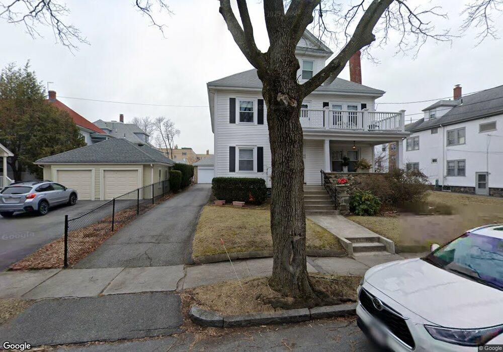
27 Freeman St Unit 29 Arlington, MA 02474
East Arlington NeighborhoodEstimated Value: $1,259,000 - $1,704,841
6
Beds
4
Baths
4,033
Sq Ft
$363/Sq Ft
Est. Value
About This Home
This home is located at 27 Freeman St Unit 29, Arlington, MA 02474 and is currently estimated at $1,465,960, approximately $363 per square foot. 27 Freeman St Unit 29 is a home located in Middlesex County with nearby schools including Hardy Elementary School, Ottoson Middle School, and Arlington High School.
Ownership History
Date
Name
Owned For
Owner Type
Purchase Details
Closed on
Nov 18, 2020
Sold by
Cavallo Anna R
Bought by
Anna R Cavallo Ret and Cavallo
Current Estimated Value
Purchase Details
Closed on
Sep 20, 1993
Sold by
Cancelliere Virginia
Bought by
Cavallo Anna R
Home Financials for this Owner
Home Financials are based on the most recent Mortgage that was taken out on this home.
Original Mortgage
$100,000
Interest Rate
7.16%
Mortgage Type
Purchase Money Mortgage
Create a Home Valuation Report for This Property
The Home Valuation Report is an in-depth analysis detailing your home's value as well as a comparison with similar homes in the area
Home Values in the Area
Average Home Value in this Area
Purchase History
| Date | Buyer | Sale Price | Title Company |
|---|---|---|---|
| Anna R Cavallo Ret | -- | None Available | |
| Cavallo Anna R | $265,000 | -- |
Source: Public Records
Mortgage History
| Date | Status | Borrower | Loan Amount |
|---|---|---|---|
| Previous Owner | Cavallo Anna R | $100,000 |
Source: Public Records
Tax History
| Year | Tax Paid | Tax Assessment Tax Assessment Total Assessment is a certain percentage of the fair market value that is determined by local assessors to be the total taxable value of land and additions on the property. | Land | Improvement |
|---|---|---|---|---|
| 2025 | $13,737 | $1,275,500 | $680,200 | $595,300 |
| 2024 | $12,686 | $1,197,900 | $647,500 | $550,400 |
| 2023 | $12,704 | $1,133,300 | $542,800 | $590,500 |
| 2022 | $12,658 | $1,108,400 | $523,200 | $585,200 |
| 2021 | $12,270 | $1,082,000 | $523,200 | $558,800 |
| 2020 | $11,967 | $1,082,000 | $523,200 | $558,800 |
| 2019 | $11,099 | $985,700 | $555,900 | $429,800 |
| 2018 | $10,132 | $835,300 | $405,500 | $429,800 |
| 2017 | $9,498 | $756,200 | $353,200 | $403,000 |
| 2016 | $9,009 | $703,800 | $300,800 | $403,000 |
| 2015 | $8,863 | $654,100 | $294,300 | $359,800 |
Source: Public Records
Map
Nearby Homes
- 454-460 Massachusetts Ave
- 120 Broadway
- 61-63 Foster St
- 29 Mott St Unit 29
- 45 Teel St
- 52 Warren St
- 53 Warren St Unit 53
- 35 Boulevard Rd Unit 37
- 3 Seagrave Rd
- 27-29 Dartmouth St Unit 1
- 18 Wellesley Rd
- 199 Everett St Unit 199
- 6 Gordon Rd
- 15 Medford St Unit 4
- 155-157 Palmer St
- 14 Farragut Ave Unit 1
- 233 Powder House Blvd
- 327 Alewife Brook Pkwy Unit A
- 327 Alewife Brook Pkwy Unit B
- 69 Clarendon Ave Unit A
- 23 Freeman St Unit 25
- 19 Freeman St
- 12 Orvis Rd Unit 14
- 16 Orvis Rd Unit 1
- 16 Orvis Rd Unit 16
- 16 Orvis Rd Unit 18
- 16 Orvis Rd Unit 2
- 6-8 Orvis Rd Unit 3
- 68 Orvis Rd
- 68 Orvis Rd Unit 3
- 6-8 Orvis Rd
- 4 Orvis Rd Unit 4
- 6 Orvis Rd Unit 6
- 230 Mass Ave Unit 9
- 230 Massachusetts Ave Unit B
- 230 Massachusetts Ave Unit 12
- 230 Massachusetts Ave Unit 11
- 230 Massachusetts Ave Unit 10
- 230 Massachusetts Ave Unit 9
- 230 Massachusetts Ave Unit 8
Your Personal Tour Guide
Ask me questions while you tour the home.