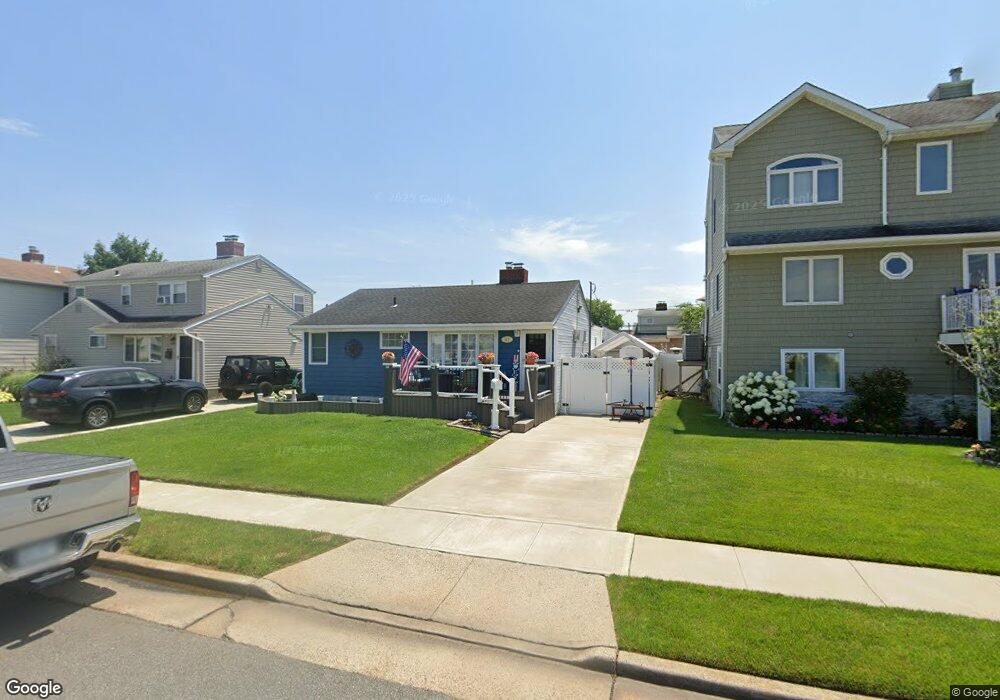
27 Grant St Freeport, NY 11520
Estimated Value: $585,000 - $604,355
4
Beds
2
Baths
1,199
Sq Ft
$496/Sq Ft
Est. Value
About This Home
This home is located at 27 Grant St, Freeport, NY 11520 and is currently estimated at $594,678, approximately $495 per square foot. 27 Grant St is a home located in Nassau County with nearby schools including Columbus Avenue School, Caroline G. Atkinson Intermediate School, and John W Dodd Middle School.
Ownership History
Date
Name
Owned For
Owner Type
Purchase Details
Closed on
Mar 20, 2018
Sold by
Leone Alison and Leone Frank
Bought by
Morrison John
Current Estimated Value
Home Financials for this Owner
Home Financials are based on the most recent Mortgage that was taken out on this home.
Original Mortgage
$321,567
Outstanding Balance
$277,351
Interest Rate
4.75%
Mortgage Type
FHA
Estimated Equity
$317,327
Purchase Details
Closed on
Apr 30, 2004
Sold by
Perez Lori
Bought by
Savitsky Paul
Purchase Details
Closed on
Oct 18, 2002
Sold by
Kittel Ernest
Purchase Details
Closed on
Aug 24, 1999
Sold by
Harkoff George
Bought by
Perez Lori and Kittel Ernest
Home Financials for this Owner
Home Financials are based on the most recent Mortgage that was taken out on this home.
Original Mortgage
$158,100
Interest Rate
7.5%
Mortgage Type
FHA
Purchase Details
Closed on
Aug 14, 1995
Sold by
Batule John and Batule Patricia
Bought by
Harkoff George
Create a Home Valuation Report for This Property
The Home Valuation Report is an in-depth analysis detailing your home's value as well as a comparison with similar homes in the area
Home Values in the Area
Average Home Value in this Area
Purchase History
| Date | Buyer | Sale Price | Title Company |
|---|---|---|---|
| Morrison John | $327,500 | None Available | |
| Savitsky Paul | $310,000 | -- | |
| -- | -- | -- | |
| Perez Lori | $159,500 | First American Title Ins Co | |
| Harkoff George | $138,500 | -- |
Source: Public Records
Mortgage History
| Date | Status | Borrower | Loan Amount |
|---|---|---|---|
| Open | Morrison John | $321,567 | |
| Previous Owner | Perez Lori | $158,100 |
Source: Public Records
Tax History
| Year | Tax Paid | Tax Assessment Tax Assessment Total Assessment is a certain percentage of the fair market value that is determined by local assessors to be the total taxable value of land and additions on the property. | Land | Improvement |
|---|---|---|---|---|
| 2025 | $7,525 | $349 | $150 | $199 |
| 2024 | $795 | $349 | $150 | $199 |
Source: Public Records
Map
Nearby Homes
- 54 Robert St
- 74 Tyler St
- 766 Guy Lombardo Ave
- 57 Hubbard Ave
- 67 Howard Ave
- 7 Howard Ave
- 870 Guy Lombardo Ave
- 825 S Ocean Ave Unit 2
- 39 Layton St
- 16 Layton St
- 725 Miller Ave Unit 117
- 725 Miller Ave Unit 318
- 725 Miller Ave Unit 235
- 605 S Ocean Ave
- 54 Ocean Watch Ct Unit 54
- 22 Wilshire Ct
- 470 Miller Ave
- 744 S Long Beach Ave
- 1 Anchorage Way Unit 101
- 1 Anchorage Way Unit 1401
Your Personal Tour Guide
Ask me questions while you tour the home.