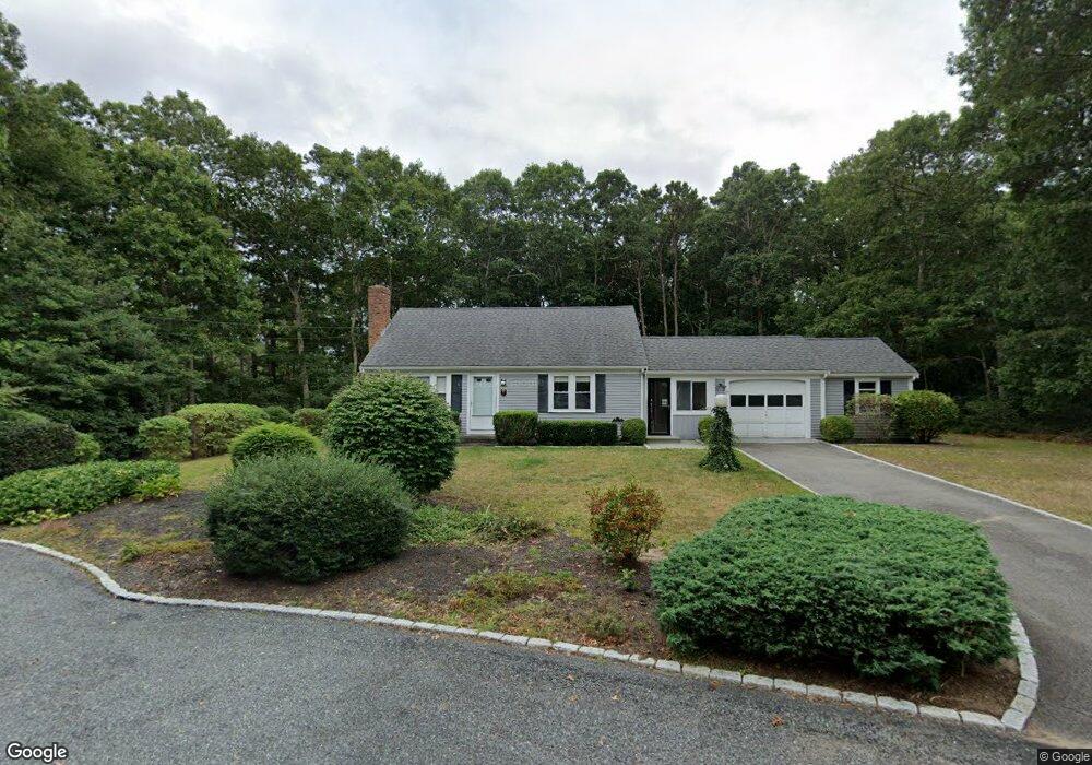
27 Hawes Run Rd West Yarmouth, MA 02673
West Yarmouth NeighborhoodEstimated Value: $516,000 - $703,000
3
Beds
3
Baths
1,020
Sq Ft
$572/Sq Ft
Est. Value
About This Home
This home is located at 27 Hawes Run Rd, West Yarmouth, MA 02673 and is currently estimated at $583,323, approximately $571 per square foot. 27 Hawes Run Rd is a home located in Barnstable County with nearby schools including Dennis-Yarmouth Regional High School, Barnstable Community Horace Mann Charter Public School, and Sturgis Charter Public School.
Ownership History
Date
Name
Owned For
Owner Type
Purchase Details
Closed on
Jan 21, 2011
Sold by
Zrebiec John F
Bought by
Capurso Shelley A and Amico Paul J
Current Estimated Value
Purchase Details
Closed on
Sep 17, 2010
Sold by
Zrebiec John F
Bought by
Zrebiec John F
Purchase Details
Closed on
Sep 18, 2008
Sold by
Zrebiec John F
Bought by
Zrebiec John F
Purchase Details
Closed on
May 25, 2007
Sold by
Zrebiec John F and Zrebiec Mary J
Bought by
Zrebiec John F
Create a Home Valuation Report for This Property
The Home Valuation Report is an in-depth analysis detailing your home's value as well as a comparison with similar homes in the area
Home Values in the Area
Average Home Value in this Area
Purchase History
| Date | Buyer | Sale Price | Title Company |
|---|---|---|---|
| Capurso Shelley A | $244,000 | -- | |
| Zrebiec John F | -- | -- | |
| Zrebiec John F | -- | -- | |
| Zrebiec John F | -- | -- |
Source: Public Records
Tax History Compared to Growth
Tax History
| Year | Tax Paid | Tax Assessment Tax Assessment Total Assessment is a certain percentage of the fair market value that is determined by local assessors to be the total taxable value of land and additions on the property. | Land | Improvement |
|---|---|---|---|---|
| 2025 | $3,367 | $475,600 | $143,400 | $332,200 |
| 2024 | $3,360 | $455,300 | $151,100 | $304,200 |
| 2023 | $3,291 | $405,800 | $134,700 | $271,100 |
| 2022 | $3,252 | $354,300 | $121,100 | $233,200 |
| 2021 | $3,170 | $331,600 | $121,100 | $210,500 |
| 2020 | $2,937 | $293,700 | $121,100 | $172,600 |
| 2019 | $2,767 | $274,000 | $121,100 | $152,900 |
| 2018 | $2,589 | $251,600 | $98,700 | $152,900 |
| 2017 | $2,405 | $240,000 | $98,700 | $141,300 |
| 2016 | $2,305 | $231,000 | $89,700 | $141,300 |
| 2015 | $2,294 | $228,500 | $89,700 | $138,800 |
Source: Public Records
Map
Nearby Homes
- 121 Camp St Unit 128
- 23 Baxter Ave
- 16 Iyannough Rd
- 248 Camp St Unit M5
- 481 Buck Island Rd Unit 9AA
- 481 Buck Island Rd Unit 17FA
- 0 Ken's Way
- 61 Coolidge Rd
- 441 Buck Island Rd Unit G3
- 441 Buck Island Rd Unit G3
- 441 Buck Island Rd Unit E5
- 441 Buck Island Rd Unit B1
- 441 Buck Island Rd Unit E1
- 22 Terry Ct
- 83 Main St
- 10 Standish Way
- 12 Denver Dr
- 13 Webster Rd
- 38 Traders Ln
- 38 Traders Ln
- 70 Camp St
- 33 Hawes Run Rd
- 64 Camp St Unit 1&2
- 64 Camp St
- 76 Camp St
- 22 Hawes Run Rd
- 22 S Hawes Run Rd
- 23 Hawes Run Rd
- 30 Hawes Run Rd
- 23 S Hawes Run Rd
- 68 Camp St
- 84 Camp St
- 63-65 Pondview Ave
- 63 Pondview Ave Unit 65
- 16 Hawes Run Rd
- 16 S Hawes Run Rd
- 17 Hawes Run Rd
- 69 Camp St
- 60 Camp St
- 55-57 Pondview Ave