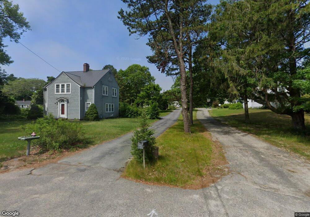
27 Head of The Bay Rd Bourne, MA 2532
Buzzards Bay NeighborhoodEstimated Value: $486,000 - $558,000
4
Beds
2
Baths
1,512
Sq Ft
$351/Sq Ft
Est. Value
About This Home
This home is located at 27 Head of The Bay Rd, Bourne, MA 2532 and is currently estimated at $530,040, approximately $350 per square foot. 27 Head of The Bay Rd is a home located in Barnstable County with nearby schools including Bourne High School and St Margaret Regional School.
Ownership History
Date
Name
Owned For
Owner Type
Purchase Details
Closed on
Jun 16, 2025
Sold by
Struhs Richard E and Struhs Deanna
Bought by
Barber Cassandra and Barber Ryan
Current Estimated Value
Home Financials for this Owner
Home Financials are based on the most recent Mortgage that was taken out on this home.
Original Mortgage
$499,500
Outstanding Balance
$497,330
Interest Rate
6.76%
Mortgage Type
Purchase Money Mortgage
Estimated Equity
$32,710
Purchase Details
Closed on
Nov 23, 2020
Sold by
Helen F W Bukantis Ret and Bukantis
Bought by
Struhs Richard E and Struhs Deanna
Home Financials for this Owner
Home Financials are based on the most recent Mortgage that was taken out on this home.
Original Mortgage
$313,405
Interest Rate
2.8%
Mortgage Type
New Conventional
Purchase Details
Closed on
Apr 11, 2011
Sold by
Bukantis Helen F
Bought by
Helen F W Bukantis Ret and Bukantis
Create a Home Valuation Report for This Property
The Home Valuation Report is an in-depth analysis detailing your home's value as well as a comparison with similar homes in the area
Home Values in the Area
Average Home Value in this Area
Purchase History
| Date | Buyer | Sale Price | Title Company |
|---|---|---|---|
| Barber Cassandra | $555,000 | None Available | |
| Barber Cassandra | $555,000 | None Available | |
| Struhs Richard E | $329,900 | None Available | |
| Struhs Richard E | $329,900 | None Available | |
| Helen F W Bukantis Ret | -- | -- | |
| Helen F W Bukantis Ret | -- | -- | |
| Helen F W Bukantis Ret | -- | -- |
Source: Public Records
Mortgage History
| Date | Status | Borrower | Loan Amount |
|---|---|---|---|
| Open | Barber Cassandra | $499,500 | |
| Closed | Barber Cassandra | $499,500 | |
| Previous Owner | Struhs Richard E | $313,405 |
Source: Public Records
Tax History Compared to Growth
Tax History
| Year | Tax Paid | Tax Assessment Tax Assessment Total Assessment is a certain percentage of the fair market value that is determined by local assessors to be the total taxable value of land and additions on the property. | Land | Improvement |
|---|---|---|---|---|
| 2025 | $3,586 | $459,200 | $184,000 | $275,200 |
| 2024 | $3,506 | $437,200 | $175,200 | $262,000 |
| 2023 | $3,438 | $390,200 | $155,100 | $235,100 |
| 2022 | $3,453 | $342,200 | $154,400 | $187,800 |
| 2021 | $3,362 | $312,200 | $140,500 | $171,700 |
| 2020 | $3,188 | $296,800 | $139,200 | $157,600 |
| 2019 | $3,032 | $288,500 | $139,200 | $149,300 |
| 2018 | $2,900 | $275,100 | $132,600 | $142,500 |
| 2017 | $2,956 | $287,000 | $145,900 | $141,100 |
| 2016 | $2,384 | $234,600 | $116,700 | $117,900 |
| 2015 | $2,362 | $234,600 | $116,700 | $117,900 |
Source: Public Records
Map
Nearby Homes
- 4 Finch Ln
- 162 Puritan Rd
- 17 Maple St
- 171 Puritan Rd
- 4 Knob Ln
- 38 Old Bridge Rd
- 41 Lewis Point Rd
- 46 Holt Rd
- 46 Holt Rd Unit A
- 0 Lewis Point Rd
- 65 Lewis Point Rd
- 151 - 153 Main St
- 90-92 Sandwich Rd Unit 9C
- 73 Lewis Point Rd
- 60 Sandwich Rd
- 90-92 Sandwich Rd Unit 2
- 23 Settlers Way
- 34 Washington Ave
- 16 Washington Ave
- 3 Wolf Rd
- 67 Maple St
- 35R Head of The Bay Rd
- 35 Head of The Bay Rd
- 73 Maple St
- 65 Maple St
- 65 Maple St Unit 65
- 29-31 Head of The Bay Rd
- 25 Head of The Bay Rd
- 75 Maple St
- 25 Head of The Bay Rd
- 64 Maple St
- 66 Maple St
- 59 Maple St
- 23 Head of The Bay Rd
- 33 Head of The Bay Rd
- 76 Maple St
- 58 Maple St
- 77 Maple St
- 160 Puritan Rd
- 17 Head of The Bay Rd