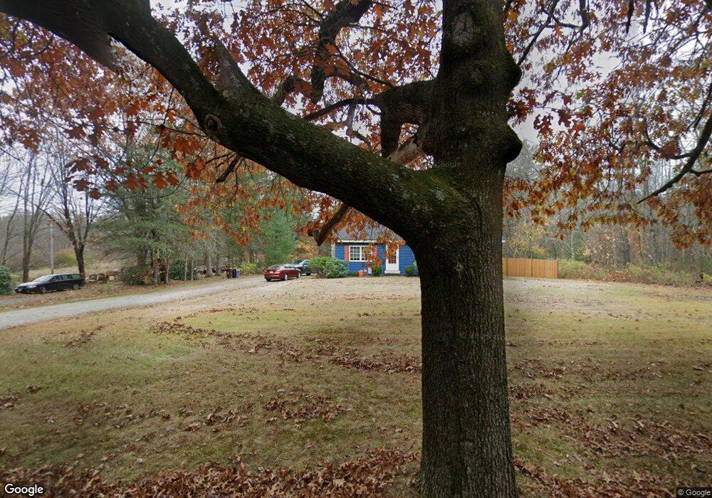
27 Heath Rd Merrimac, MA 01860
Estimated Value: $573,000 - $611,603
4
Beds
2
Baths
1,188
Sq Ft
$498/Sq Ft
Est. Value
About This Home
This home is located at 27 Heath Rd, Merrimac, MA 01860 and is currently estimated at $591,401, approximately $497 per square foot. 27 Heath Rd is a home located in Essex County with nearby schools including Pentucket Regional High School.
Ownership History
Date
Name
Owned For
Owner Type
Purchase Details
Closed on
Apr 2, 1997
Sold by
Tgettis Stephen C and Tgettis Emily L
Bought by
Hood Arthur R and Hood Jan F
Current Estimated Value
Create a Home Valuation Report for This Property
The Home Valuation Report is an in-depth analysis detailing your home's value as well as a comparison with similar homes in the area
Home Values in the Area
Average Home Value in this Area
Purchase History
| Date | Buyer | Sale Price | Title Company |
|---|---|---|---|
| Hood Arthur R | $128,000 | -- |
Source: Public Records
Mortgage History
| Date | Status | Borrower | Loan Amount |
|---|---|---|---|
| Open | Hood Arthur R | $100,000 | |
| Closed | Hood Arthur R | $94,000 | |
| Closed | Hood Arthur R | $106,600 |
Source: Public Records
Tax History Compared to Growth
Tax History
| Year | Tax Paid | Tax Assessment Tax Assessment Total Assessment is a certain percentage of the fair market value that is determined by local assessors to be the total taxable value of land and additions on the property. | Land | Improvement |
|---|---|---|---|---|
| 2025 | $7,490 | $565,300 | $382,400 | $182,900 |
| 2024 | $7,008 | $519,100 | $337,900 | $181,200 |
| 2023 | $6,765 | $458,000 | $303,100 | $154,900 |
| 2022 | $6,735 | $412,200 | $263,800 | $148,400 |
| 2021 | $5,945 | $364,700 | $220,300 | $144,400 |
| 2020 | $5,427 | $364,700 | $220,300 | $144,400 |
| 2019 | $5,002 | $316,400 | $185,400 | $131,000 |
| 2018 | $4,986 | $316,400 | $185,400 | $131,000 |
| 2017 | $4,613 | $282,300 | $159,300 | $123,000 |
| 2016 | $4,518 | $279,600 | $159,300 | $120,300 |
| 2015 | $4,391 | $270,200 | $154,900 | $115,300 |
| 2014 | $4,293 | $270,200 | $154,900 | $115,300 |
Source: Public Records
Map
Nearby Homes
- 186 Brandy Brow Rd
- 897 Amesbury Rd
- 14 Corliss Hill Rd
- 36 Orchard St
- 0 Mountain View Ave
- 128 Newton Rd Unit 20
- 128 Newton Rd Unit 29
- 120 Newton Rd Unit 2D
- 24 Union St
- 6 Vendome St Unit 6
- 83 Sweet Hill Rd
- 48 Little Pond Rd
- 0 W Main St
- 20 Grove St Unit 20
- 48 Newton Rd
- 2-4 Central St
- 18 River Rd
- 4 Rear Mechanic St
- 53 Old Amesbury Line Rd
- 37 School St
- 0 Meadow Ave
- 25 Heath Rd
- 268 Brandybrow Rd
- 28 Heath Rd
- 34 Heath Rd
- 253 Brandy Brow Rd
- 254 Brandy Brow Rd
- 258 Brandy Brow Rd
- 3 E Meadow Dr
- 462203122 Brandy Brow Rd
- 4622031223 Brandy Brow Rd
- 243 Brandy Brow Rd
- 26 Heath Rd
- 227 Brandy Brow Rd
- 248 Brandy Brow Rd
- 244 Brandy Brow Rd
- 24 Heath Rd
- 38 Heath Rd
- 272 Brandy Brow Rd
- 6 E Meadow Dr