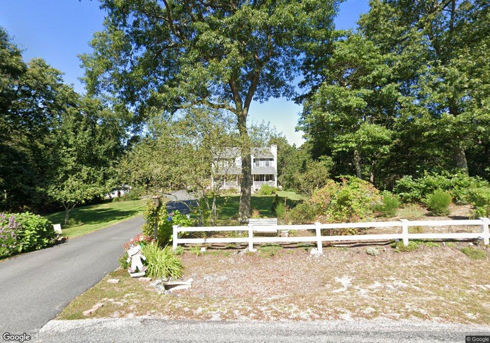
27 Honey Locust Dr Charlestown, RI 02813
Estimated Value: $686,000 - $785,000
3
Beds
3
Baths
2,016
Sq Ft
$362/Sq Ft
Est. Value
About This Home
This home is located at 27 Honey Locust Dr, Charlestown, RI 02813 and is currently estimated at $729,832, approximately $362 per square foot. 27 Honey Locust Dr is a home located in Washington County with nearby schools including Chariho Regional Middle School and Chariho High School.
Ownership History
Date
Name
Owned For
Owner Type
Purchase Details
Closed on
Jul 14, 2015
Sold by
Demers Norman R and Demers Leslie G
Bought by
Leslie G Demers Lt
Current Estimated Value
Purchase Details
Closed on
Mar 16, 1995
Sold by
Pioneer Consolidated
Bought by
Demers Norman R and Demers Leslie
Create a Home Valuation Report for This Property
The Home Valuation Report is an in-depth analysis detailing your home's value as well as a comparison with similar homes in the area
Home Values in the Area
Average Home Value in this Area
Purchase History
| Date | Buyer | Sale Price | Title Company |
|---|---|---|---|
| Leslie G Demers Lt | -- | -- | |
| Leslie G Demers Lt | -- | -- | |
| Demers Norman R | $155,000 | -- |
Source: Public Records
Mortgage History
| Date | Status | Borrower | Loan Amount |
|---|---|---|---|
| Previous Owner | Demers Norman R | $120,000 | |
| Previous Owner | Demers Norman R | $150,000 | |
| Previous Owner | Demers Norman R | $150,000 |
Source: Public Records
Tax History Compared to Growth
Tax History
| Year | Tax Paid | Tax Assessment Tax Assessment Total Assessment is a certain percentage of the fair market value that is determined by local assessors to be the total taxable value of land and additions on the property. | Land | Improvement |
|---|---|---|---|---|
| 2025 | $3,171 | $534,700 | $144,700 | $390,000 |
| 2024 | $3,091 | $534,700 | $144,700 | $390,000 |
| 2023 | $3,069 | $534,700 | $144,700 | $390,000 |
| 2022 | $2,799 | $342,600 | $98,200 | $244,400 |
| 2021 | $2,802 | $342,600 | $98,200 | $244,400 |
| 2020 | $2,820 | $342,600 | $98,200 | $244,400 |
| 2019 | $2,992 | $324,200 | $98,200 | $226,000 |
| 2018 | $3,125 | $324,200 | $98,200 | $226,000 |
| 2017 | $3,109 | $324,200 | $98,200 | $226,000 |
| 2016 | $3,028 | $296,600 | $89,300 | $207,300 |
| 2015 | $2,999 | $296,600 | $89,300 | $207,300 |
| 2014 | $2,936 | $296,600 | $89,300 | $207,300 |
Source: Public Records
Map
Nearby Homes
- 4720 S County Trail
- 10 Narrow Ln
- 154 Black Pond Rd
- 89 Narrow Ln
- 0 Pasquisett Trail
- 27 Foxtrot Dr
- 4960 S County Trail
- 40 Toadstool Knolls
- 197 Old Coach Rd
- 0 S County Trail
- 106 Lauri Dr
- 45 Elizabeth Cooper Dr
- 23 Mohawk Trail
- 14 Lakeside Dr
- 16 Center St
- 155 Kings Factory Rd
- 4459 Old Post Rd
- 139 Scapa Flow Rd
- 19 W Spruce St
- 0 Falcone Ln
- 31 Honey Locust Dr
- 19 Honey Locust Dr
- 33 Honey Locust Dr
- 4639 S County Trail
- 11 Honey Locust Dr
- 30 Honey Locust Dr
- 26 Honey Locust Dr
- 16 Honey Locust Dr
- 8 Honey Locust Dr
- 4650 S County Trail
- 4654 S County Trail
- 4630 - A South County Trail
- 4662 S County Trail
- 4630 S County Trail Unit B
- 4630 S County Trail Unit A
- 4630A S County Trail
- 4630 S County Trail
- 4630B S County Trail
- 4615 S County Trail
- 4674 S County Trail