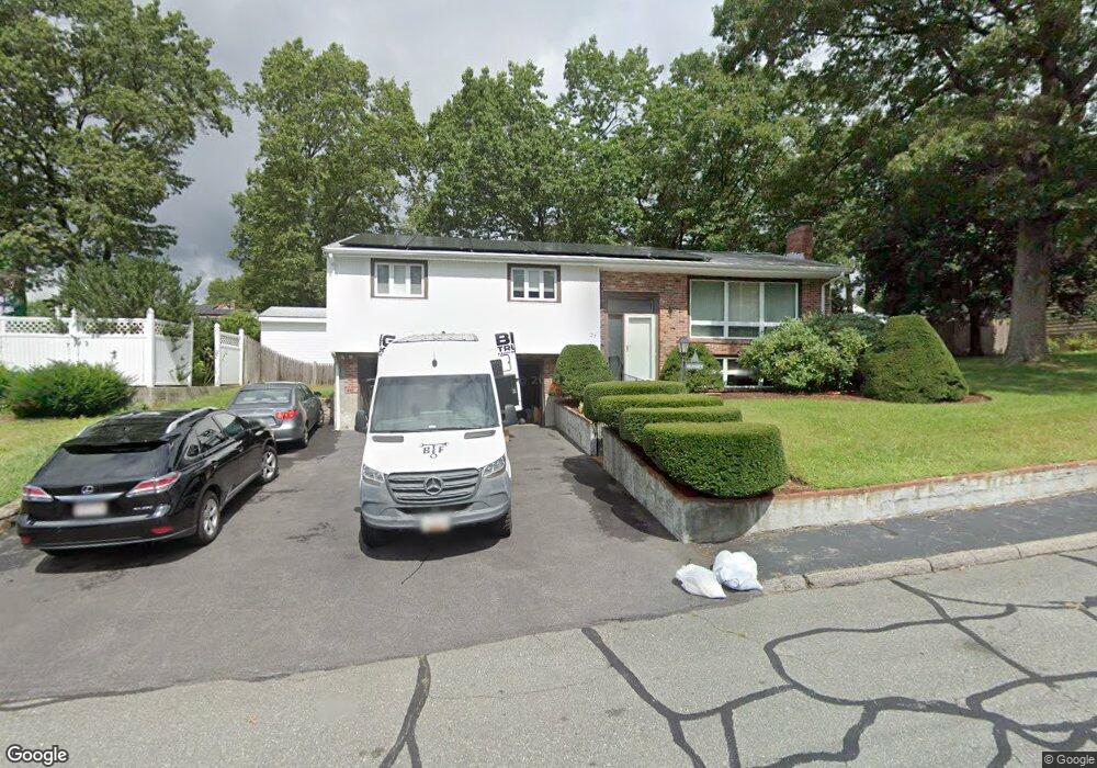
27 Imrie St Randolph, MA 02368
North Randolph NeighborhoodEstimated Value: $623,000 - $721,000
3
Beds
3
Baths
1,504
Sq Ft
$438/Sq Ft
Est. Value
About This Home
This home is located at 27 Imrie St, Randolph, MA 02368 and is currently estimated at $658,766, approximately $438 per square foot. 27 Imrie St is a home located in Norfolk County with nearby schools including Randolph High School.
Create a Home Valuation Report for This Property
The Home Valuation Report is an in-depth analysis detailing your home's value as well as a comparison with similar homes in the area
Home Values in the Area
Average Home Value in this Area
Tax History Compared to Growth
Tax History
| Year | Tax Paid | Tax Assessment Tax Assessment Total Assessment is a certain percentage of the fair market value that is determined by local assessors to be the total taxable value of land and additions on the property. | Land | Improvement |
|---|---|---|---|---|
| 2025 | $6,676 | $575,000 | $253,700 | $321,300 |
| 2024 | $6,543 | $571,400 | $248,800 | $322,600 |
| 2023 | $6,209 | $514,000 | $226,100 | $287,900 |
| 2022 | $5,988 | $440,300 | $188,500 | $251,800 |
| 2021 | $5,773 | $390,600 | $157,000 | $233,600 |
| 2020 | $5,623 | $377,100 | $157,000 | $220,100 |
| 2019 | $5,538 | $369,700 | $149,600 | $220,100 |
| 2018 | $5,412 | $340,800 | $136,000 | $204,800 |
| 2017 | $5,074 | $313,600 | $129,600 | $184,000 |
| 2016 | $4,949 | $284,600 | $117,700 | $166,900 |
| 2015 | $5,008 | $276,700 | $112,100 | $164,600 |
Source: Public Records
Map
Nearby Homes
- 232 Canton St Unit 104
- 232 Canton St Unit 205
- 232 Canton St Unit 112
- 1603 Irving Rd
- 1307 Irving Rd
- 10 Michael Rd
- 11 Glen Ln
- 3 Franklin Square Unit H
- 19 Cynthia Rd
- 14 Anderson Dr
- 240 York St
- 317 Chestnut St
- 39 Marion St
- 68 High St
- Lot 0 York St
- 8 Robert Rd Unit R
- 17 Hills St
- 974 N Main St Unit 3
- 2 Smith Rd
- 9 Royal Crest Dr Unit 12