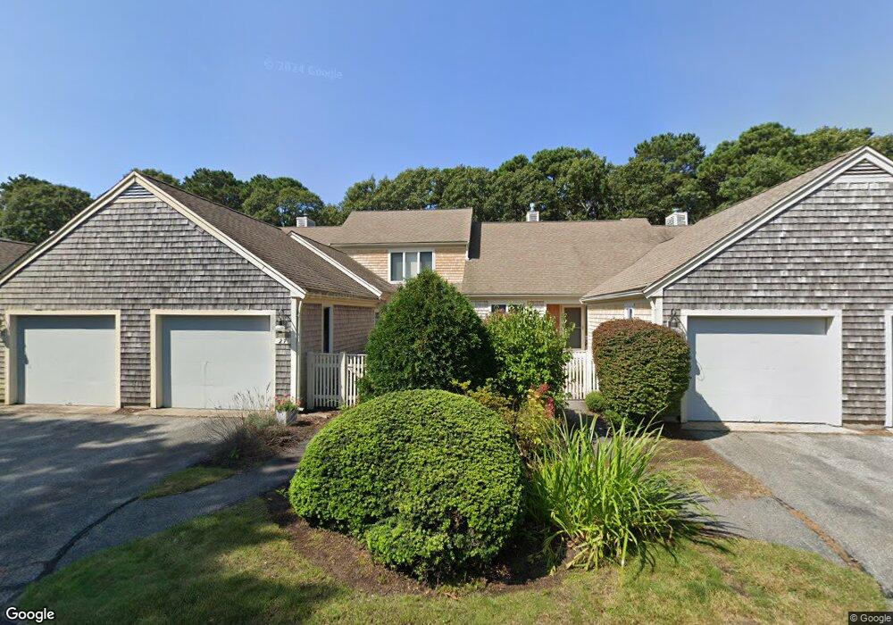
27 Kates Path Yarmouth Port, MA 02675
Yarmouth Port NeighborhoodEstimated Value: $565,000 - $583,000
2
Beds
3
Baths
1,201
Sq Ft
$476/Sq Ft
Est. Value
About This Home
This home is located at 27 Kates Path, Yarmouth Port, MA 02675 and is currently estimated at $571,608, approximately $475 per square foot. 27 Kates Path is a home located in Barnstable County with nearby schools including Dennis-Yarmouth Regional High School.
Ownership History
Date
Name
Owned For
Owner Type
Purchase Details
Closed on
Feb 19, 2025
Sold by
Ferreira Karen A
Bought by
27 Kates Path T and 27 Greenwood
Current Estimated Value
Purchase Details
Closed on
Apr 14, 2017
Sold by
Virginia M Robinson Lt and Poirier
Bought by
Ferreira Karen A
Purchase Details
Closed on
Jul 8, 2016
Sold by
Robinson Virginia M
Bought by
Virginia M Robinson Lt and Poirier
Purchase Details
Closed on
Jan 10, 1990
Sold by
Olmsted Harriet A
Bought by
Zlotnick Amy P
Home Financials for this Owner
Home Financials are based on the most recent Mortgage that was taken out on this home.
Original Mortgage
$131,200
Interest Rate
9.61%
Mortgage Type
Purchase Money Mortgage
Create a Home Valuation Report for This Property
The Home Valuation Report is an in-depth analysis detailing your home's value as well as a comparison with similar homes in the area
Home Values in the Area
Average Home Value in this Area
Purchase History
| Date | Buyer | Sale Price | Title Company |
|---|---|---|---|
| 27 Kates Path T | -- | None Available | |
| Ferreira Karen A | $300,000 | -- | |
| Virginia M Robinson Lt | -- | -- | |
| Zlotnick Amy P | $164,000 | -- |
Source: Public Records
Mortgage History
| Date | Status | Borrower | Loan Amount |
|---|---|---|---|
| Previous Owner | Zlotnick Amy P | $131,200 |
Source: Public Records
Tax History Compared to Growth
Tax History
| Year | Tax Paid | Tax Assessment Tax Assessment Total Assessment is a certain percentage of the fair market value that is determined by local assessors to be the total taxable value of land and additions on the property. | Land | Improvement |
|---|---|---|---|---|
| 2025 | $3,452 | $487,500 | $0 | $487,500 |
| 2024 | $3,467 | $469,800 | $0 | $469,800 |
| 2023 | $3,122 | $384,900 | $0 | $384,900 |
| 2022 | $3,565 | $388,300 | $0 | $388,300 |
| 2021 | $3,468 | $362,800 | $0 | $362,800 |
| 2020 | $3,500 | $350,000 | $0 | $350,000 |
| 2019 | $3,281 | $324,900 | $0 | $324,900 |
| 2018 | $3,085 | $299,800 | $0 | $299,800 |
| 2017 | $2,879 | $287,300 | $0 | $287,300 |
| 2016 | $2,742 | $274,700 | $0 | $274,700 |
| 2015 | -- | $271,000 | $0 | $271,000 |
Source: Public Records
Map
Nearby Homes
- 228 Kates Path
- 17 Kates Path Unit A
- 34 Kates Path
- 34 Kates Path Unit 34
- 64 Kates Path
- 50 John Hall Cartway
- 50 John Hall Cartway Unit 50
- 42 John Hall Cartway Unit 42
- 43 Canterbury Rd
- 7 Forest Gate Unit 7
- 44 Stratford Ln
- 25 Oak Glen Village Unit 25
- 25 Oak Glen
- 30 W Woods
- 30 W Woods Cir Unit 30
- 2 Pine Grove
- 86 Pompano Rd
- 51 Bray Farm Rd N
- 59 Massachusetts 6a Unit 19-2
- 6 Nimble Hill Dr
- 29 Kates Path
- 25 Kates Path
- 23 Kates Path
- 25 Kates Path Unit A
- 23 Kates Path Unit D
- 27 Kates Path Unit C
- 136 Kates Path Unit C
- 246 Kates Path
- 244 Kates Path
- 234 Kates Path
- 232 Kates Path
- 230 Kates Path
- 224 Kates Path
- 222 Kates Path
- 220 Kates Path
- 218 Kates Path
- 214 Kates Path
- 212 Kates Path
- 138 Kates Path
- 136 Kates Path