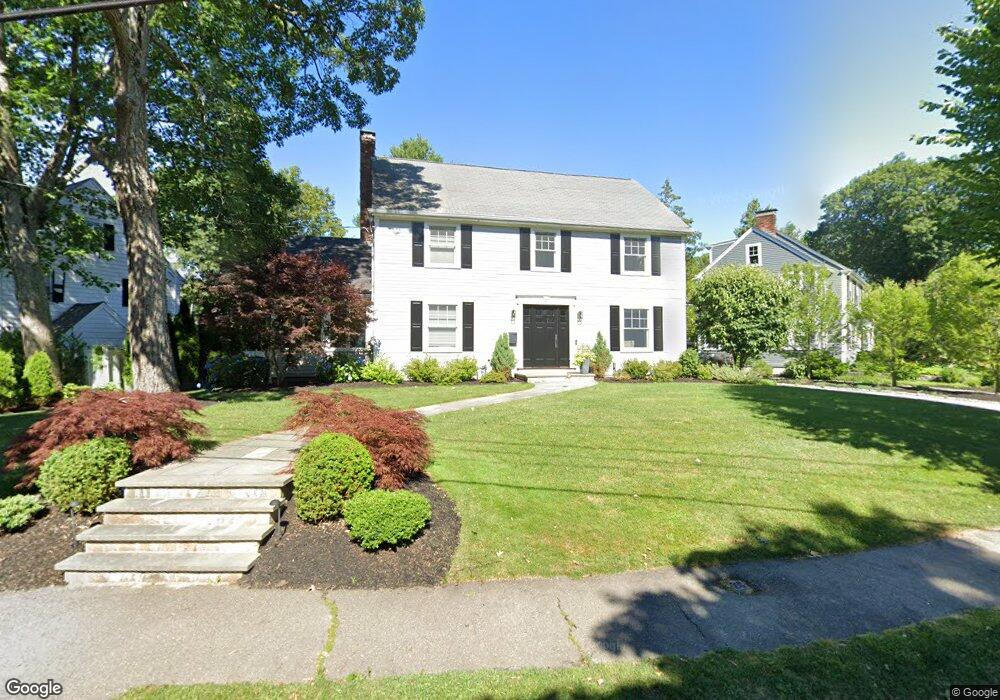
27 Kingston Rd Newton Highlands, MA 02461
Newton Highlands NeighborhoodEstimated Value: $2,070,000 - $2,346,040
4
Beds
4
Baths
1,996
Sq Ft
$1,109/Sq Ft
Est. Value
About This Home
This home is located at 27 Kingston Rd, Newton Highlands, MA 02461 and is currently estimated at $2,213,510, approximately $1,108 per square foot. 27 Kingston Rd is a home located in Middlesex County with nearby schools including Zervas Elementary School, Oak Hill Middle School, and Newton South High School.
Ownership History
Date
Name
Owned For
Owner Type
Purchase Details
Closed on
Aug 1, 2008
Sold by
Shapiro Fay T
Bought by
Penna Amy and Penna Nicholas
Current Estimated Value
Home Financials for this Owner
Home Financials are based on the most recent Mortgage that was taken out on this home.
Original Mortgage
$690,400
Outstanding Balance
$456,232
Interest Rate
6.47%
Mortgage Type
Purchase Money Mortgage
Estimated Equity
$1,757,278
Create a Home Valuation Report for This Property
The Home Valuation Report is an in-depth analysis detailing your home's value as well as a comparison with similar homes in the area
Home Values in the Area
Average Home Value in this Area
Purchase History
| Date | Buyer | Sale Price | Title Company |
|---|---|---|---|
| Penna Amy | $865,000 | -- |
Source: Public Records
Mortgage History
| Date | Status | Borrower | Loan Amount |
|---|---|---|---|
| Open | Penna Amy | $690,400 |
Source: Public Records
Tax History Compared to Growth
Tax History
| Year | Tax Paid | Tax Assessment Tax Assessment Total Assessment is a certain percentage of the fair market value that is determined by local assessors to be the total taxable value of land and additions on the property. | Land | Improvement |
|---|---|---|---|---|
| 2025 | $20,141 | $2,055,200 | $1,170,700 | $884,500 |
| 2024 | $19,474 | $1,995,300 | $1,136,600 | $858,700 |
| 2023 | $18,687 | $1,835,700 | $873,300 | $962,400 |
| 2022 | $17,881 | $1,699,700 | $808,600 | $891,100 |
| 2021 | $17,254 | $1,603,500 | $762,800 | $840,700 |
| 2020 | $16,741 | $1,603,500 | $762,800 | $840,700 |
| 2019 | $16,269 | $1,556,800 | $740,600 | $816,200 |
| 2018 | $15,863 | $1,466,100 | $674,400 | $791,700 |
| 2017 | $15,380 | $1,383,100 | $636,200 | $746,900 |
| 2016 | $14,710 | $1,292,600 | $594,600 | $698,000 |
| 2015 | $14,025 | $1,208,000 | $555,700 | $652,300 |
Source: Public Records
Map
Nearby Homes
- 35 Kingston Rd
- 2 Raeburn Terrace
- 200 Lincoln St
- 25 Allen Ave
- 28 Wilson Cir Unit 28
- 32 Wilson Cir Unit 32
- 26 Wilson Cir Unit 26
- 3 Glenmore Terrace Unit 2
- 1151 Walnut St Unit 205
- 1151 Walnut St Unit 405
- 1151 Walnut St Unit 207
- 120 Stanley Rd
- 1077 Boylston St
- 1430 Beacon St
- 1114 Beacon St Unit 106
- 1114 Beacon St Unit 203
- 1114 Beacon St Unit 111
- 1114 Beacon St Unit 206
- 1114 Beacon St Unit 104
- 1114 Beacon St Unit 207
- 15 Kingston Rd
- 43 Kingston Rd
- 116 Plymouth Rd
- 124 Plymouth Rd
- 110 Plymouth Rd
- 30 Kingston Rd
- 134 Plymouth Rd
- 26 Kingston Rd
- 36 Kingston Rd
- 20 Kingston Rd
- 140 Plymouth Rd
- 16 Kingston Rd
- 42 Kingston Rd
- 10 Kingston Rd
- 154 Plymouth Rd
- 48 Kingston Rd
- 2 Kingston Rd
- 3 Sagamore Rd
- 129 Plymouth Rd
- 52 Kingston Rd