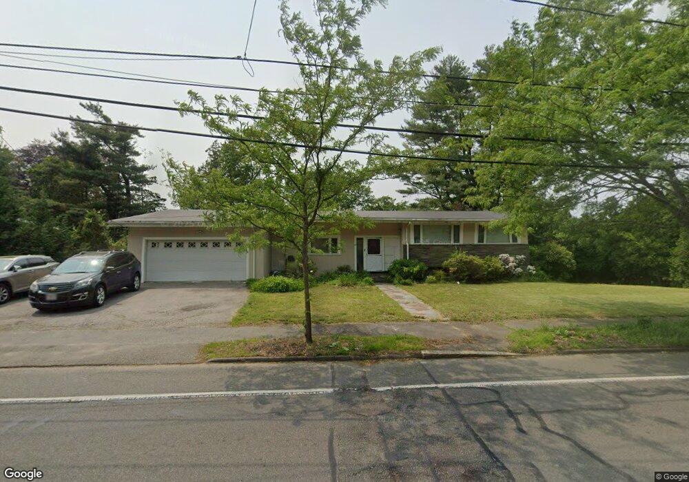
27 Lagrange St Chestnut Hill, MA 02467
South Brookline NeighborhoodEstimated Value: $1,475,160 - $1,882,000
5
Beds
3
Baths
1,712
Sq Ft
$944/Sq Ft
Est. Value
About This Home
This home is located at 27 Lagrange St, Chestnut Hill, MA 02467 and is currently estimated at $1,615,790, approximately $943 per square foot. 27 Lagrange St is a home located in Norfolk County with nearby schools including Baker School, Brookline High School, and Mount Alvernia Academy.
Ownership History
Date
Name
Owned For
Owner Type
Purchase Details
Closed on
Mar 27, 2017
Sold by
Lee Julia G
Bought by
Lee Ft
Current Estimated Value
Purchase Details
Closed on
Jul 16, 1993
Sold by
Klingsberg Sandra
Bought by
Lee Julia G
Home Financials for this Owner
Home Financials are based on the most recent Mortgage that was taken out on this home.
Original Mortgage
$185,000
Interest Rate
7.4%
Mortgage Type
Purchase Money Mortgage
Create a Home Valuation Report for This Property
The Home Valuation Report is an in-depth analysis detailing your home's value as well as a comparison with similar homes in the area
Home Values in the Area
Average Home Value in this Area
Purchase History
| Date | Buyer | Sale Price | Title Company |
|---|---|---|---|
| Lee Ft | -- | -- | |
| Lee Julia G | $268,000 | -- |
Source: Public Records
Mortgage History
| Date | Status | Borrower | Loan Amount |
|---|---|---|---|
| Previous Owner | Lee Julia G | $185,000 |
Source: Public Records
Tax History
| Year | Tax Paid | Tax Assessment Tax Assessment Total Assessment is a certain percentage of the fair market value that is determined by local assessors to be the total taxable value of land and additions on the property. | Land | Improvement |
|---|---|---|---|---|
| 2025 | $13,098 | $1,327,100 | $979,900 | $347,200 |
| 2024 | $12,460 | $1,275,300 | $942,200 | $333,100 |
| 2023 | $11,098 | $1,113,100 | $764,000 | $349,100 |
| 2022 | $10,801 | $1,060,000 | $727,500 | $332,500 |
| 2021 | $9,989 | $1,019,300 | $699,600 | $319,700 |
| 2020 | $8,982 | $950,500 | $636,000 | $314,500 |
| 2019 | $8,482 | $905,200 | $605,700 | $299,500 |
| 2018 | $8,632 | $912,500 | $591,700 | $320,800 |
| 2017 | $8,507 | $861,000 | $558,400 | $302,600 |
| 2016 | $8,384 | $804,600 | $521,800 | $282,800 |
| 2015 | $8,030 | $751,900 | $487,600 | $264,300 |
| 2014 | $7,835 | $687,900 | $448,600 | $239,300 |
Source: Public Records
Map
Nearby Homes
- 60 Alberta Rd
- 50-56 Broadlawn Park Unit 221
- 44 Broadlawn Park Unit 22
- 66 Brookline St
- 1125 W Roxbury Pkwy
- 70 Pond Brook Rd
- 36 Westgate Rd Unit 1
- 42 Bryon Rd Unit 6
- 72 Wallis Rd
- 60 Bryon Rd Unit 1
- 66 Bryon Rd Unit 2
- 36 Goodnough Rd
- 55 Bellingham Rd
- 16 Dorcar Rd
- 3 Glenoe Rd
- 0 Glenoe Rd
- 17 Tirrell Crescent
- 70 Craftsland Rd
- 771 Heath St Unit A
- 809-811 Heath St Unit 811
Your Personal Tour Guide
Ask me questions while you tour the home.