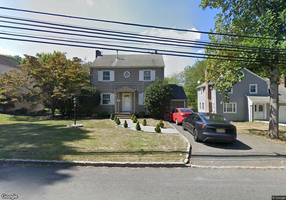
27 Laurel Ave Livingston, NJ 07039
Estimated Value: $709,000 - $928,000
--
Bed
--
Bath
1,358
Sq Ft
$600/Sq Ft
Est. Value
About This Home
This home is located at 27 Laurel Ave, Livingston, NJ 07039 and is currently estimated at $815,057, approximately $600 per square foot. 27 Laurel Ave is a home located in Essex County with nearby schools including Livingston Sr High School, Aquinas Academy, and Mount Carmel Guild High School.
Ownership History
Date
Name
Owned For
Owner Type
Purchase Details
Closed on
Jun 14, 2006
Sold by
Church Of God Of East Orange
Bought by
Sun King Private Limited
Current Estimated Value
Purchase Details
Closed on
Feb 28, 2006
Sold by
Perrone Gregory
Bought by
Ramos Flavia
Home Financials for this Owner
Home Financials are based on the most recent Mortgage that was taken out on this home.
Original Mortgage
$368,000
Interest Rate
6.27%
Mortgage Type
New Conventional
Purchase Details
Closed on
Jul 25, 1994
Sold by
Randolph Gary
Bought by
Perrone Gregory and Pyonin Heidi
Home Financials for this Owner
Home Financials are based on the most recent Mortgage that was taken out on this home.
Original Mortgage
$140,000
Interest Rate
8.4%
Create a Home Valuation Report for This Property
The Home Valuation Report is an in-depth analysis detailing your home's value as well as a comparison with similar homes in the area
Home Values in the Area
Average Home Value in this Area
Purchase History
| Date | Buyer | Sale Price | Title Company |
|---|---|---|---|
| Sun King Private Limited | $440,000 | -- | |
| Ramos Flavia | $460,000 | -- | |
| Perrone Gregory | $175,000 | -- |
Source: Public Records
Mortgage History
| Date | Status | Borrower | Loan Amount |
|---|---|---|---|
| Previous Owner | Ramos Flavia | $368,000 | |
| Previous Owner | Perrone Gregory | $140,000 |
Source: Public Records
Tax History Compared to Growth
Tax History
| Year | Tax Paid | Tax Assessment Tax Assessment Total Assessment is a certain percentage of the fair market value that is determined by local assessors to be the total taxable value of land and additions on the property. | Land | Improvement |
|---|---|---|---|---|
| 2025 | $10,636 | $448,400 | $260,800 | $187,600 |
| 2024 | $10,636 | $448,400 | $260,800 | $187,600 |
| 2022 | $10,461 | $448,400 | $260,800 | $187,600 |
| 2021 | $10,376 | $448,400 | $260,800 | $187,600 |
| 2020 | $10,183 | $448,400 | $260,800 | $187,600 |
| 2019 | $10,354 | $395,800 | $274,200 | $121,600 |
| 2018 | $10,216 | $395,800 | $274,200 | $121,600 |
| 2017 | $10,081 | $395,800 | $274,200 | $121,600 |
| 2016 | $9,895 | $395,800 | $274,200 | $121,600 |
| 2015 | $9,749 | $395,800 | $274,200 | $121,600 |
| 2014 | $9,432 | $395,800 | $274,200 | $121,600 |
Source: Public Records
Map
Nearby Homes
- 40 Lorelei Rd
- 19 Tilden Ct
- 30 Shrewsbury Dr
- 22 Tilden Ct
- 15 Orchard Ln
- 3 Troy Dr
- 319 E Mount Pleasant Ave
- 22 Tuxedo Dr
- 11 Shadowlawn Dr
- 7 Rosedale Terrace
- 38 Lafayette Dr
- 54 Knollwood Dr
- 12 Chelsea Dr
- 8 Tanger Dr
- 76 Springbrook Rd
- 21 Maplewood Dr
- 16 Fernwood Rd
- 36 Scarsdale Dr
- 8 Driftwood Dr
- 7 Franklin Ave