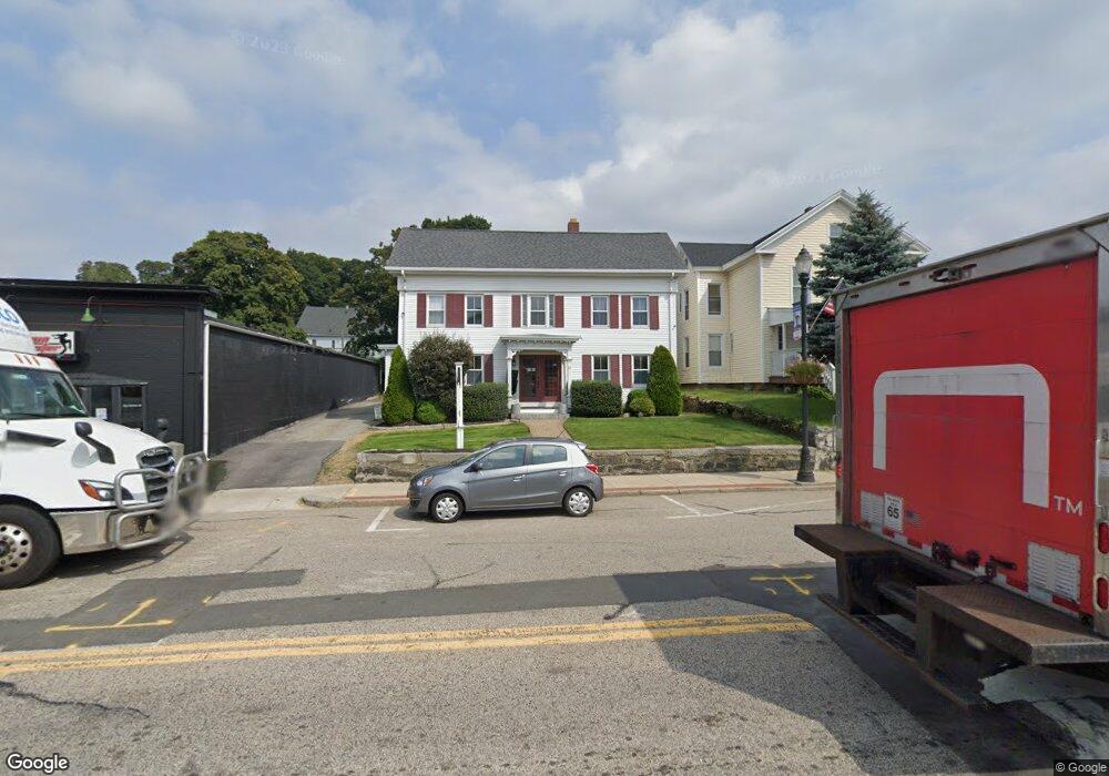
27 Main St Marlborough, MA 01752
Estimated Value: $556,901 - $734,000
3
Beds
2
Baths
2,298
Sq Ft
$271/Sq Ft
Est. Value
About This Home
This home is located at 27 Main St, Marlborough, MA 01752 and is currently estimated at $622,975, approximately $271 per square foot. 27 Main St is a home located in Middlesex County with nearby schools including Marlborough High School, New Covenant Christian School, and Glenhaven Academy - JRI School.
Ownership History
Date
Name
Owned For
Owner Type
Purchase Details
Closed on
Nov 23, 2009
Sold by
Senecal Linda R
Bought by
Dancing Penguin Part L
Current Estimated Value
Home Financials for this Owner
Home Financials are based on the most recent Mortgage that was taken out on this home.
Original Mortgage
$180,000
Outstanding Balance
$116,689
Interest Rate
4.86%
Mortgage Type
Purchase Money Mortgage
Estimated Equity
$506,286
Purchase Details
Closed on
Oct 21, 2008
Sold by
Renzi Benedict R Est and Senecal Linda R
Bought by
Senacal Linda R
Purchase Details
Closed on
Apr 26, 2005
Sold by
Renzi Benedict R and Renzi Pauline R
Bought by
Renzi Benedict R
Create a Home Valuation Report for This Property
The Home Valuation Report is an in-depth analysis detailing your home's value as well as a comparison with similar homes in the area
Home Values in the Area
Average Home Value in this Area
Purchase History
| Date | Buyer | Sale Price | Title Company |
|---|---|---|---|
| Dancing Penguin Part L | $240,000 | -- | |
| Senacal Linda R | -- | -- | |
| Renzi Benedict R | -- | -- |
Source: Public Records
Mortgage History
| Date | Status | Borrower | Loan Amount |
|---|---|---|---|
| Open | Dancing Penguin Part L | $180,000 |
Source: Public Records
Tax History Compared to Growth
Tax History
| Year | Tax Paid | Tax Assessment Tax Assessment Total Assessment is a certain percentage of the fair market value that is determined by local assessors to be the total taxable value of land and additions on the property. | Land | Improvement |
|---|---|---|---|---|
| 2025 | $5,018 | $508,900 | $168,300 | $340,600 |
| 2024 | $4,724 | $461,300 | $153,000 | $308,300 |
| 2023 | $4,813 | $417,100 | $119,900 | $297,200 |
| 2022 | $4,622 | $352,300 | $114,200 | $238,100 |
| 2021 | $5,089 | $368,800 | $93,100 | $275,700 |
| 2020 | $3,565 | $251,400 | $90,700 | $160,700 |
| 2019 | $3,465 | $246,300 | $88,900 | $157,400 |
| 2018 | $3,004 | $205,300 | $77,500 | $127,800 |
| 2017 | $3,124 | $203,900 | $77,400 | $126,500 |
| 2016 | $3,151 | $205,400 | $77,400 | $128,000 |
| 2015 | $3,294 | $209,000 | $81,500 | $127,500 |
Source: Public Records
Map
Nearby Homes
- 24 Bolton St
- 38 Sawin St
- 75 Warren Ave
- 139 Lincoln St
- 175 Main St
- 57 Neil St
- 25 Walnut St
- 86 Rice St
- Lot 1 Quinn Rd
- 18 Brimsmead St
- 16 Clinton St
- 24 Clinton St
- 82 Brimsmead St
- 53 Hillcrest Rd
- 272 Lincoln St Unit 102
- 272 Lincoln St Unit 101
- 272 Lincoln St Unit 203
- 164 Stevens St
- 110 Prospect St
- 132 Prospect St
- 27 Main St Unit 201,202,203
- 27 Main St Unit 201
- 27 Main St Unit 202
- 25 Main St
- 4 Brown St
- 35 Main St
- 34 Main St
- 12 Brown St
- 32 Main St
- 32 Main St Unit 34
- 32 Main St Unit 1
- 32 Main St Unit 401
- 32 Main St Unit 202
- 32 Main St Unit 38
- 30 Main St
- 16 Brown St
- 14 High St
- 28 Main St Unit A
- 28a Main St
- 12 High St