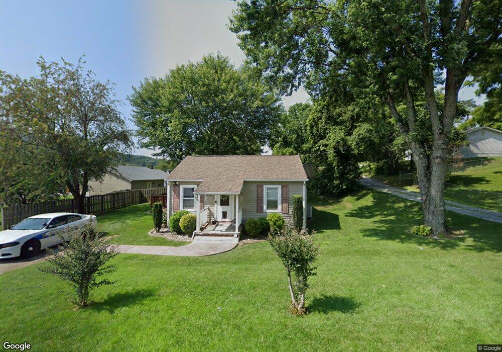
27 Maple Ave Troutville, VA 24175
Estimated Value: $165,767 - $203,000
2
Beds
1
Bath
918
Sq Ft
$205/Sq Ft
Est. Value
About This Home
This home is located at 27 Maple Ave, Troutville, VA 24175 and is currently estimated at $188,442, approximately $205 per square foot. 27 Maple Ave is a home located in Botetourt County with nearby schools including Troutville Elementary School, Read Mountain Middle School, and Lord Botetourt High School.
Ownership History
Date
Name
Owned For
Owner Type
Purchase Details
Closed on
Mar 4, 2011
Sold by
Clark David A
Bought by
Maxey Natalie L
Current Estimated Value
Home Financials for this Owner
Home Financials are based on the most recent Mortgage that was taken out on this home.
Original Mortgage
$98,877
Outstanding Balance
$68,194
Interest Rate
4.87%
Mortgage Type
FHA
Estimated Equity
$120,248
Create a Home Valuation Report for This Property
The Home Valuation Report is an in-depth analysis detailing your home's value as well as a comparison with similar homes in the area
Home Values in the Area
Average Home Value in this Area
Purchase History
| Date | Buyer | Sale Price | Title Company |
|---|---|---|---|
| Maxey Natalie L | $101,450 | -- |
Source: Public Records
Mortgage History
| Date | Status | Borrower | Loan Amount |
|---|---|---|---|
| Open | Maxey Natalie L | $98,877 |
Source: Public Records
Tax History Compared to Growth
Tax History
| Year | Tax Paid | Tax Assessment Tax Assessment Total Assessment is a certain percentage of the fair market value that is determined by local assessors to be the total taxable value of land and additions on the property. | Land | Improvement |
|---|---|---|---|---|
| 2025 | $811 | $115,800 | $13,600 | $102,200 |
| 2024 | $811 | $115,800 | $13,600 | $102,200 |
| 2023 | $688 | $87,100 | $12,400 | $74,700 |
| 2022 | $688 | $87,100 | $12,400 | $74,700 |
| 2021 | $688 | $87,100 | $12,400 | $74,700 |
| 2020 | $688 | $87,100 | $12,400 | $74,700 |
| 2019 | $577 | $73,100 | $12,400 | $60,700 |
| 2018 | $577 | $73,100 | $12,400 | $60,700 |
| 2017 | $577 | $73,100 | $12,400 | $60,700 |
| 2016 | $577 | $73,100 | $12,400 | $60,700 |
| 2015 | $638 | $88,600 | $12,400 | $76,200 |
| 2014 | $638 | $88,600 | $12,400 | $76,200 |
| 2010 | -- | $88,600 | $12,400 | $76,200 |
Source: Public Records
Map
Nearby Homes
- 144 Maple Ave
- 182 Sunset Ave
- 0000 Lee Hwy
- 117 Berkley Ct
- 4949 Lee Hwy
- 319 Trinity Rd
- 4893 Lee Hwy
- 0 Lee Hwy Unit 920651
- 0 Lee Hwy Unit 916500
- 230 Keswick Farm Rd
- 4393 Lee Hwy
- 297 Island Green Rd
- 233 Merion Cir
- Lot 26 Graystone Dr
- 298 Merion Cir
- 73 Merion Cir
- 20 Island Green Rd
- 4034 Lee Hwy
- 20 Ohara Dr
- 1974 Stoney Battery Rd