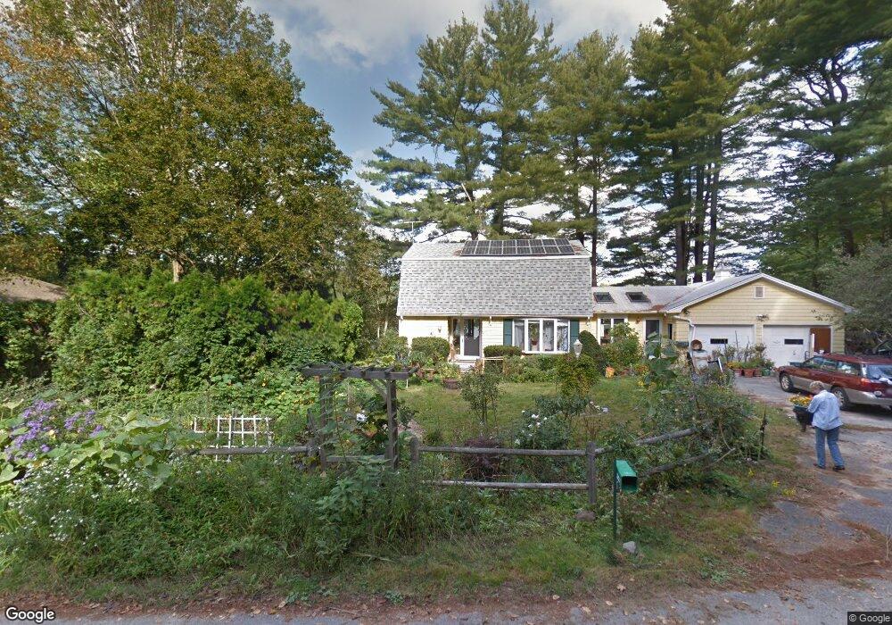
27 Mill Pond Rd Kittery, ME 03904
Estimated Value: $779,000 - $1,556,000
3
Beds
2
Baths
1,503
Sq Ft
$660/Sq Ft
Est. Value
About This Home
This home is located at 27 Mill Pond Rd, Kittery, ME 03904 and is currently estimated at $992,076, approximately $660 per square foot. 27 Mill Pond Rd is a home located in York County with nearby schools including Shapleigh School, Horace Mitchell Primary School, and Robert W Traip Academy.
Ownership History
Date
Name
Owned For
Owner Type
Purchase Details
Closed on
Jul 23, 2024
Sold by
Graham Cleone T
Bought by
Kempster Erin M and Klein Tamara
Current Estimated Value
Home Financials for this Owner
Home Financials are based on the most recent Mortgage that was taken out on this home.
Original Mortgage
$660,000
Outstanding Balance
$650,868
Interest Rate
6.95%
Mortgage Type
Purchase Money Mortgage
Estimated Equity
$341,208
Create a Home Valuation Report for This Property
The Home Valuation Report is an in-depth analysis detailing your home's value as well as a comparison with similar homes in the area
Home Values in the Area
Average Home Value in this Area
Purchase History
| Date | Buyer | Sale Price | Title Company |
|---|---|---|---|
| Kempster Erin M | $825,000 | None Available | |
| Kempster Erin M | $825,000 | None Available |
Source: Public Records
Mortgage History
| Date | Status | Borrower | Loan Amount |
|---|---|---|---|
| Open | Kempster Erin M | $660,000 | |
| Closed | Kempster Erin M | $660,000 |
Source: Public Records
Tax History
| Year | Tax Paid | Tax Assessment Tax Assessment Total Assessment is a certain percentage of the fair market value that is determined by local assessors to be the total taxable value of land and additions on the property. | Land | Improvement |
|---|---|---|---|---|
| 2024 | $7,022 | $494,500 | $315,400 | $179,100 |
| 2023 | $6,730 | $494,500 | $315,400 | $179,100 |
| 2022 | $6,666 | $494,500 | $315,400 | $179,100 |
| 2021 | $6,429 | $494,500 | $315,400 | $179,100 |
| 2020 | $6,379 | $494,500 | $315,400 | $179,100 |
| 2019 | $7,188 | $413,100 | $266,700 | $146,400 |
| 2018 | $6,940 | $413,100 | $266,700 | $146,400 |
| 2017 | $6,816 | $413,100 | $266,700 | $146,400 |
| 2016 | $6,630 | $413,100 | $266,700 | $146,400 |
| 2015 | $6,473 | $413,100 | $266,700 | $146,400 |
| 2014 | $6,411 | $413,100 | $266,700 | $146,400 |
| 2013 | $6,287 | $413,100 | $266,700 | $146,400 |
Source: Public Records
Map
Nearby Homes
- 2 Wainwright Ave
- 13 Cross St
- 12 Gillis Dr Unit 3
- 100 Shepard's Cove Rd Unit F204
- 100 Shepards Cove Rd Unit F204
- 8 Spruce Point Rd
- 10-12 Pine St
- 197 State Rd
- 9 Main St Unit 3
- 36 Cedar Dr
- 5 Spinney Way Unit 9
- 27 Oak Terrace
- 25 Oak Terrace
- 35 Badgers Island W Unit 203
- 35 Badgers Island W Unit 301
- 35 Badgers Island W Unit 302
- 35 Badgers Island W Unit 103
- 15 Picott Rd
- 36 State St
- 137 Daniel St Unit D302
- lot7B Mill Pond Rd
- 0 Mill Pond Rd
- 38 Mill Pond Rd
- 11 Mill Pond Rd
- 22 Mill Pond Rd
- 29 Mill Pond Rd
- 2 Chickadee Ln
- 9 Mill Pond Rd
- 7 Mill Pond Rd
- 14 Mill Pond Rd
- 31 Mill Pond Rd
- 5 Mill Pond Rd
- 4 Chickadee Ln
- 12 Mill Pond Rd
- 10 Mill Pond Rd
- 3 Mill Pond Rd
- 8 Mill Pond Rd
- 17 Debra Ln
- 15 Debra Ln
- 34 Mill Pond Rd