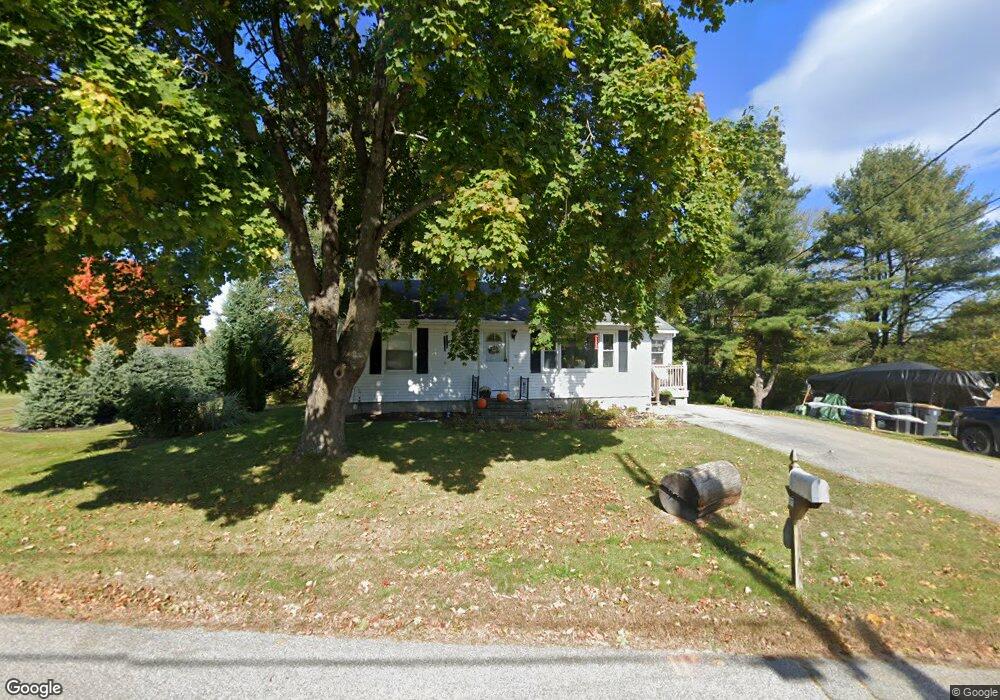
27 Milliken Rd Scarborough, ME 04074
Estimated Value: $410,700 - $463,000
3
Beds
2
Baths
864
Sq Ft
$511/Sq Ft
Est. Value
About This Home
This home is located at 27 Milliken Rd, Scarborough, ME 04074 and is currently estimated at $441,925, approximately $511 per square foot. 27 Milliken Rd is a home located in Cumberland County with nearby schools including Scarborough High School and Cornerstone Baptist Academy.
Ownership History
Date
Name
Owned For
Owner Type
Purchase Details
Closed on
Jun 23, 2023
Sold by
Haynes Roxane M
Bought by
Haynes Donald C and Haynes Roxane M
Current Estimated Value
Home Financials for this Owner
Home Financials are based on the most recent Mortgage that was taken out on this home.
Original Mortgage
$92,000
Outstanding Balance
$89,540
Interest Rate
6.39%
Mortgage Type
Purchase Money Mortgage
Estimated Equity
$352,385
Purchase Details
Closed on
Nov 17, 2008
Sold by
Ouellette Paul A and Ouellette Barbara J
Bought by
Gionest Roxane M
Home Financials for this Owner
Home Financials are based on the most recent Mortgage that was taken out on this home.
Original Mortgage
$181,632
Interest Rate
6.13%
Mortgage Type
FHA
Create a Home Valuation Report for This Property
The Home Valuation Report is an in-depth analysis detailing your home's value as well as a comparison with similar homes in the area
Home Values in the Area
Average Home Value in this Area
Purchase History
| Date | Buyer | Sale Price | Title Company |
|---|---|---|---|
| Haynes Donald C | -- | None Available | |
| Gionest Roxane M | -- | -- |
Source: Public Records
Mortgage History
| Date | Status | Borrower | Loan Amount |
|---|---|---|---|
| Open | Haynes Donald C | $92,000 | |
| Previous Owner | Gionest Roxane M | $181,632 |
Source: Public Records
Tax History Compared to Growth
Tax History
| Year | Tax Paid | Tax Assessment Tax Assessment Total Assessment is a certain percentage of the fair market value that is determined by local assessors to be the total taxable value of land and additions on the property. | Land | Improvement |
|---|---|---|---|---|
| 2024 | $4,021 | $367,900 | $165,600 | $202,300 |
| 2023 | $3,973 | $248,800 | $118,000 | $130,800 |
| 2022 | $3,829 | $248,800 | $118,000 | $130,800 |
| 2021 | $3,361 | $248,800 | $118,000 | $130,800 |
| 2020 | $3,697 | $248,800 | $118,000 | $130,800 |
| 2019 | $3,657 | $248,800 | $118,000 | $130,800 |
| 2017 | $483 | $185,500 | $101,600 | $83,900 |
| 2016 | $2,953 | $185,500 | $101,600 | $83,900 |
| 2015 | $2,873 | $185,500 | $101,600 | $83,900 |
| 2014 | $2,801 | $185,500 | $101,600 | $83,900 |
| 2013 | -- | $185,500 | $101,600 | $83,900 |
Source: Public Records
Map
Nearby Homes
- 46 Payne Rd
- 36 Pine Point Rd
- Lot 5 Jean's Way
- 1 Griffin Rd
- 626 Us Route 1
- 38 Church St
- 10 Foxwell Dr
- 19 Paulsen Dr
- 9 Paulsen Dr
- 31 Old Blue Point Rd
- 91 B Broadturn Rd
- 2 Bunker Hill Terrace
- 0 W Beech Ridge Rd
- 149 Stewart Dr
- 96C Broadturn Rd
- 153 Stewart Dr
- 90 Broadturn Rd Unit 9
- 159 Stewart Dr
- 93 Two Rod Rd
- 192 Stewart Dr