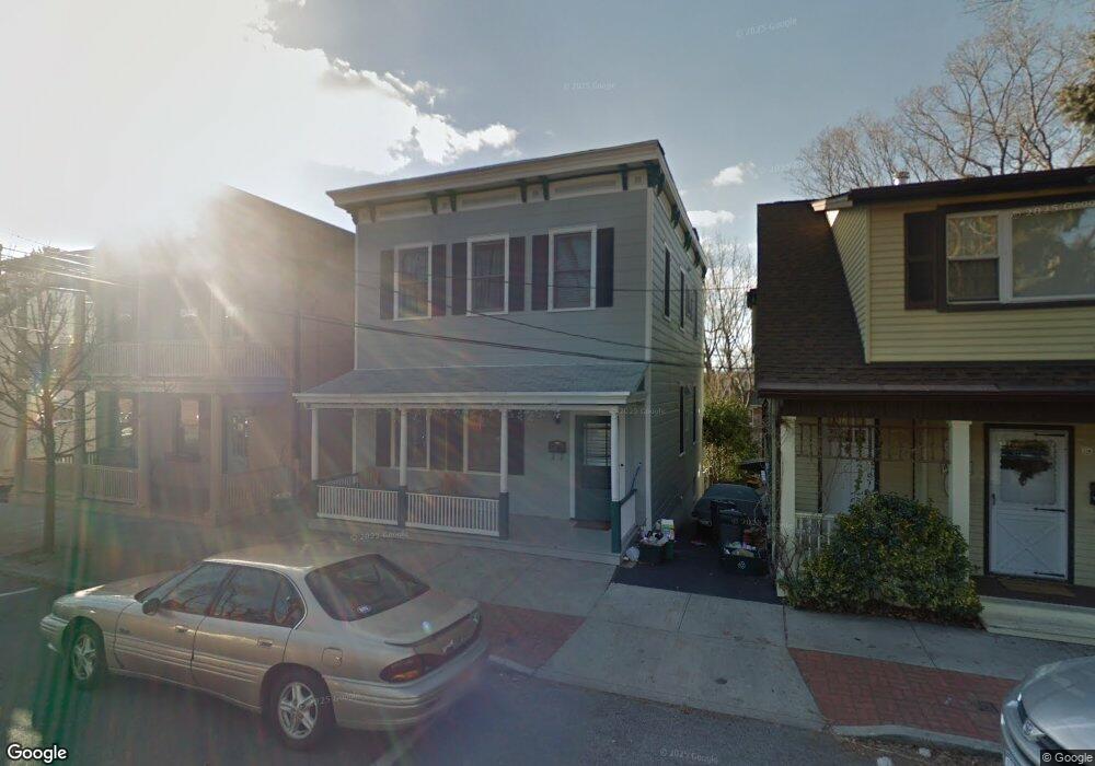
27 N Ferris St Irvington, NY 10533
Estimated Value: $1,122,000 - $1,286,000
3
Beds
2
Baths
1,680
Sq Ft
$720/Sq Ft
Est. Value
About This Home
This home is located at 27 N Ferris St, Irvington, NY 10533 and is currently estimated at $1,209,367, approximately $719 per square foot. 27 N Ferris St is a home located in Westchester County with nearby schools including Main Street School, Dows Lane Elementary School, and Irvington Middle School.
Ownership History
Date
Name
Owned For
Owner Type
Purchase Details
Closed on
Jul 12, 2012
Sold by
Ruggiero Frederick T
Bought by
Gregorick Kenneth and Gregorick Maria
Current Estimated Value
Home Financials for this Owner
Home Financials are based on the most recent Mortgage that was taken out on this home.
Original Mortgage
$524,000
Outstanding Balance
$362,906
Interest Rate
3.74%
Mortgage Type
New Conventional
Estimated Equity
$846,461
Purchase Details
Closed on
Aug 31, 1998
Sold by
Cole John and Cole Cherrill
Bought by
Reilly Mary B
Create a Home Valuation Report for This Property
The Home Valuation Report is an in-depth analysis detailing your home's value as well as a comparison with similar homes in the area
Home Values in the Area
Average Home Value in this Area
Purchase History
| Date | Buyer | Sale Price | Title Company |
|---|---|---|---|
| Gregorick Kenneth | $655,000 | None Available | |
| Reilly Mary B | $236,900 | Chicago Title Insurance Co |
Source: Public Records
Mortgage History
| Date | Status | Borrower | Loan Amount |
|---|---|---|---|
| Open | Gregorick Kenneth | $524,000 |
Source: Public Records
Tax History Compared to Growth
Tax History
| Year | Tax Paid | Tax Assessment Tax Assessment Total Assessment is a certain percentage of the fair market value that is determined by local assessors to be the total taxable value of land and additions on the property. | Land | Improvement |
|---|---|---|---|---|
| 2024 | $27,521 | $961,400 | $532,000 | $429,400 |
| 2023 | $25,716 | $870,500 | $506,600 | $363,900 |
| 2022 | $25,044 | $801,700 | $506,600 | $295,100 |
| 2021 | $23,960 | $763,600 | $506,600 | $257,000 |
| 2020 | $25,297 | $784,400 | $506,600 | $277,800 |
| 2019 | $24,867 | $784,400 | $506,600 | $277,800 |
| 2018 | $18,113 | $784,400 | $506,600 | $277,800 |
| 2017 | $7,095 | $755,400 | $506,600 | $248,800 |
| 2016 | $512,158 | $726,300 | $506,600 | $219,700 |
| 2015 | -- | $10,250 | $550 | $9,700 |
| 2014 | -- | $10,250 | $550 | $9,700 |
| 2013 | $5,474 | $10,250 | $550 | $9,700 |
Source: Public Records
Map
Nearby Homes
- 14 S Broadway Unit 2-3B
- 14 S Broadway Unit 12-1A
- 14 S Broadway Unit 7-3A
- 2 Fargo Ln
- 6 Marker Ridge Unit 3
- 4 Marker Ridge Unit 2
- 4 Marker Ridge
- 16 Marker Ridge Unit 8
- 13 Marker Ridge Unit 18
- 19 Marker Ridge Unit 25
- 22 Marker Ridge Unit 11
- 15 Marker Ridge Unit 16
- 15 Marker Ridge
- 31 Westwood Close
- 17 Marker Ridge
- 24 Marker Ridge
- 24 Marker Ridge Unit 12
- 43 Matthiessen Park N
- 26 Marker Ridge Unit 13
- 30 Marker Ridge Unit 15
- 29 N Ferris St
- 25 N Ferris St
- 21 N Ferris St
- 26 N Eckar St Unit 2-N
- 26 N Eckar St Unit 1-S
- 26 N Eckar St Unit 1N
- 26 N Eckar St
- 28 N Eckar St
- 9 N Ferris St
- 19 N Ferris St
- 24 N Eckar St
- 15 Matthiessen Park S
- 20 N Eckar St
- 18 N Eckar St Unit 2
- 18 N Eckar St Unit 1
- 18 N Eckar St
- 15 N Ferris St Unit 2
- 16 N Eckar St
- 14 N Eckar St
- 13 Matthiessen Park S