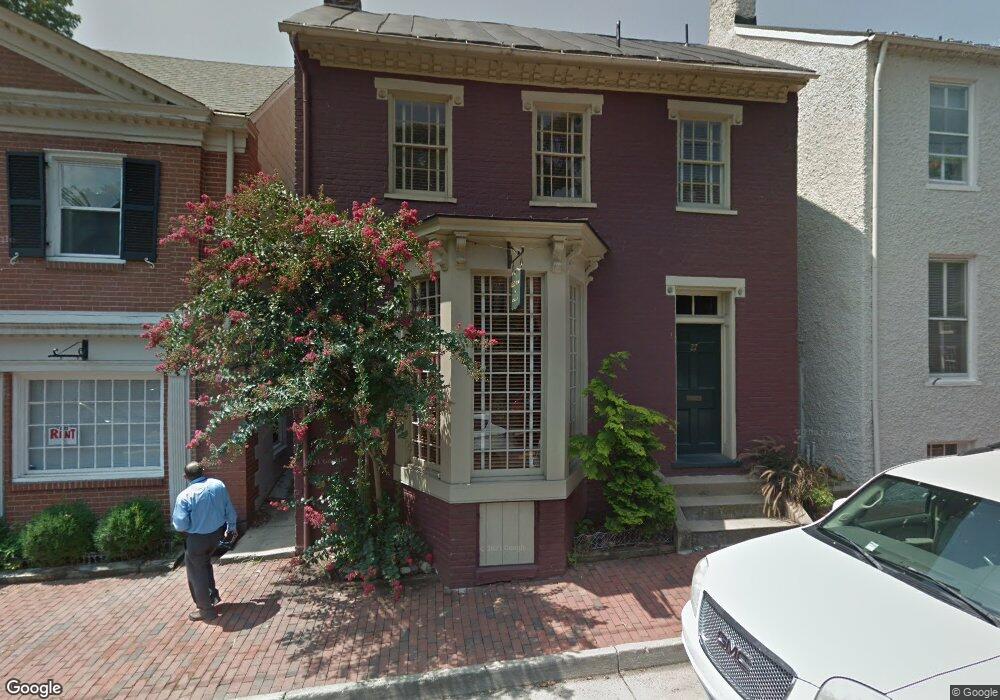
27 N King St Unit C Leesburg, VA 20176
Estimated Value: $942,707
--
Bed
--
Bath
2,000
Sq Ft
$471/Sq Ft
Est. Value
About This Home
This home is located at 27 N King St Unit C, Leesburg, VA 20176 and is currently estimated at $942,707, approximately $471 per square foot. 27 N King St Unit C is a home located in Loudoun County with nearby schools including Frances Hazel Reid Elementary School, Smart's Mill Middle School, and Tuscarora High School.
Ownership History
Date
Name
Owned For
Owner Type
Purchase Details
Closed on
Apr 14, 2022
Sold by
Anderson Robert D
Bought by
Loco Investments Llc
Current Estimated Value
Home Financials for this Owner
Home Financials are based on the most recent Mortgage that was taken out on this home.
Original Mortgage
$637,500
Outstanding Balance
$603,330
Interest Rate
5%
Mortgage Type
New Conventional
Estimated Equity
$339,377
Purchase Details
Closed on
Apr 5, 2007
Sold by
Moyes and Moyes Anderson
Bought by
Anderson Robert D
Home Financials for this Owner
Home Financials are based on the most recent Mortgage that was taken out on this home.
Original Mortgage
$427,500
Interest Rate
6.25%
Mortgage Type
Construction
Create a Home Valuation Report for This Property
The Home Valuation Report is an in-depth analysis detailing your home's value as well as a comparison with similar homes in the area
Home Values in the Area
Average Home Value in this Area
Purchase History
| Date | Buyer | Sale Price | Title Company |
|---|---|---|---|
| Loco Investments Llc | $850,000 | First American Title | |
| Anderson Robert D | $325,000 | -- |
Source: Public Records
Mortgage History
| Date | Status | Borrower | Loan Amount |
|---|---|---|---|
| Open | Loco Investments Llc | $637,500 | |
| Previous Owner | Anderson Robert D | $427,500 |
Source: Public Records
Tax History Compared to Growth
Tax History
| Year | Tax Paid | Tax Assessment Tax Assessment Total Assessment is a certain percentage of the fair market value that is determined by local assessors to be the total taxable value of land and additions on the property. | Land | Improvement |
|---|---|---|---|---|
| 2025 | $6,831 | $848,600 | $209,100 | $639,500 |
| 2024 | $7,340 | $848,600 | $209,100 | $639,500 |
| 2023 | $7,065 | $807,460 | $209,100 | $598,360 |
| 2022 | $4,630 | $520,180 | $209,100 | $311,080 |
| 2021 | $4,928 | $502,830 | $278,700 | $224,130 |
| 2020 | $5,251 | $507,330 | $278,700 | $228,630 |
| 2019 | $5,333 | $510,330 | $278,700 | $231,630 |
| 2018 | $5,473 | $504,440 | $278,700 | $225,740 |
| 2017 | $5,675 | $504,440 | $278,700 | $225,740 |
| 2016 | $5,776 | $504,440 | $0 | $0 |
| 2015 | $916 | $221,670 | $0 | $221,670 |
| 2014 | $926 | $227,100 | $0 | $227,100 |
Source: Public Records
Map
Nearby Homes
- 222 Wirt St NW
- 2 Stationmaster St SE Unit 302
- 3 Stationmaster St SE Unit 402
- 5 Stationmaster St SE Unit 202
- 276 Ariel Dr NE
- 0 Loudoun St SW Unit VALO2106424
- 293 Ariel Dr NE
- 216 Wildman St NE
- 414 Madison Ct SE
- 314 Rock Spring Dr SW
- 109 Belmont Dr SW
- 227 Dry Mill Rd SW
- 409 Wingate Place SW
- 403 Inzolia Ct NW
- 304 Lafayette Place SW
- 459 Kornblau Terrace SE
- 411 Bicksler Square SE
- Tisbury Plan at Morven Court
- Addison II Plan at Morven Court
- 265 High Rail Terrace SE
- 27 N King St
- 23 N King St
- 29 N King St
- 5 Cornwall St NW
- 21 N King St
- 101 N King St Unit 1
- 101 N King St Unit 2
- 101 N King St Unit 3
- 101 N King St
- 24 N King St
- 19 N King St
- 26 N King St Unit B
- 26 N King St Unit A
- 26 N King St
- 26 N King St Unit C
- 30 N King St
- 103 N King St
- 11 Cornwall St NW
- 17 N King St
- 102 N King St