Estimated Value: $734,000 - $889,000
3
Beds
2
Baths
2,059
Sq Ft
$385/Sq Ft
Est. Value
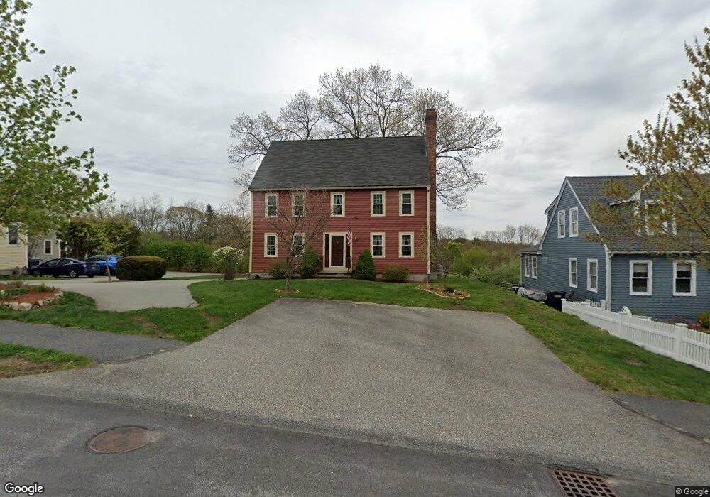
About This Home
This home is located at 27 Nylander Way, Acton, MA 01720 and is currently estimated at $793,374, approximately $385 per square foot. 27 Nylander Way is a home located in Middlesex County with nearby schools including Acton-Boxborough Regional High School, Maynard Knowledge Beginnings, and The Imago School.
Ownership History
Date
Name
Owned For
Owner Type
Purchase Details
Closed on
Sep 3, 1993
Sold by
Pert Corp
Bought by
Joyce Frederick E and Joyce Paulette B
Current Estimated Value
Home Financials for this Owner
Home Financials are based on the most recent Mortgage that was taken out on this home.
Original Mortgage
$160,000
Interest Rate
7.11%
Mortgage Type
Purchase Money Mortgage
Create a Home Valuation Report for This Property
The Home Valuation Report is an in-depth analysis detailing your home's value as well as a comparison with similar homes in the area
Home Values in the Area
Average Home Value in this Area
Purchase History
| Date | Buyer | Sale Price | Title Company |
|---|---|---|---|
| Joyce Frederick E | $220,000 | -- |
Source: Public Records
Mortgage History
| Date | Status | Borrower | Loan Amount |
|---|---|---|---|
| Open | Joyce Frederick E | $104,117 | |
| Open | Joyce Frederick E | $150,000 | |
| Closed | Joyce Frederick E | $160,000 |
Source: Public Records
Tax History Compared to Growth
Tax History
| Year | Tax Paid | Tax Assessment Tax Assessment Total Assessment is a certain percentage of the fair market value that is determined by local assessors to be the total taxable value of land and additions on the property. | Land | Improvement |
|---|---|---|---|---|
| 2025 | $12,492 | $728,400 | $0 | $728,400 |
| 2024 | $12,579 | $754,600 | $0 | $754,600 |
| 2023 | $12,956 | $737,800 | $0 | $737,800 |
| 2022 | $12,547 | $645,100 | $0 | $645,100 |
| 2021 | $10,497 | $518,900 | $0 | $518,900 |
| 2020 | $10,205 | $530,400 | $0 | $530,400 |
| 2019 | $10,274 | $530,400 | $0 | $530,400 |
| 2018 | $9,692 | $500,100 | $0 | $500,100 |
| 2017 | $9,532 | $500,100 | $0 | $500,100 |
| 2016 | $9,369 | $487,200 | $0 | $487,200 |
| 2015 | $8,595 | $451,200 | $0 | $451,200 |
| 2014 | $7,945 | $408,500 | $0 | $408,500 |
Source: Public Records
Map
Nearby Homes
- 169 Main St
- 129 Main St Unit 129
- 129 Main St
- 131 Main St
- 19 Railroad St Unit C2
- 8 High St Unit G1
- 86 School St
- 40 High St
- 128 Audubon Dr
- 70 River St
- 8 Laurel Ct
- 12 Brewster Ln
- 5 Oakwood Rd
- 4,7,8 Crestwood Ln
- 25 Main St
- 2 Clover Hill Rd
- 118 Parker St Unit 16
- 89 Windsor Ave
- 128 Parker St Unit 3B
- 132 Parker St Unit G5
- 29 Nylander Way
- 25 Nylander Way
- 31 Nylander Way
- 23 Nylander Way
- 10 Abel Jones Place
- 21 Nylander Way
- 2 Abel Jones Place
- 2 Abel Jones Place Unit 28
- 33 Nylander Way
- 35 Nylander Way
- 19 Nylander Way
- 19 Nylander Way Unit 19
- 19 Nylander Way Unit 3
- 6 Abel Jones Place
- 8 Abel Jones Place Unit 31
- 8 Abel Jones Place
- 32 Nylander Way
- 17 Nylander Way
- 17 Nylander Way Unit 2
- 17 Nylander Way Unit 17