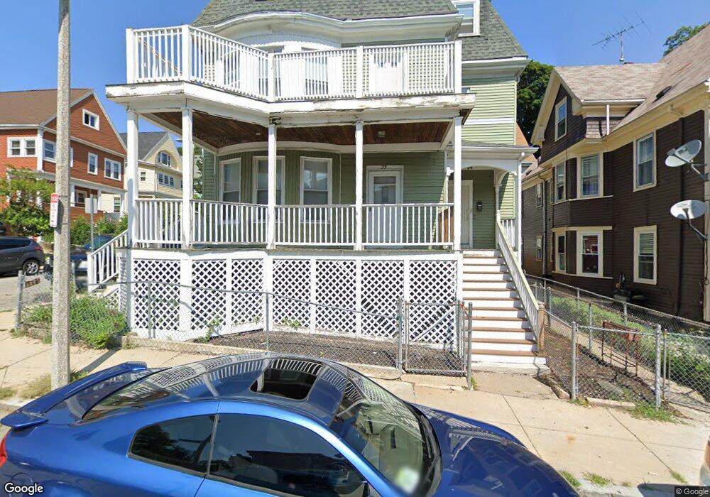
27 Page St Dorchester, MA 02121
Franklin Field North NeighborhoodEstimated Value: $980,000 - $1,085,000
5
Beds
3
Baths
4,186
Sq Ft
$244/Sq Ft
Est. Value
About This Home
This home is located at 27 Page St, Dorchester, MA 02121 and is currently estimated at $1,021,333, approximately $243 per square foot. 27 Page St is a home located in Suffolk County with nearby schools including UP Academy Charter School of Dorchester, Codman Academy Charter Public School, and Mother Caroline Academy & Education Center.
Ownership History
Date
Name
Owned For
Owner Type
Purchase Details
Closed on
Apr 5, 1993
Sold by
Fhlmc
Bought by
Straughter Yvette M
Current Estimated Value
Home Financials for this Owner
Home Financials are based on the most recent Mortgage that was taken out on this home.
Original Mortgage
$52,250
Interest Rate
7.6%
Mortgage Type
Purchase Money Mortgage
Purchase Details
Closed on
Oct 7, 1992
Sold by
Murphy Dolores
Bought by
Fhlmc
Purchase Details
Closed on
May 22, 1989
Sold by
Kenco Rlty Corp
Bought by
Coakley Patricia
Home Financials for this Owner
Home Financials are based on the most recent Mortgage that was taken out on this home.
Original Mortgage
$132,000
Interest Rate
10.97%
Mortgage Type
Purchase Money Mortgage
Purchase Details
Closed on
Sep 30, 1988
Sold by
Small James
Bought by
Kenco Rlty Corp
Create a Home Valuation Report for This Property
The Home Valuation Report is an in-depth analysis detailing your home's value as well as a comparison with similar homes in the area
Home Values in the Area
Average Home Value in this Area
Purchase History
| Date | Buyer | Sale Price | Title Company |
|---|---|---|---|
| Straughter Yvette M | $55,000 | -- | |
| Fhlmc | $153,288 | -- | |
| Coakley Patricia | $165,000 | -- | |
| Kenco Rlty Corp | $100,000 | -- |
Source: Public Records
Mortgage History
| Date | Status | Borrower | Loan Amount |
|---|---|---|---|
| Open | Kenco Rlty Corp | $30,000 | |
| Open | Kenco Rlty Corp | $75,000 | |
| Closed | Kenco Rlty Corp | $52,250 | |
| Previous Owner | Kenco Rlty Corp | $132,000 |
Source: Public Records
Tax History Compared to Growth
Tax History
| Year | Tax Paid | Tax Assessment Tax Assessment Total Assessment is a certain percentage of the fair market value that is determined by local assessors to be the total taxable value of land and additions on the property. | Land | Improvement |
|---|---|---|---|---|
| 2025 | $8,208 | $708,800 | $240,600 | $468,200 |
| 2024 | $7,631 | $700,100 | $275,600 | $424,500 |
| 2023 | $6,834 | $636,300 | $250,500 | $385,800 |
| 2022 | $6,467 | $594,400 | $234,000 | $360,400 |
| 2021 | $5,873 | $550,400 | $216,700 | $333,700 |
| 2020 | $5,433 | $514,500 | $203,700 | $310,800 |
| 2019 | $4,930 | $467,700 | $138,600 | $329,100 |
| 2018 | $4,263 | $406,800 | $138,600 | $268,200 |
| 2017 | $4,264 | $402,600 | $138,600 | $264,000 |
| 2016 | $3,850 | $350,000 | $138,600 | $211,400 |
| 2015 | $3,697 | $305,300 | $98,700 | $206,600 |
| 2014 | $3,524 | $280,100 | $98,700 | $181,400 |
Source: Public Records
Map
Nearby Homes
- 27 Bradshaw St
- 54 Bicknell St Unit 3
- 54 Bicknell St Unit 2
- 54 Bicknell St Unit 1
- 52 Bicknell St
- 35 Bradshaw St
- 61 Charlotte St Unit 2
- 52 Mclellan St
- 41 Charlotte St
- 88 Esmond St
- 64 Greenwood St
- 7-9 Esmond St
- 21 Mclellan St
- 15 Nightingale St
- 88 Wales St Unit 3
- 81 Kingsdale St
- 849 Blue Hill Ave
- 104 Nightingale St
- 12 Spencer St
- 9-13 Hewins St
- 23 Page St
- 19 Page St
- 19 Page St Unit 2
- 19 Page St Unit 1
- 19 Page St Unit 3
- 64 Mclellan St Unit 1
- 64 Mclellan St
- 80 Mclellan St
- 60 Mclellan St
- 60 Mclellan St Unit 2
- 60 Mclellan St Unit 1
- 60 Mclellan St Unit 3
- 82 Mclellan St
- 82 Mclellan St Unit 82
- 82 Mclellan St Unit 1
- 11 Page St
- 69 Mclellan St
- 71 Mclellan St Unit 3
- 75 Mclellan St
- 65 Mclellan St