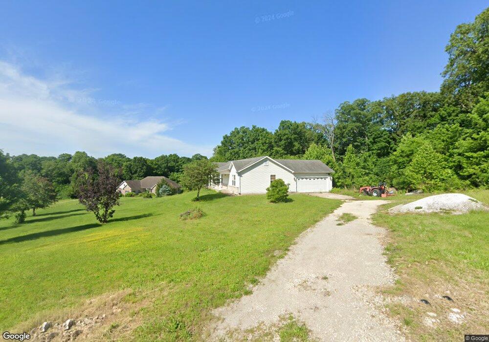
27 Parc Forest Trail Hawk Point, MO 63349
Estimated Value: $301,000 - $521,000
3
Beds
2
Baths
1,700
Sq Ft
$237/Sq Ft
Est. Value
About This Home
This home is located at 27 Parc Forest Trail, Hawk Point, MO 63349 and is currently estimated at $402,344, approximately $236 per square foot. 27 Parc Forest Trail is a home located in Lincoln County with nearby schools including Hawk Point Elementary School, Troy Middle School, and Troy Buchanan High School.
Ownership History
Date
Name
Owned For
Owner Type
Purchase Details
Closed on
Feb 19, 2013
Sold by
Distefano Blake Laura M
Bought by
Blake David W
Current Estimated Value
Home Financials for this Owner
Home Financials are based on the most recent Mortgage that was taken out on this home.
Original Mortgage
$120,000
Outstanding Balance
$84,003
Interest Rate
3.44%
Mortgage Type
New Conventional
Estimated Equity
$318,341
Purchase Details
Closed on
Nov 29, 2007
Sold by
Blake David W and Distenno Blake Laura M
Bought by
Blake David W
Purchase Details
Closed on
May 10, 2007
Sold by
Mph Lincoln Properties Llc
Home Financials for this Owner
Home Financials are based on the most recent Mortgage that was taken out on this home.
Original Mortgage
$37,145
Interest Rate
8.62%
Mortgage Type
Adjustable Rate Mortgage/ARM
Create a Home Valuation Report for This Property
The Home Valuation Report is an in-depth analysis detailing your home's value as well as a comparison with similar homes in the area
Purchase History
| Date | Buyer | Sale Price | Title Company |
|---|---|---|---|
| Blake David W | -- | None Available | |
| Blake David W | -- | None Available | |
| -- | -- | None Available |
Source: Public Records
Mortgage History
| Date | Status | Borrower | Loan Amount |
|---|---|---|---|
| Open | Blake David W | $120,000 | |
| Previous Owner | -- | $37,145 |
Source: Public Records
Tax History
| Year | Tax Paid | Tax Assessment Tax Assessment Total Assessment is a certain percentage of the fair market value that is determined by local assessors to be the total taxable value of land and additions on the property. | Land | Improvement |
|---|---|---|---|---|
| 2025 | $2,221 | $36,693 | $5,155 | $31,538 |
| 2024 | $2,036 | $32,990 | $3,658 | $29,332 |
| 2023 | $2,025 | $32,990 | $3,658 | $29,332 |
| 2022 | $1,910 | $31,326 | $3,658 | $27,668 |
| 2021 | $1,919 | $164,870 | $0 | $0 |
| 2020 | $1,644 | $143,720 | $0 | $0 |
| 2019 | $1,646 | $143,720 | $0 | $0 |
| 2018 | $1,699 | $27,805 | $0 | $0 |
| 2017 | $1,704 | $27,805 | $0 | $0 |
| 2016 | $1,499 | $23,975 | $0 | $0 |
| 2015 | $1,504 | $23,975 | $0 | $0 |
| 2014 | -- | $23,975 | $0 | $0 |
| 2013 | -- | $23,931 | $0 | $0 |
Source: Public Records
Map
Nearby Homes
- 804 Timber Creek Ct
- 113 Bridlespur Ct
- 401 Deep Forest Dr
- 64 Mocking Bird Ln
- 140 Turkey Creek Crossing Dr
- 6.09 State Highway A
- 4 Ashley Ln
- 39024 Winter St
- 339 White Rd
- 39298 Winter St
- 000 Truxton Church Rd
- 38569 Canelos Farm Rd
- 0 Cedar Circle Ln Unit MIS25071955
- 38520 Pin Oak Church Rd
- 116.18 + - Acres Highway Dd
- 8 Summers Breeze Ct
- 116.18 Acres Highway Dd Unit Bellflower MO 63333
- 2 Country Ridge Trail
- State Highway Dd (46+ - Acres Unit Tract F
- 0 Unit MIS26004409
- 0 Timber Creek Ct
- 805 Timber Creek Ct
- 23 Parc Forest Trail
- 700 White Trail Dr
- 701 White Trail Dr
- 35 Parc Forest Trail
- 19 Parc Forest Trail
- 19 Parc Forest Trail
- 709 White Trail Dr
- 705 White Trail Dr
- 38 Parc Forest Trail
- 47 Parc Forest Trail
- 15 Parc Forest Trail
- 15 Parc Forest Trail Unit Lot 4
- 44 Parc Forest Trail
- 513 Wilderness Ct
- 50 Parc Forest Trail
- 0 Lot 16 the Timbers Unit 20005835
- 1 Parc Forest Trail
- 11 Parc Forest Trail
Your Personal Tour Guide
Ask me questions while you tour the home.