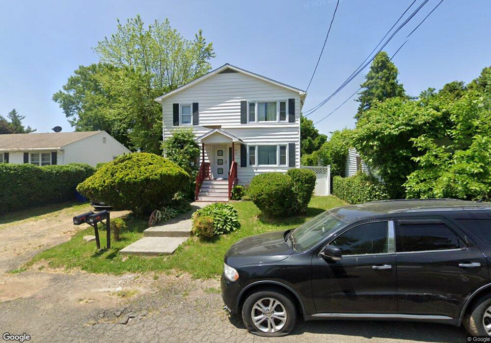
27 Pershing Ave Unit 29 Bridgeport, CT 06606
Reservoir-Whiskey Hill NeighborhoodEstimated Value: $441,464 - $606,000
6
Beds
2
Baths
2,464
Sq Ft
$213/Sq Ft
Est. Value
About This Home
This home is located at 27 Pershing Ave Unit 29, Bridgeport, CT 06606 and is currently estimated at $524,866, approximately $213 per square foot. 27 Pershing Ave Unit 29 is a home located in Fairfield County with nearby schools including Hallen School, Central High School, and Northeastern Adventist Academy - Fairfield County.
Ownership History
Date
Name
Owned For
Owner Type
Purchase Details
Closed on
Feb 4, 2000
Sold by
Thompson Rosa L
Bought by
Jones Herbert L and Jones Mamie
Current Estimated Value
Home Financials for this Owner
Home Financials are based on the most recent Mortgage that was taken out on this home.
Original Mortgage
$149,750
Interest Rate
7.91%
Create a Home Valuation Report for This Property
The Home Valuation Report is an in-depth analysis detailing your home's value as well as a comparison with similar homes in the area
Home Values in the Area
Average Home Value in this Area
Purchase History
| Date | Buyer | Sale Price | Title Company |
|---|---|---|---|
| Jones Herbert L | $151,060 | -- | |
| Jones Herbert L | $151,060 | -- |
Source: Public Records
Mortgage History
| Date | Status | Borrower | Loan Amount |
|---|---|---|---|
| Closed | Jones Herbert L | $99,000 | |
| Closed | Jones Herbert L | $114,347 | |
| Closed | Jones Herbert L | $149,750 |
Source: Public Records
Tax History
| Year | Tax Paid | Tax Assessment Tax Assessment Total Assessment is a certain percentage of the fair market value that is determined by local assessors to be the total taxable value of land and additions on the property. | Land | Improvement |
|---|---|---|---|---|
| 2025 | $7,764 | $178,690 | $64,930 | $113,760 |
| 2024 | $7,764 | $178,690 | $64,930 | $113,760 |
| 2023 | $7,764 | $178,690 | $64,930 | $113,760 |
| 2022 | $7,764 | $178,690 | $64,930 | $113,760 |
| 2021 | $7,764 | $178,690 | $64,930 | $113,760 |
| 2020 | $7,052 | $130,620 | $37,370 | $93,250 |
| 2019 | $7,052 | $130,620 | $37,370 | $93,250 |
| 2018 | $7,102 | $130,620 | $37,370 | $93,250 |
| 2017 | $7,102 | $130,620 | $37,370 | $93,250 |
| 2016 | $7,102 | $130,620 | $37,370 | $93,250 |
| 2015 | $7,350 | $174,170 | $42,840 | $131,330 |
| 2014 | $7,350 | $174,170 | $42,840 | $131,330 |
Source: Public Records
Map
Nearby Homes
- 110 Wilkins Ave
- 28 Wilkins Ave
- 769 Sylvan Ave Unit 13
- 940 Reservoir Ave
- 45 Polk St
- 717 Reservoir Ave
- 705 Reservoir Ave
- 125 Robert St
- 474 Indian Ave
- 85 Platt St
- 403 Indian Ave
- 438 Soundview Ave
- 355 Chamberlain Ave
- 410 Alba Ave
- 235 Douglas St
- 207 Hillcrest Rd
- 245 Indian Ave
- 274 Platt St
- 181 Cityview Ave
- 365 Platt St
- 115 Edwards St
- 18 Pershing Ave
- 95 Edwards St
- 145 Edwards St
- 19 Pershing Ave
- 91 Edwards St
- 118 Edwards St
- 151 Edwards St
- 136 Edwards St
- 81 Edwards St
- 138 Edwards St
- 98 Wilkins Ave
- 90 Edwards St
- 88 Wilkins Ave
- 156 Edwards St
- 53 Funston Ave
- 78 Wilkins Ave
- 142 Wilkins Ave
- 769 Sylvan Ave Unit 16
- 769 Sylvan Ave Unit 14
Your Personal Tour Guide
Ask me questions while you tour the home.