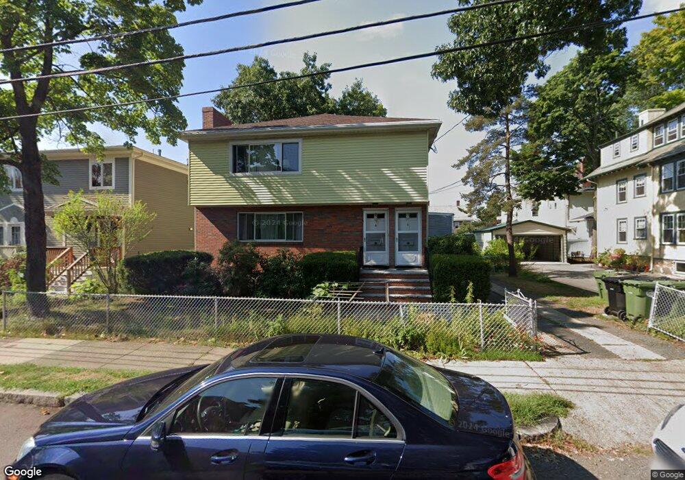
27 Phillips St Unit 29 Watertown, MA 02472
East Watertown NeighborhoodEstimated Value: $1,099,000 - $1,287,609
4
Beds
4
Baths
2,820
Sq Ft
$420/Sq Ft
Est. Value
About This Home
This home is located at 27 Phillips St Unit 29, Watertown, MA 02472 and is currently estimated at $1,184,652, approximately $420 per square foot. 27 Phillips St Unit 29 is a home located in Middlesex County with nearby schools including The Kendall School, St. Stephen's Armenian Elementary School, and Beacon High School.
Ownership History
Date
Name
Owned For
Owner Type
Purchase Details
Closed on
Oct 22, 2003
Sold by
Foun Donald and Foun Andrew
Bought by
Foun Donald and Foun Jinying
Current Estimated Value
Home Financials for this Owner
Home Financials are based on the most recent Mortgage that was taken out on this home.
Original Mortgage
$250,000
Outstanding Balance
$116,184
Interest Rate
6.15%
Mortgage Type
Purchase Money Mortgage
Estimated Equity
$1,068,468
Purchase Details
Closed on
Feb 22, 1999
Sold by
Foun Danny
Bought by
Foun Andrew and Foun Linda
Create a Home Valuation Report for This Property
The Home Valuation Report is an in-depth analysis detailing your home's value as well as a comparison with similar homes in the area
Home Values in the Area
Average Home Value in this Area
Purchase History
| Date | Buyer | Sale Price | Title Company |
|---|---|---|---|
| Foun Donald | $280,000 | -- | |
| Foun Donald | $280,000 | -- | |
| Foun Andrew | $130,000 | -- |
Source: Public Records
Mortgage History
| Date | Status | Borrower | Loan Amount |
|---|---|---|---|
| Open | Foun Andrew | $110,000 | |
| Open | Foun Donald | $250,000 | |
| Closed | Foun Andrew | $250,000 | |
| Previous Owner | Foun Andrew | $41,000 |
Source: Public Records
Tax History Compared to Growth
Tax History
| Year | Tax Paid | Tax Assessment Tax Assessment Total Assessment is a certain percentage of the fair market value that is determined by local assessors to be the total taxable value of land and additions on the property. | Land | Improvement |
|---|---|---|---|---|
| 2025 | $11,630 | $995,700 | $478,900 | $516,800 |
| 2024 | $10,453 | $893,400 | $465,300 | $428,100 |
| 2023 | $11,866 | $873,800 | $450,300 | $423,500 |
| 2022 | $10,943 | $825,900 | $405,300 | $420,600 |
| 2021 | $9,860 | $804,900 | $397,800 | $407,100 |
| 2020 | $9,493 | $782,000 | $382,800 | $399,200 |
| 2019 | $9,122 | $708,200 | $367,700 | $340,500 |
| 2018 | $8,517 | $632,300 | $326,500 | $305,800 |
| 2017 | $8,783 | $632,300 | $326,500 | $305,800 |
| 2016 | $8,187 | $598,500 | $292,700 | $305,800 |
| 2015 | $7,838 | $521,500 | $277,700 | $243,800 |
| 2014 | $7,802 | $521,500 | $277,700 | $243,800 |
Source: Public Records
Map
Nearby Homes
- 93 Spring St Unit 29
- 11 Broadway Unit 11
- 71 Palfrey St Unit 71
- 21 Fayette St Unit 1
- 235 Mount Auburn St
- 61-63 Church St
- 14 N Beacon Ct
- 14 Royal St
- 27 Ladd St Unit 27
- 25 Ladd St Unit 25
- 25 Ladd St
- 194 N Beacon St
- 91 Fayette St
- 126 Summer St Unit 126
- 24-26 Louise St
- 84 Boylston St
- 214 Palfrey St
- 99 Pleasant St Unit 2-1
- 180-182 Walnut St
- 33 Capitol St
- 33 Phillips St Unit 2
- 33 Phillips St Unit 1
- 23 Phillips St Unit 2
- 23 Phillips St
- 23 Phillips St Unit 1
- 30 Irving St
- 17 Phillips St
- 22 Irving St Unit 24
- 22 Irving St
- 22 Irving St Unit 22
- 22 Irving St Unit 1
- 24 Irving St
- 34 Phillips St
- 34 Phillips St Unit 34
- 6 Garnet St
- 26 Phillips St
- 9 Garnet St Unit 9
- 11 Garnet St
- 11 Garnet St Unit 2
- 11 Garnet St Unit 11