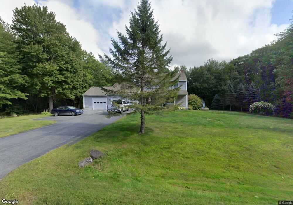
27 Quail Trail Buxton, ME 04093
Estimated Value: $533,589 - $575,000
3
Beds
2
Baths
1,680
Sq Ft
$331/Sq Ft
Est. Value
About This Home
This home is located at 27 Quail Trail, Buxton, ME 04093 and is currently estimated at $555,897, approximately $330 per square foot. 27 Quail Trail is a home with nearby schools including Bonny Eagle High School.
Ownership History
Date
Name
Owned For
Owner Type
Purchase Details
Closed on
Sep 26, 2018
Sold by
Myrick Jeanne L
Bought by
Murphy Donald C and Murphy Brooke J
Current Estimated Value
Home Financials for this Owner
Home Financials are based on the most recent Mortgage that was taken out on this home.
Original Mortgage
$247,800
Outstanding Balance
$213,854
Interest Rate
4.5%
Mortgage Type
New Conventional
Estimated Equity
$342,043
Purchase Details
Closed on
Feb 21, 2017
Sold by
Myrick Arland L
Bought by
Myrick Jeanne L
Purchase Details
Closed on
Mar 14, 2006
Sold by
White Jeanne L
Bought by
Myrick Arland L and Myrick Jeanne L
Create a Home Valuation Report for This Property
The Home Valuation Report is an in-depth analysis detailing your home's value as well as a comparison with similar homes in the area
Home Values in the Area
Average Home Value in this Area
Purchase History
| Date | Buyer | Sale Price | Title Company |
|---|---|---|---|
| Murphy Donald C | -- | -- | |
| Myrick Jeanne L | -- | -- | |
| Myrick Arland L | -- | -- |
Source: Public Records
Mortgage History
| Date | Status | Borrower | Loan Amount |
|---|---|---|---|
| Open | Murphy Donald C | $247,800 |
Source: Public Records
Tax History
| Year | Tax Paid | Tax Assessment Tax Assessment Total Assessment is a certain percentage of the fair market value that is determined by local assessors to be the total taxable value of land and additions on the property. | Land | Improvement |
|---|---|---|---|---|
| 2025 | $5,446 | $477,700 | $98,300 | $379,400 |
| 2024 | $5,250 | $477,700 | $98,300 | $379,400 |
| 2023 | $4,982 | $477,700 | $98,300 | $379,400 |
| 2022 | $4,892 | $477,700 | $98,300 | $379,400 |
| 2021 | $4,381 | $303,000 | $60,800 | $242,200 |
| 2020 | $4,053 | $303,000 | $60,800 | $242,200 |
| 2019 | $3,942 | $266,000 | $60,800 | $205,200 |
| 2018 | $3,478 | $266,000 | $60,800 | $205,200 |
| 2017 | $3,346 | $266,000 | $60,800 | $205,200 |
| 2016 | $3,471 | $266,000 | $60,800 | $205,200 |
| 2015 | $3,445 | $266,000 | $60,800 | $205,200 |
| 2014 | $3,274 | $257,800 | $60,800 | $197,000 |
| 2013 | $3,223 | $257,800 | $60,800 | $197,000 |
Source: Public Records
Map
Nearby Homes
- 30 Joan Dixon Way
- Lot 2 Commerce Way
- 4 Pelletier Dr
- 4 Moderation St
- 2 Bonny Eagle Rd
- 107 Sokokis Trail
- 866 Parker Farm Rd Unit A
- 866 Parker Farm Rd Unit B
- 866 Parker Farm Lot B Rd
- 866 Parker Farm Lot A Rd
- 207 Dunnell Rd
- 7 Pelletier Dr
- Lot 8 Pelletier Dr
- Lot 10 Pelletier Dr
- 82 Carll Rd
- TBD Saco Rd
- 95 River Rd
- 1306 Long Plains Rd
- 42 Brandons Way
- 19 Depot St
- 34 Green Ridge Dr
- 11 Quail Trail
- 37 Quail Trail
- Lots 10 & Quail Trail
- 34 Quail Trail
- 28 Quail Trail
- 22 Quail Trail
- 22 Green Ridge Dr
- Lot #9 Quail Trail
- Lot #7 Quail Trail
- 40 Quail Trail
- 37 Green Ridge Dr
- 36 Green Ridge Dr
- 27 Green Ridge Dr
- 48 Green Ridge Dr
- 46 Quail Trail
- 23 Green Ridge Dr
- 12 Green Ridge Dr
- 16 Quail Trail
- 33 Green Ridge Dr
Your Personal Tour Guide
Ask me questions while you tour the home.