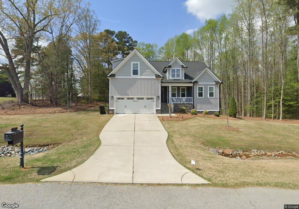
27 Rean Ct Unit L31 Angier, NC 27501
Pleasant Grove NeighborhoodEstimated Value: $384,891 - $450,000
3
Beds
3
Baths
2,072
Sq Ft
$202/Sq Ft
Est. Value
About This Home
This home is located at 27 Rean Ct Unit L31, Angier, NC 27501 and is currently estimated at $417,723, approximately $201 per square foot. 27 Rean Ct Unit L31 is a home located in Johnston County with nearby schools including McGee's Crossroads Elementary School, McGee's Crossroads Middle School, and West Johnston High School.
Ownership History
Date
Name
Owned For
Owner Type
Purchase Details
Closed on
Nov 27, 2018
Sold by
Capitol City Homes Llc
Bought by
Miller Morgan M and Denton Brian
Current Estimated Value
Home Financials for this Owner
Home Financials are based on the most recent Mortgage that was taken out on this home.
Original Mortgage
$225,000
Outstanding Balance
$198,230
Interest Rate
4.8%
Mortgage Type
New Conventional
Estimated Equity
$219,493
Purchase Details
Closed on
Jan 17, 2012
Sold by
Bdg Amary Associates Llc
Bought by
Capitol City Homes Llc
Create a Home Valuation Report for This Property
The Home Valuation Report is an in-depth analysis detailing your home's value as well as a comparison with similar homes in the area
Home Values in the Area
Average Home Value in this Area
Purchase History
| Date | Buyer | Sale Price | Title Company |
|---|---|---|---|
| Miller Morgan M | $250,000 | None Available | |
| Capitol City Homes Llc | $825,000 | None Available |
Source: Public Records
Mortgage History
| Date | Status | Borrower | Loan Amount |
|---|---|---|---|
| Open | Miller Morgan M | $225,000 |
Source: Public Records
Tax History Compared to Growth
Tax History
| Year | Tax Paid | Tax Assessment Tax Assessment Total Assessment is a certain percentage of the fair market value that is determined by local assessors to be the total taxable value of land and additions on the property. | Land | Improvement |
|---|---|---|---|---|
| 2025 | $2,478 | $390,170 | $80,000 | $310,170 |
| 2024 | $1,986 | $245,160 | $40,000 | $205,160 |
| 2023 | $1,925 | $245,160 | $40,000 | $205,160 |
| 2022 | $1,986 | $245,160 | $40,000 | $205,160 |
| 2021 | $1,986 | $245,160 | $40,000 | $205,160 |
| 2020 | $2,059 | $245,160 | $40,000 | $205,160 |
| 2019 | $2,010 | $245,160 | $40,000 | $205,160 |
| 2018 | $0 | $40,000 | $40,000 | $0 |
| 2017 | $336 | $40,000 | $40,000 | $0 |
| 2016 | $336 | $40,000 | $40,000 | $0 |
| 2015 | $336 | $40,000 | $40,000 | $0 |
| 2014 | $336 | $40,000 | $40,000 | $0 |
Source: Public Records
Map
Nearby Homes
- 115 Wiggins Rd
- 230 Paula Dr
- 135 White Memorial Rd
- 19 Lake Refuge Ct
- 175 White Memorial Rd
- 100 Pine Needle Dr
- 160 Old Cabin Ct
- 250 Crosscreek Ln
- 38.2 Acres Wiggins Rd
- 197 Silverside Dr
- 105 Pinecrest Dr
- 135 Brookstone Way
- 3002 Red Cir
- 1025 Lake Path Rd
- 823 Shadow Lake Dr
- 623 Canady Ct
- 170 Parrish Landing Way
- 506 Harbor Cove Dr
- 126 Lakeside Cir
- 376 Everland Pkwy
- 62 Suzanne Dr
- 62 Suzanne Dr Unit L32
- 26 Rean Ct Unit L29
- 26 Rean Ct
- 16191 Nc 210 Hwy
- 80 Suzanne Dr Unit L33
- 32 Suzanne Dr Unit L28
- 32 Suzanne Dr
- 12 Rean Ct Unit L28
- 57 Suzanne Dr
- 41 Suzanne Dr
- 34 Rean Ct
- 71 Suzanne Dr Unit L36
- 71 Suzanne Dr
- 83 Suzanne Dr
- 79 Suzanne Dr Unit L35
- 79 Suzanne Dr
- 79 Suzanne Dr
- 26 Edmund Dr
- 10 Suzanne Dr Unit L27