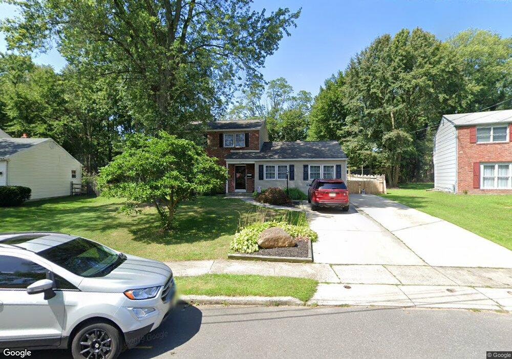
27 Red Leaf Rd Moorestown, NJ 08057
Estimated Value: $446,245 - $548,000
Studio
--
Bath
1,967
Sq Ft
$258/Sq Ft
Est. Value
About This Home
This home is located at 27 Red Leaf Rd, Moorestown, NJ 08057 and is currently estimated at $507,811, approximately $258 per square foot. 27 Red Leaf Rd is a home located in Burlington County with nearby schools including Mary E. Roberts Elementary School, Moorestown Upper Elementary School, and William Allen Middle School.
Ownership History
Date
Name
Owned For
Owner Type
Purchase Details
Closed on
Jan 28, 2003
Sold by
Walker James T
Bought by
Walker James T and Walker Melanie
Current Estimated Value
Home Financials for this Owner
Home Financials are based on the most recent Mortgage that was taken out on this home.
Original Mortgage
$110,000
Interest Rate
5.25%
Purchase Details
Closed on
May 21, 1999
Sold by
Namnum Judith
Bought by
Walker James T
Home Financials for this Owner
Home Financials are based on the most recent Mortgage that was taken out on this home.
Original Mortgage
$117,000
Interest Rate
6.82%
Purchase Details
Closed on
Oct 24, 1994
Sold by
Marker William H and Marker Nancy L
Bought by
Namnum Judith T
Create a Home Valuation Report for This Property
The Home Valuation Report is an in-depth analysis detailing your home's value as well as a comparison with similar homes in the area
Home Values in the Area
Average Home Value in this Area
Purchase History
| Date | Buyer | Sale Price | Title Company |
|---|---|---|---|
| Walker James T | -- | American Home Title | |
| Walker James T | $152,000 | -- | |
| Namnum Judith T | $138,000 | -- |
Source: Public Records
Mortgage History
| Date | Status | Borrower | Loan Amount |
|---|---|---|---|
| Closed | Walker James T | $110,000 | |
| Closed | Walker James T | $117,000 |
Source: Public Records
Tax History Compared to Growth
Tax History
| Year | Tax Paid | Tax Assessment Tax Assessment Total Assessment is a certain percentage of the fair market value that is determined by local assessors to be the total taxable value of land and additions on the property. | Land | Improvement |
|---|---|---|---|---|
| 2025 | $6,879 | $240,600 | $68,000 | $172,600 |
| 2024 | $6,672 | $240,600 | $68,000 | $172,600 |
| 2023 | $6,672 | $240,600 | $68,000 | $172,600 |
| 2022 | $6,638 | $240,600 | $68,000 | $172,600 |
| 2021 | $6,554 | $240,600 | $68,000 | $172,600 |
| 2020 | $6,511 | $240,600 | $68,000 | $172,600 |
| 2019 | $6,393 | $240,600 | $68,000 | $172,600 |
| 2018 | $6,205 | $240,600 | $68,000 | $172,600 |
| 2017 | $6,246 | $240,600 | $68,000 | $172,600 |
| 2016 | $6,217 | $240,600 | $68,000 | $172,600 |
| 2015 | $6,135 | $240,600 | $68,000 | $172,600 |
| 2014 | $5,835 | $240,600 | $68,000 | $172,600 |
Source: Public Records
Map
Nearby Homes
- 206 Crider Ave Unit 206
- 106 Pine St
- 11 Errickson Ave
- 620 N Lincoln Ave
- 506 N Garfield Ave
- 62 Eraser Rd
- 44 Eraser Rd
- 20 -22 New Albany Rd
- 149 Chalkboard Ct
- 21 N Lenola Rd
- 9 N Lenola Rd
- 117 Domenica Dr
- 33 Vincent Way
- 99 Grant Ave
- 206 E Camden Ave
- 411 Stiles Ave Unit E-5
- 114 Grant Ave
- 411 C12 Stiles Ave Unit C-12
- 531 Covington Terrace
- 15 S Pine Ave