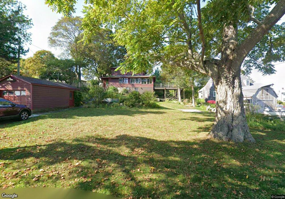
27 Riverside Rd Gloucester, MA 01930
Riverview NeighborhoodEstimated Value: $721,000 - $904,000
4
Beds
2
Baths
1,856
Sq Ft
$443/Sq Ft
Est. Value
About This Home
This home is located at 27 Riverside Rd, Gloucester, MA 01930 and is currently estimated at $822,724, approximately $443 per square foot. 27 Riverside Rd is a home located in Essex County with nearby schools including Beeman Memorial, Ralph B O'maley Middle School, and Gloucester High School.
Ownership History
Date
Name
Owned For
Owner Type
Purchase Details
Closed on
May 18, 1999
Sold by
Card Marion M and Randlett Rawson W
Bought by
Evans Paul R and Bishop Deborah A
Current Estimated Value
Create a Home Valuation Report for This Property
The Home Valuation Report is an in-depth analysis detailing your home's value as well as a comparison with similar homes in the area
Home Values in the Area
Average Home Value in this Area
Purchase History
| Date | Buyer | Sale Price | Title Company |
|---|---|---|---|
| Evans Paul R | $225,000 | -- |
Source: Public Records
Mortgage History
| Date | Status | Borrower | Loan Amount |
|---|---|---|---|
| Open | Evans Paul R | $45,000 | |
| Open | Evans Paul R | $226,000 | |
| Closed | Evans Paul R | $45,000 |
Source: Public Records
Tax History
| Year | Tax Paid | Tax Assessment Tax Assessment Total Assessment is a certain percentage of the fair market value that is determined by local assessors to be the total taxable value of land and additions on the property. | Land | Improvement |
|---|---|---|---|---|
| 2025 | $7,030 | $723,200 | $288,300 | $434,900 |
| 2024 | $6,903 | $709,500 | $274,600 | $434,900 |
| 2023 | $6,623 | $625,400 | $245,300 | $380,100 |
| 2022 | $6,353 | $541,600 | $208,500 | $333,100 |
| 2021 | $6,132 | $492,900 | $189,500 | $303,400 |
| 2020 | $6,075 | $492,700 | $189,500 | $303,200 |
| 2019 | $5,858 | $461,600 | $189,500 | $272,100 |
| 2018 | $5,687 | $439,800 | $189,500 | $250,300 |
| 2017 | $5,206 | $394,700 | $180,500 | $214,200 |
| 2016 | $5,071 | $372,600 | $181,000 | $191,600 |
| 2015 | $4,888 | $358,100 | $181,000 | $177,100 |
Source: Public Records
Map
Nearby Homes
- 13 Honeysuckle Rd
- 672 Washington St
- 2 Finch Ln
- 167 Atlantic St
- 226 Atlantic St
- 6 Monroe Ct
- 98 Maplewood Ave
- 16 Cleveland Place Unit 11
- 40 Sargent St
- 19 Trask St Unit 2
- 15 Harvard St
- 33 Maplewood Ave Unit 16
- 7 Colburn St
- 84 Centennial Ave
- 5 Samoset Rd Unit B
- 10 Oak St Unit 3
- 20 Beacon St Unit 2
- 20 Beacon St Unit 1
- 160 Prospect St Unit 3
- 33 Middle St
- 23 Riverside Rd
- 24 Shore Hill Rd
- 22 Shore Hill Rd
- 19R Riverside Rd
- 28 Riverside Rd
- 22 Riverside Rd
- 19 Riverside Rd
- 32 Riverside Rd
- 9 Wheelers Point Rd
- 18 Riverside Rd
- 25 Shore Hill Rd
- 8 Wheelers Point Rd
- 16 Riverside Rd
- 20 Shore Hill Rd
- 7 Wheelers Point Rd
- 17 Riverside Rd
- 17 Riverside Rd
- 14 Riverside Rd
- 14 Riverside Road (Wheelers Pt)
- 3 Hills Rd
Your Personal Tour Guide
Ask me questions while you tour the home.