Estimated Value: $213,608 - $246,000
Studio
2
Baths
1,716
Sq Ft
$135/Sq Ft
Est. Value
About This Home
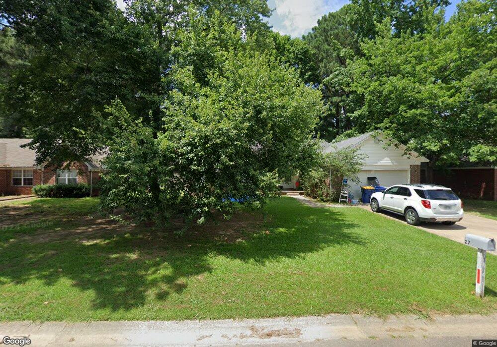
This home is located at 27 Robin Ln, Cabot, AR 72023 and is currently estimated at $231,402, approximately $134 per square foot. 27 Robin Ln is a home located in Lonoke County with nearby schools including Central Elementary School, Cabot Junior High South, and Cabot Middle School South.
Ownership History
Date
Name
Owned For
Owner Type
Purchase Details
Closed on
Nov 29, 2016
Sold by
Veterans Admin
Bought by
Geater David N
Current Estimated Value
Purchase Details
Closed on
Jan 26, 2016
Sold by
U S Bank National Association
Bought by
Veterans Admin
Purchase Details
Closed on
Jan 15, 2016
Sold by
Hill Joseph V and Hill Mary T
Bought by
U S Bank National Association
Purchase Details
Closed on
Feb 27, 2006
Sold by
Hill Joseph V
Bought by
Hill Mary T
Purchase Details
Closed on
Sep 16, 1996
Bought by
Hill
Purchase Details
Closed on
Sep 8, 1995
Bought by
Cates and Wife Anita
Create a Home Valuation Report for This Property
The Home Valuation Report is an in-depth analysis detailing your home's value as well as a comparison with similar homes in the area
Purchase History
| Date | Buyer | Sale Price | Title Company |
|---|---|---|---|
| Geater David N | $85,000 | None Available | |
| Veterans Admin | -- | Attorney | |
| U S Bank National Association | $105,462 | Attorney | |
| Hill Mary T | -- | -- | |
| Hill | $90,000 | -- | |
| Hill | $90,000 | -- | |
| Cates | $12,000 | -- |
Source: Public Records
Mortgage History
| Date | Status | Borrower | Loan Amount |
|---|---|---|---|
| Closed | U S Bank National Association | $0 |
Source: Public Records
Tax History
| Year | Tax Paid | Tax Assessment Tax Assessment Total Assessment is a certain percentage of the fair market value that is determined by local assessors to be the total taxable value of land and additions on the property. | Land | Improvement |
|---|---|---|---|---|
| 2025 | $1,285 | $25,240 | $2,800 | $22,440 |
| 2024 | $1,285 | $25,240 | $2,800 | $22,440 |
| 2023 | $1,285 | $25,240 | $2,800 | $22,440 |
| 2022 | $1,285 | $25,240 | $2,800 | $22,440 |
| 2021 | $1,285 | $25,240 | $2,800 | $22,440 |
| 2020 | $1,177 | $23,120 | $2,800 | $20,320 |
| 2019 | $1,177 | $23,120 | $2,800 | $20,320 |
| 2018 | $1,142 | $23,120 | $2,800 | $20,320 |
| 2017 | $1,142 | $0 | $0 | $0 |
| 2016 | $792 | $23,120 | $2,800 | $20,320 |
| 2015 | $744 | $22,150 | $2,800 | $19,350 |
| 2014 | $744 | $22,150 | $2,800 | $19,350 |
Source: Public Records
Map
Nearby Homes
- 34 Bent Tree Dr
- 40 Bent Tree Dr
- 00 Plaza Blvd
- 92 Sycamore Cir
- 37 Pond St
- 49 Oak Meadows Dr
- 57 Meadowlark Dr
- 19 Sycamore St
- 51 Meadowlark Dr
- 16 Meadowlark Dr
- 35 Warren St
- 23 Robinson St
- 20 Paige Ave
- 105 Earnhardt Cir
- 28 Pheasant Run Dr
- Lots 44 &45 Broadmoor Cir
- 19 Talladega Dr
- 11 Warren St
- 1309 S Pine St
- 4 Beechwood St
Your Personal Tour Guide
Ask me questions while you tour the home.