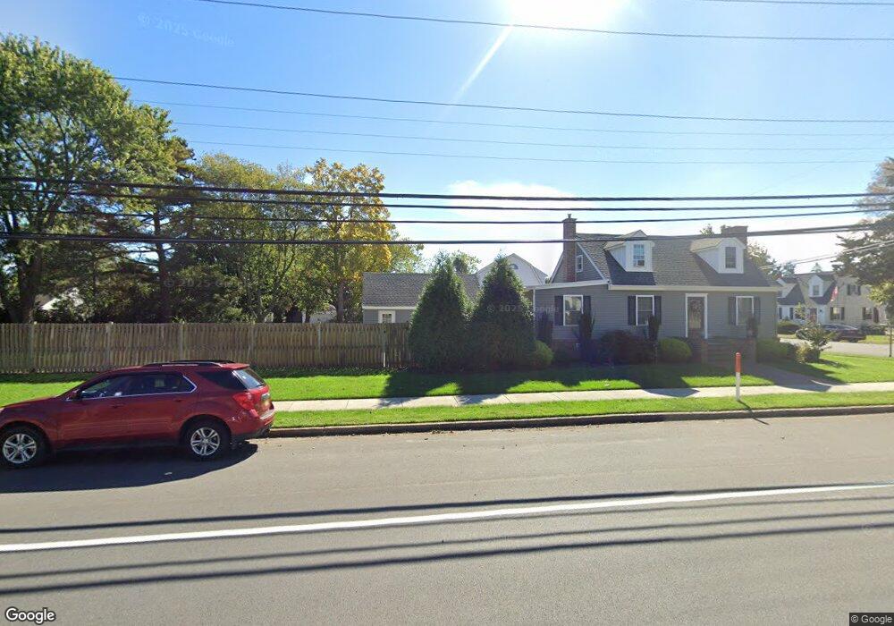
27 Route Us 9 N Marmora, NJ 08223
Estimated Value: $373,167 - $465,000
--
Bed
--
Bath
1,296
Sq Ft
$333/Sq Ft
Est. Value
About This Home
This home is located at 27 Route Us 9 N, Marmora, NJ 08223 and is currently estimated at $431,292, approximately $332 per square foot. 27 Route Us 9 N is a home located in Cape May County with nearby schools including Upper Township Primary School, Upper Township Elementary School, and Upper Township Middle School.
Ownership History
Date
Name
Owned For
Owner Type
Purchase Details
Closed on
Mar 26, 2016
Sold by
Lilly Thomas and Lilly Monique
Bought by
Comeforo Brian and Gallagher Joy
Current Estimated Value
Purchase Details
Closed on
Jun 10, 2008
Sold by
Seng Christopher E and Seng Jessica L
Bought by
Lilly Thomas and Lilly Monique
Purchase Details
Closed on
Jan 21, 1993
Sold by
Winner George A and Winner Sadie W
Bought by
Winner George A and Winner Sadie W
Create a Home Valuation Report for This Property
The Home Valuation Report is an in-depth analysis detailing your home's value as well as a comparison with similar homes in the area
Home Values in the Area
Average Home Value in this Area
Purchase History
| Date | Buyer | Sale Price | Title Company |
|---|---|---|---|
| Comeforo Brian | $185,000 | None Available | |
| Lilly Thomas | $171,100 | None Available | |
| Winner George A | -- | -- |
Source: Public Records
Tax History Compared to Growth
Tax History
| Year | Tax Paid | Tax Assessment Tax Assessment Total Assessment is a certain percentage of the fair market value that is determined by local assessors to be the total taxable value of land and additions on the property. | Land | Improvement |
|---|---|---|---|---|
| 2025 | $4,937 | $215,100 | $117,300 | $97,800 |
| 2024 | $4,937 | $215,100 | $117,300 | $97,800 |
| 2023 | $4,693 | $215,100 | $117,300 | $97,800 |
| 2022 | $4,521 | $215,100 | $117,300 | $97,800 |
| 2021 | $3,227 | $215,100 | $117,300 | $97,800 |
| 2020 | $4,192 | $215,100 | $117,300 | $97,800 |
| 2019 | $4,080 | $215,100 | $117,300 | $97,800 |
| 2018 | $3,973 | $215,100 | $117,300 | $97,800 |
| 2017 | $3,923 | $215,100 | $117,300 | $97,800 |
| 2016 | $3,612 | $194,700 | $117,300 | $77,400 |
| 2015 | $3,514 | $194,700 | $117,300 | $77,400 |
| 2014 | $3,165 | $215,000 | $145,000 | $70,000 |
Source: Public Records
Map
Nearby Homes
- 32 Norwood Rd
- 1 Roosevelt Blvd
- 14 Lyndhurst Rd
- 125 N Shore Rd
- 202 N Shore Rd
- 14 Roberts Ave
- 16 Lenape Ln
- 36 E Hollywood Ln
- 246 Egret Ln
- 430 S Shore Rd
- 601 2nd Ave
- 527 N 527 N Shore Rd
- 507 Conch Dr
- 705 Route Us 9 S
- 214 Bartram Ln
- 24 E Timber Dr
- 3709 Waterview Blvd
- 3708 Westminster Ln
- 731 Oceancrest Ave
- 734 Stagecoach Rd
- 7 Wistar Ave
- 32 Allendale Rd
- 33 South Dr
- 6 Wistar Ave
- 33 Route Us 9 N
- 21 Route Us 9 N
- 22 Allendale Rd
- 25 Allendale Rd
- 34 Route Us 9 N
- 36 Allendale Rd
- 31 Allendale Rd
- 37 Route Us 9 N
- 2 St Martins Place
- 21 Allendale Rd
- 33 Allendale Rd
- 15 Route Us 9 N
- 16 Allendale Rd
- 30 Norwood Rd
- 26 Norwood Rd
- 4 St Martins Place