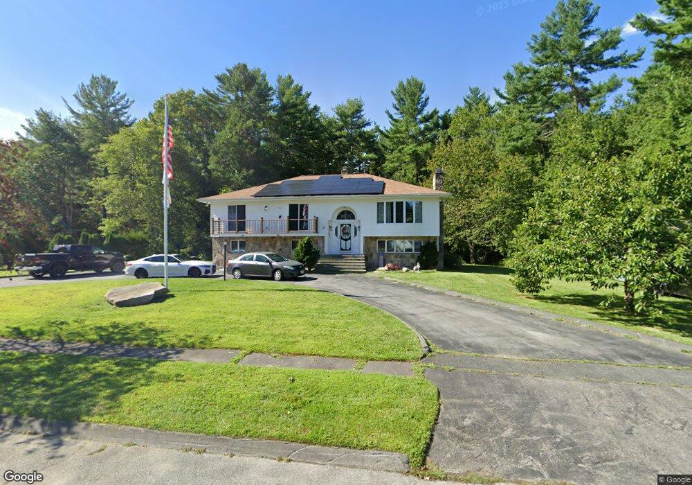
27 Running Deer Rd North Dartmouth, MA 02747
Estimated Value: $672,928 - $825,000
4
Beds
3
Baths
2,600
Sq Ft
$284/Sq Ft
Est. Value
About This Home
This home is located at 27 Running Deer Rd, North Dartmouth, MA 02747 and is currently estimated at $737,482, approximately $283 per square foot. 27 Running Deer Rd is a home located in Bristol County with nearby schools including Dartmouth High School.
Ownership History
Date
Name
Owned For
Owner Type
Purchase Details
Closed on
Mar 26, 2021
Sold by
Araujo Maria and Araujo Herman
Bought by
Araujo Robert G
Current Estimated Value
Home Financials for this Owner
Home Financials are based on the most recent Mortgage that was taken out on this home.
Original Mortgage
$386,650
Outstanding Balance
$346,780
Interest Rate
2.73%
Mortgage Type
FHA
Estimated Equity
$390,702
Purchase Details
Closed on
Jan 30, 1986
Bought by
Araujo Herman and Araujo Maria
Create a Home Valuation Report for This Property
The Home Valuation Report is an in-depth analysis detailing your home's value as well as a comparison with similar homes in the area
Home Values in the Area
Average Home Value in this Area
Purchase History
| Date | Buyer | Sale Price | Title Company |
|---|---|---|---|
| Araujo Robert G | $475,000 | None Available | |
| Araujo Herman | $30,000 | -- |
Source: Public Records
Mortgage History
| Date | Status | Borrower | Loan Amount |
|---|---|---|---|
| Open | Araujo Robert G | $386,650 | |
| Previous Owner | Araujo Herman | $271,000 | |
| Previous Owner | Araujo Herman | $270,000 |
Source: Public Records
Tax History Compared to Growth
Tax History
| Year | Tax Paid | Tax Assessment Tax Assessment Total Assessment is a certain percentage of the fair market value that is determined by local assessors to be the total taxable value of land and additions on the property. | Land | Improvement |
|---|---|---|---|---|
| 2025 | $5,447 | $601,900 | $255,000 | $346,900 |
| 2024 | $5,349 | $585,200 | $247,800 | $337,400 |
| 2023 | $4,856 | $501,100 | $205,400 | $295,700 |
| 2022 | $4,868 | $469,900 | $205,400 | $264,500 |
| 2021 | $4,802 | $443,400 | $199,800 | $243,600 |
| 2020 | $4,683 | $430,400 | $197,800 | $232,600 |
| 2019 | $4,442 | $409,400 | $190,000 | $219,400 |
| 2018 | $4,189 | $391,400 | $193,900 | $197,500 |
| 2017 | $4,107 | $386,000 | $179,400 | $206,600 |
| 2016 | $3,637 | $343,800 | $149,800 | $194,000 |
| 2015 | $3,538 | $336,600 | $140,300 | $196,300 |
| 2014 | $3,431 | $328,600 | $136,600 | $192,000 |
Source: Public Records
Map
Nearby Homes
- 264 Collins Corner Rd
- 300 High Hill Rd
- Lot 2/3 Quanapoag Rd
- 390 Old Fall River Rd
- 349 Old Fall River Rd
- 150 Quanapoag Rd
- 335 Old Fall River Rd
- 2-1 N Hixville Rd
- Lot 16-18 Old Fall River Rd
- 576 Faunce Corner Rd
- 599 Quanapoag Rd
- 491 Faunce Corner Rd
- 309 Yellow Hill Rd
- 411 Faunce Corner Rd
- Block 30 Hixville Rd
- Block 27 Hixville Rd
- 496-L62M40 Hixville Rd
- 00 Hixville Rd
- Block 14 Hixville Rd
- 37 Maxine St
- 31 Running Deer Rd
- 24 Running Deer Rd
- 23 Running Deer Rd
- 20 Running Deer Rd
- 28 Running Deer Rd
- 16 Running Deer Rd
- 35 Running Deer Rd
- 19 Running Deer Rd
- 12 Running Deer Rd
- 15 Running Deer Rd
- 8 Running Deer Rd
- 11 Running Deer Rd
- 7 Running Deer Rd
- 4 Running Deer Rd
- 267 Flag Swamp Rd
- 3 Running Deer Rd
- 266 Flag Swamp Rd
- 254 Flag Swamp Rd
- 252 Flag Swamp Rd
- 258 Flag Swamp Rd