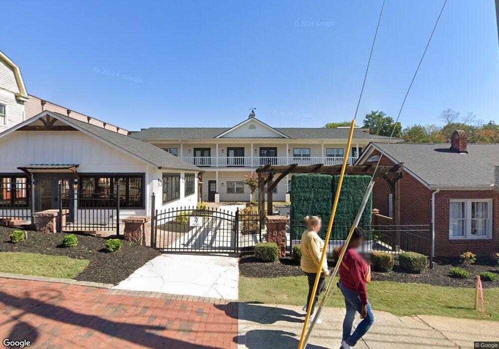
27 S Park St Dahlonega, GA 30533
Estimated Value: $257,000
--
Bed
1
Bath
1,256
Sq Ft
$205/Sq Ft
Est. Value
About This Home
This home is located at 27 S Park St, Dahlonega, GA 30533 and is currently priced at $257,000, approximately $204 per square foot. 27 S Park St is a home located in Lumpkin County with nearby schools including Clay County Middle School and Lumpkin County High School.
Ownership History
Date
Name
Owned For
Owner Type
Purchase Details
Closed on
Oct 29, 2021
Sold by
Parks Family Properties Lllp
Bought by
Csw Hospitality Group Llc
Current Estimated Value
Home Financials for this Owner
Home Financials are based on the most recent Mortgage that was taken out on this home.
Original Mortgage
$1,199,900
Outstanding Balance
$77,772
Interest Rate
3.01%
Mortgage Type
New Conventional
Purchase Details
Closed on
May 25, 2010
Sold by
Creekside Resources Inc
Bought by
Clark E L
Purchase Details
Closed on
Mar 13, 2007
Sold by
Not Provided
Bought by
Clark E L
Purchase Details
Closed on
Feb 23, 2007
Sold by
Not Provided
Bought by
Clark E L
Create a Home Valuation Report for This Property
The Home Valuation Report is an in-depth analysis detailing your home's value as well as a comparison with similar homes in the area
Home Values in the Area
Average Home Value in this Area
Purchase History
| Date | Buyer | Sale Price | Title Company |
|---|---|---|---|
| Csw Hospitality Group Llc | $220,000 | -- | |
| Clark E L | -- | -- | |
| Clark E L | -- | -- | |
| Clark E L | -- | -- | |
| Clark E L | $4,650,000 | -- | |
| Clark E L | -- | -- |
Source: Public Records
Mortgage History
| Date | Status | Borrower | Loan Amount |
|---|---|---|---|
| Open | Csw Hospitality Group Llc | $1,199,900 |
Source: Public Records
Tax History Compared to Growth
Tax History
| Year | Tax Paid | Tax Assessment Tax Assessment Total Assessment is a certain percentage of the fair market value that is determined by local assessors to be the total taxable value of land and additions on the property. | Land | Improvement |
|---|---|---|---|---|
| 2024 | $2,293 | $85,198 | $46,550 | $38,648 |
| 2023 | $2,456 | $85,198 | $46,550 | $38,648 |
| 2022 | $2,688 | $90,168 | $46,550 | $43,618 |
| 2021 | $2,805 | $85,965 | $46,550 | $39,415 |
| 2020 | $2,432 | $71,756 | $46,550 | $25,206 |
| 2019 | $2,436 | $71,516 | $46,550 | $24,966 |
| 2018 | $2,491 | $68,439 | $46,550 | $21,889 |
Source: Public Records
Map
Nearby Homes
- 0 Highway 19 N Unit 10594984
- 0 S Chestatee St Unit 10619536
- 95 Jones St
- 315 Church St
- 1392 S Chestatee St
- 168 W Main St
- 399 N Chestatee St
- 120 Riley Rd
- 329 Morrison Moore Pkwy E
- 6480A Highway 52
- 0 Highway 60 Unit 7241582
- 0 Highway 9 S Unit 10487179
- 0 Highway 9 S Unit 7548614
- 502 Wimpy Mill Rd
- 0 Calhoun Rd Unit 7643314
- 0 Calhoun Rd Unit 10598012
- 00 Calhoun Rd
- 94 Mountain View Dr
- 0 Alicia Ln
- 0 Crown Mountain Unit 7682225
- 47 S Park St
- 40 Public Square S
- 0 Shepherds Cove Unit LOT 53 3281308
- 0 Off Eagle Rest Rd Unit 7179766
- 0 Off Eagle Rest Rd Unit 3288506
- 65 S Park St
- 60 E Main St Unit M
- 199 Choice Ave
- S Public Square
- 83 S Park St
- 6.05 Ac S Chestatee St
- 00 S Chestatee St
- 0 S Chestatee St
- 0 S Chestatee St Unit 7578343
- 0 S Chestatee St Unit 10520838
- 0 S Chestatee St Unit 7542481
- 0 S Chestatee St Unit 10410921
- 0 S Chestatee St Unit 7498320
- 0 S Chestatee St Unit 7041783
- 0 S Chestatee St Unit 7418619