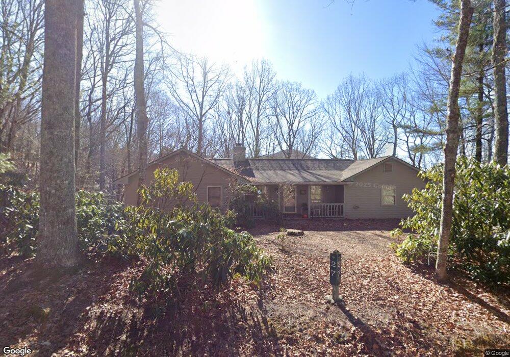
27 Saddleback Cir Dillard, GA 30537
Estimated Value: $360,609 - $559,000
3
Beds
2
Baths
1,646
Sq Ft
$273/Sq Ft
Est. Value
About This Home
This home is located at 27 Saddleback Cir, Dillard, GA 30537 and is currently estimated at $448,652, approximately $272 per square foot. 27 Saddleback Cir is a home located in Rabun County with nearby schools including Rabun County Primary School and Rabun County High School.
Ownership History
Date
Name
Owned For
Owner Type
Purchase Details
Closed on
Apr 17, 2017
Bought by
Bennett Linda G
Current Estimated Value
Purchase Details
Closed on
Jun 1, 2000
Bought by
Gortney William M
Purchase Details
Closed on
May 1, 1998
Purchase Details
Closed on
May 1, 1997
Purchase Details
Closed on
Jun 1, 1995
Purchase Details
Closed on
Aug 1, 1983
Create a Home Valuation Report for This Property
The Home Valuation Report is an in-depth analysis detailing your home's value as well as a comparison with similar homes in the area
Home Values in the Area
Average Home Value in this Area
Purchase History
| Date | Buyer | Sale Price | Title Company |
|---|---|---|---|
| Bennett Linda G | -- | -- | |
| Bennett Linda G | -- | -- | |
| Gortney William M | $180,000 | -- | |
| Gortney William M | $180,000 | -- | |
| -- | -- | -- | |
| -- | -- | -- | |
| -- | -- | -- | |
| -- | -- | -- | |
| -- | $10,000 | -- | |
| -- | $10,000 | -- | |
| -- | $14,300 | -- | |
| -- | $14,300 | -- |
Source: Public Records
Tax History
| Year | Tax Paid | Tax Assessment Tax Assessment Total Assessment is a certain percentage of the fair market value that is determined by local assessors to be the total taxable value of land and additions on the property. | Land | Improvement |
|---|---|---|---|---|
| 2025 | $2,942 | $106,485 | $26,000 | $80,485 |
| 2024 | $2,812 | $101,805 | $26,000 | $75,805 |
| 2023 | $2,776 | $88,692 | $20,800 | $67,892 |
| 2022 | $1,478 | $80,732 | $18,200 | $62,532 |
| 2021 | $1,240 | $66,118 | $10,400 | $55,718 |
| 2020 | $1,171 | $60,351 | $10,400 | $49,951 |
| 2019 | $1,179 | $60,351 | $10,400 | $49,951 |
| 2018 | $1,183 | $60,351 | $10,400 | $49,951 |
| 2017 | $1,350 | $71,822 | $10,400 | $61,422 |
| 2016 | $1,354 | $71,822 | $10,400 | $61,422 |
| 2015 | $1,478 | $76,765 | $10,400 | $66,365 |
| 2014 | $1,486 | $76,765 | $10,400 | $66,365 |
Source: Public Records
Map
Nearby Homes
- 42 Lost Valley Dr
- 119 Buttermilk Cir
- 0 Saddleback Cir Unit 10538862
- 374 W Sugarbush Dr
- 137 Pleasant Mountain Dr
- 0 LOT 41 Rebel Cir
- 522 Rebel Cir
- LOT 1 Pleasant Mountain Dr
- 41 Peek and Peak Dr
- 452 E Sugarbush Dr
- 480 Sky High Dr
- 156 Tahoe Ln
- 594 Sky High Dr
- 226 Moon Ridge Dr
- 578 Saddleback Cir
- 291 Saddleback Cir
- 70 Fairway Ln
- LOT 35 Thomas Knob Estates Rd
- 767 Driver Ln
- 0 Ridgepole Dr SE Unit 10557269
- 0 W Sugarbush Dr
- 0 W Sugarbush Dr Unit 7515821
- 0 W Sugarbush Dr Unit 10448599
- 0 W Sugarbush Dr Unit 10379120
- 0 W Sugarbush Dr Unit 8201159
- 42 Chestatee Ln
- 42 Chestatee Ln Unit 12
- 2 Buttermilk Cir
- 26 Buttermilk Cir
- 164 W Sugarbush Dr
- 2 Chestatee Ln
- 40 E Sugarbush Dr
- 40 E Sugarbush Dr Unit 20
- 428 Buttermilk Cir
- 71 71 Saddleback Cir
- 59 Kelsey Mtn Rd
- 195 W Sugarbush Dr
- 413 Buttermilk Cir
- 0 Lost Valley Unit 8194900
- 0 Lost Valley Unit 64 10097470
Your Personal Tour Guide
Ask me questions while you tour the home.