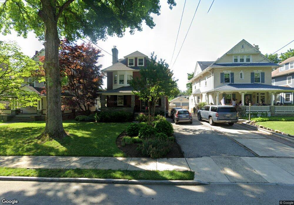
27 Saint Pauls Rd Ardmore, PA 19003
Estimated Value: $801,174 - $981,000
4
Beds
2
Baths
2,401
Sq Ft
$377/Sq Ft
Est. Value
About This Home
This home is located at 27 Saint Pauls Rd, Ardmore, PA 19003 and is currently estimated at $905,544, approximately $377 per square foot. 27 Saint Pauls Rd is a home located in Montgomery County with nearby schools including Penn Valley School, Welsh Valley Middle School, and Lower Merion High School.
Ownership History
Date
Name
Owned For
Owner Type
Purchase Details
Closed on
Aug 26, 2020
Sold by
Torf Andrea I and Rubenstein Ronald C
Bought by
Dimarco James T and Cooperstein Kaitlin L
Current Estimated Value
Home Financials for this Owner
Home Financials are based on the most recent Mortgage that was taken out on this home.
Original Mortgage
$510,400
Outstanding Balance
$452,946
Interest Rate
2.9%
Mortgage Type
Purchase Money Mortgage
Estimated Equity
$452,598
Purchase Details
Closed on
Jun 15, 1998
Sold by
Thompson Jeri L and Hazell Shannon M
Bought by
Rubenstein Ronald C and Torf Andrea I
Purchase Details
Closed on
Jun 29, 1994
Sold by
Galib Emile H and Galib Janet B
Bought by
Thompson Jeri L and Hazell Shannon M
Create a Home Valuation Report for This Property
The Home Valuation Report is an in-depth analysis detailing your home's value as well as a comparison with similar homes in the area
Home Values in the Area
Average Home Value in this Area
Purchase History
| Date | Buyer | Sale Price | Title Company |
|---|---|---|---|
| Dimarco James T | $700,000 | None Available | |
| Rubenstein Ronald C | $301,000 | -- | |
| Thompson Jeri L | $228,000 | -- |
Source: Public Records
Mortgage History
| Date | Status | Borrower | Loan Amount |
|---|---|---|---|
| Open | Dimarco James T | $510,400 |
Source: Public Records
Tax History Compared to Growth
Tax History
| Year | Tax Paid | Tax Assessment Tax Assessment Total Assessment is a certain percentage of the fair market value that is determined by local assessors to be the total taxable value of land and additions on the property. | Land | Improvement |
|---|---|---|---|---|
| 2025 | $8,550 | $204,730 | $41,220 | $163,510 |
| 2024 | $8,550 | $204,730 | $41,220 | $163,510 |
| 2023 | $8,193 | $204,730 | $41,220 | $163,510 |
| 2022 | $8,042 | $204,730 | $41,220 | $163,510 |
| 2021 | $7,859 | $204,730 | $41,220 | $163,510 |
| 2020 | $7,667 | $204,730 | $41,220 | $163,510 |
| 2019 | $7,531 | $204,730 | $41,220 | $163,510 |
| 2018 | $7,532 | $204,730 | $41,220 | $163,510 |
| 2017 | $7,255 | $204,730 | $41,220 | $163,510 |
| 2016 | $7,175 | $204,730 | $41,220 | $163,510 |
| 2015 | $6,690 | $204,730 | $41,220 | $163,510 |
| 2014 | $6,690 | $204,730 | $41,220 | $163,510 |
Source: Public Records
Map
Nearby Homes
- 14 Simpson Rd
- 101 Grandview Rd
- 140 Walnut Ave
- 383 Lakeside Rd Unit G2
- 383 Lakeside Rd Unit 105
- 64 E Spring Ave
- 1219 W Wynnewood Rd Unit 311
- 1968 W Montgomery Ave
- 222 E Montgomery Ave Unit 304
- 222 Lippincott Ave
- 1525 W Wynnewood Rd
- 221 Ardmore Ave
- 103 W Montgomery Ave Unit 1A
- 818 Clifford Ave
- 264 W Montgomery Ave Unit 304
- 2814 Saint Marys Rd
- 761 Hathaway Ln
- 754 Oak View Rd
- 442 E Spring Ave
- 2939 Berkley Rd
- 25 Saint Pauls Rd
- 29 Saint Pauls Rd Unit 814
- 23 Saint Pauls Rd
- 31 Saint Pauls Rd
- 21 Saint Pauls Rd
- 33 Saint Pauls Rd
- 19 Saint Pauls Rd
- 30 Saint Pauls Rd
- 28 Saint Pauls Rd
- 32 Saint Pauls Rd
- 26 Saint Pauls Rd
- 35 Saint Pauls Rd
- 34 Saint Pauls Rd
- 24 Saint Pauls Rd
- 38 Linwood Ave
- 36 Saint Pauls Rd
- 17 Saint Pauls Rd
- 22 Saint Pauls Rd
- 37 Saint Pauls Rd
- 38 Saint Pauls Rd