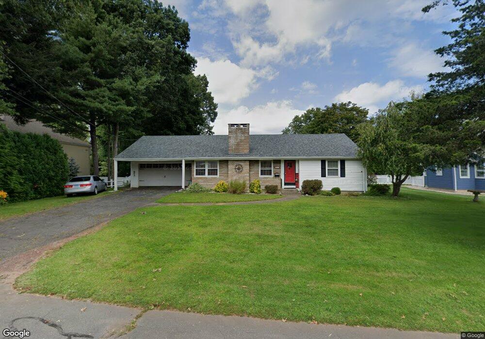
27 Simms Rd Berlin, CT 06037
Estimated Value: $427,000 - $452,000
3
Beds
3
Baths
1,552
Sq Ft
$285/Sq Ft
Est. Value
About This Home
This home is located at 27 Simms Rd, Berlin, CT 06037 and is currently estimated at $442,744, approximately $285 per square foot. 27 Simms Rd is a home located in Hartford County with nearby schools including Mary E. Griswold School, Catherine M. Mcgee Middle School, and Berlin High School.
Ownership History
Date
Name
Owned For
Owner Type
Purchase Details
Closed on
May 12, 2004
Sold by
Est Zenga Rose M and Maglio Louis
Bought by
Brochu Stephen D and Brochu Jill A
Current Estimated Value
Home Financials for this Owner
Home Financials are based on the most recent Mortgage that was taken out on this home.
Original Mortgage
$212,000
Interest Rate
5.47%
Create a Home Valuation Report for This Property
The Home Valuation Report is an in-depth analysis detailing your home's value as well as a comparison with similar homes in the area
Home Values in the Area
Average Home Value in this Area
Purchase History
| Date | Buyer | Sale Price | Title Company |
|---|---|---|---|
| Brochu Stephen D | $265,000 | -- | |
| Brochu Stephen D | $265,000 | -- |
Source: Public Records
Mortgage History
| Date | Status | Borrower | Loan Amount |
|---|---|---|---|
| Open | Brochu Stephen D | $200,000 | |
| Closed | Brochu Stephen D | $20,000 | |
| Closed | Brochu Stephen D | $204,900 | |
| Closed | Brochu Stephen D | $212,000 |
Source: Public Records
Tax History
| Year | Tax Paid | Tax Assessment Tax Assessment Total Assessment is a certain percentage of the fair market value that is determined by local assessors to be the total taxable value of land and additions on the property. | Land | Improvement |
|---|---|---|---|---|
| 2025 | $6,994 | $228,200 | $100,500 | $127,700 |
| 2024 | $6,894 | $228,200 | $100,500 | $127,700 |
| 2023 | $6,746 | $228,200 | $100,500 | $127,700 |
| 2022 | $6,227 | $181,500 | $82,100 | $99,400 |
| 2021 | $6,158 | $181,500 | $82,100 | $99,400 |
| 2020 | $6,158 | $181,500 | $82,100 | $99,400 |
| 2019 | $6,158 | $181,500 | $82,100 | $99,400 |
| 2018 | $5,899 | $181,500 | $82,100 | $99,400 |
| 2017 | $5,465 | $172,900 | $81,400 | $91,500 |
| 2016 | $5,309 | $172,300 | $81,400 | $90,900 |
| 2015 | $5,229 | $172,300 | $81,400 | $90,900 |
| 2014 | $4,983 | $172,300 | $81,400 | $90,900 |
Source: Public Records
Map
Nearby Homes
- 220 Kensington Ave
- 266 Farmington Ave
- 22 Mason Dr
- 186 Kensington Ave
- 170 Dayl Dr
- 152 Lyons St
- 30 Norden St
- 67 Brooklawn St
- 207 Roslyn Dr
- 243 Pond St
- 0 Slope South Dr
- 26 Chamberlain St
- 351 Lincoln St
- 5 Briar Ln
- 340 Lincoln St
- 156 Reservoir Rd
- 368 Reservoir Rd
- 275 Winthrop St
- 86 Buell St
- 126 Winthrop St
Your Personal Tour Guide
Ask me questions while you tour the home.