Estimated Value: $189,000 - $219,000
--
Bed
2
Baths
1,233
Sq Ft
$163/Sq Ft
Est. Value
About This Home
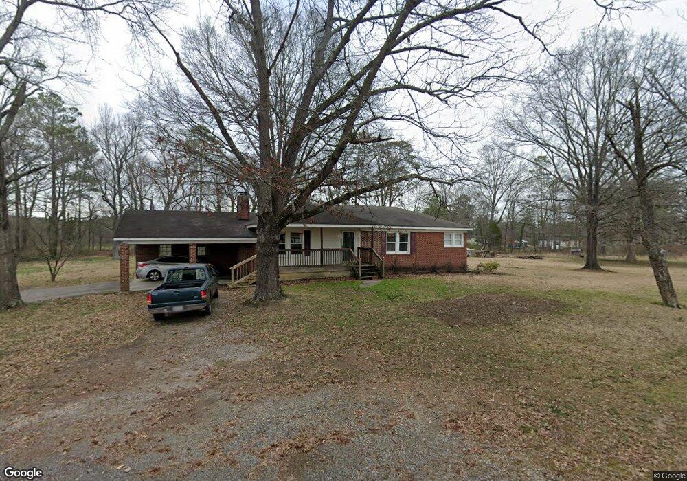
This home is located at 27 Simon Dr NW, Rome, GA 30165 and is currently estimated at $201,328, approximately $163 per square foot. 27 Simon Dr NW is a home with nearby schools including Coosa Middle School and Coosa High School.
Ownership History
Date
Name
Owned For
Owner Type
Purchase Details
Closed on
Jan 21, 1993
Bought by
P and R
Current Estimated Value
Purchase Details
Closed on
Nov 1, 1991
Sold by
Talley Robert J
Bought by
Talley Robert J
Purchase Details
Closed on
Sep 28, 1989
Sold by
Jenkins Dorothy Ann and Jenkins Danny D
Bought by
Jenkins Dorothy Ann
Purchase Details
Closed on
Sep 24, 1982
Sold by
Jenkins Dorothy Ann
Bought by
Jenkins Dorothy Ann and Jenkins Danny D
Purchase Details
Closed on
Aug 25, 1982
Sold by
Benton Jack Etal
Bought by
Jenkins Dorothy Ann
Purchase Details
Closed on
Feb 24, 1978
Sold by
Benton B G
Bought by
Benton Jack Etal
Purchase Details
Closed on
Jan 1, 1955
Bought by
Benton B G
Create a Home Valuation Report for This Property
The Home Valuation Report is an in-depth analysis detailing your home's value as well as a comparison with similar homes in the area
Home Values in the Area
Average Home Value in this Area
Purchase History
| Date | Buyer | Sale Price | Title Company |
|---|---|---|---|
| P | -- | -- | |
| Talley Robert J | $73,000 | -- | |
| Jenkins Dorothy Ann | -- | -- | |
| Jenkins Dorothy Ann | -- | -- | |
| Jenkins Dorothy Ann | -- | -- | |
| Benton Jack Etal | -- | -- | |
| Benton B G | -- | -- |
Source: Public Records
Tax History Compared to Growth
Tax History
| Year | Tax Paid | Tax Assessment Tax Assessment Total Assessment is a certain percentage of the fair market value that is determined by local assessors to be the total taxable value of land and additions on the property. | Land | Improvement |
|---|---|---|---|---|
| 2024 | $799 | $66,949 | $19,599 | $47,350 |
| 2023 | $1,384 | $63,235 | $17,818 | $45,417 |
| 2022 | $1,151 | $48,256 | $14,737 | $33,519 |
| 2021 | $966 | $38,498 | $13,408 | $25,090 |
| 2020 | $919 | $35,523 | $11,659 | $23,864 |
| 2019 | $881 | $34,113 | $11,659 | $22,454 |
| 2018 | $850 | $32,333 | $11,105 | $21,228 |
| 2017 | $823 | $30,778 | $10,282 | $20,496 |
| 2016 | $824 | $30,311 | $10,280 | $20,031 |
| 2015 | $808 | $30,311 | $10,280 | $20,031 |
| 2014 | $808 | $30,311 | $10,280 | $20,031 |
Source: Public Records
Map
Nearby Homes
- 1 Ann Dr NW
- 4485 Alabama Hwy
- 293 N Avery Rd NW
- 86 N Avery Rd NW
- 53 Northside Dr NW
- 10 Nest Dr NW
- 45 Albert Ave NW
- 48 Atwood Dr NW
- 87 Northside Dr NW
- 4813 Alabama Hwy SW
- 5 Red Fox Dr SW
- 0 Charleston Dr NW Unit 10543945
- 0 Charleston Dr NW Unit 7598114
- 775 Mays Bridge Rd SW
- 16 Polaris Terrace NW
- 43 Brownlow Dr NW
- 26 Red Fox Dr SW
- 33 Cedar Ln NW
- 31 Cedar Ln NW
- 876 Barker Rd SW
- 14 Pinecrest Dr NW
- 22 Simon Dr NW
- 131 Vann Dr NW
- 131 Vann Dr NW
- 131 Vann Dr NW
- 25 Simon Dr
- 16 Pinecrest Dr NW
- 16 Pinecrest Dr NW
- 119 Vann Dr NW
- 12 Pinecrest Dr NW
- 69 Vann Dr NW
- 0 Vann Rd NW Unit 7192399
- 0 Vann Rd NW
- 20 Pinecrest Dr NW
- 87 Vann Dr NW
- 54 Simon Dr
- 10 Pinecrest Dr NW
- 143 Vann Dr NW
- 4266B Alabama Hwy NW
- 19 Pinecrest Dr NW