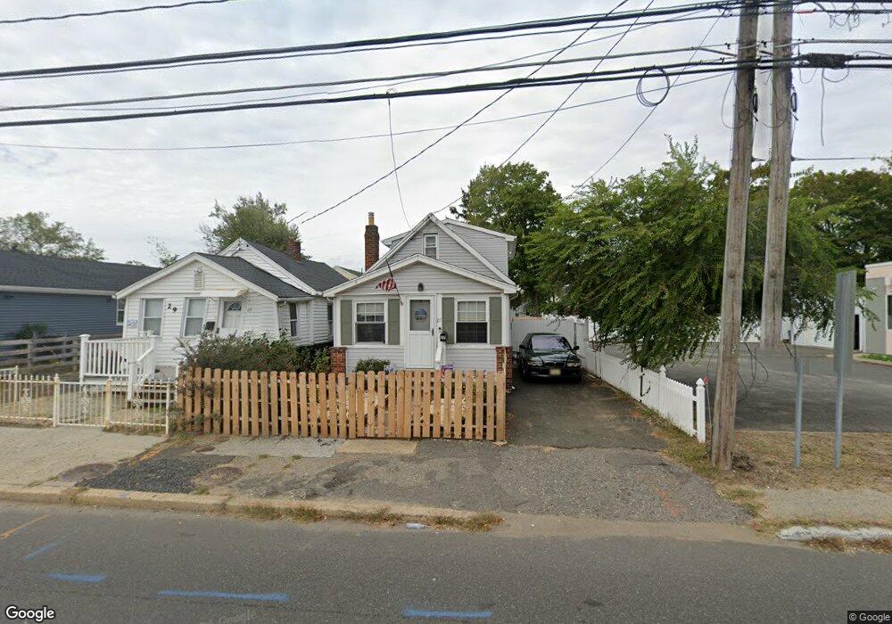
27 State Route 36 W Keansburg, NJ 07734
Estimated Value: $277,000 - $303,823
2
Beds
1
Bath
1,061
Sq Ft
$271/Sq Ft
Est. Value
About This Home
This home is located at 27 State Route 36 W, Keansburg, NJ 07734 and is currently estimated at $287,456, approximately $270 per square foot. 27 State Route 36 W is a home located in Monmouth County with nearby schools including Joseph C. Caruso School, Joseph R. Bolger Middle School, and Keansburg High School.
Ownership History
Date
Name
Owned For
Owner Type
Purchase Details
Closed on
Jan 9, 2023
Sold by
Auriemmo Francis
Bought by
Auriemmo William
Current Estimated Value
Purchase Details
Closed on
Nov 4, 2008
Sold by
Pila Raymond
Bought by
Auriemmo Francis
Home Financials for this Owner
Home Financials are based on the most recent Mortgage that was taken out on this home.
Original Mortgage
$78,000
Interest Rate
6.47%
Mortgage Type
Purchase Money Mortgage
Purchase Details
Closed on
May 25, 2006
Sold by
Ritchie Joan
Bought by
Ritchie Joan and Pila Raymond
Home Financials for this Owner
Home Financials are based on the most recent Mortgage that was taken out on this home.
Original Mortgage
$106,000
Interest Rate
6.62%
Mortgage Type
New Conventional
Purchase Details
Closed on
Nov 27, 2001
Sold by
Karol Richard
Bought by
Ritchie Joan
Create a Home Valuation Report for This Property
The Home Valuation Report is an in-depth analysis detailing your home's value as well as a comparison with similar homes in the area
Home Values in the Area
Average Home Value in this Area
Purchase History
| Date | Buyer | Sale Price | Title Company |
|---|---|---|---|
| Auriemmo William | $85,800 | -- | |
| Auriemmo Francis | $104,000 | East Coast Title Agency | |
| Ritchie Joan | -- | -- | |
| Ritchie Joan | $77,000 | -- |
Source: Public Records
Mortgage History
| Date | Status | Borrower | Loan Amount |
|---|---|---|---|
| Previous Owner | Auriemmo Francis | $78,000 | |
| Previous Owner | Ritchie Joan | $106,000 |
Source: Public Records
Tax History Compared to Growth
Tax History
| Year | Tax Paid | Tax Assessment Tax Assessment Total Assessment is a certain percentage of the fair market value that is determined by local assessors to be the total taxable value of land and additions on the property. | Land | Improvement |
|---|---|---|---|---|
| 2025 | $4,424 | $246,400 | $130,400 | $116,000 |
| 2024 | $4,095 | $201,100 | $87,200 | $113,900 |
| 2023 | $4,095 | $158,100 | $39,800 | $118,300 |
| 2022 | $3,796 | $154,900 | $39,800 | $115,100 |
| 2021 | $3,796 | $123,400 | $30,400 | $93,000 |
| 2020 | $4,332 | $108,100 | $41,600 | $66,500 |
| 2019 | $4,260 | $107,600 | $41,600 | $66,000 |
| 2018 | $4,151 | $106,200 | $41,600 | $64,600 |
| 2017 | $4,015 | $105,800 | $40,700 | $65,100 |
| 2016 | $3,945 | $108,200 | $36,200 | $72,000 |
| 2015 | $3,727 | $106,400 | $36,200 | $70,200 |
| 2014 | $3,376 | $99,200 | $30,200 | $69,000 |
Source: Public Records
Map
Nearby Homes
- 18 Saint Johns Place
- 18 John St
- 25 Hart St
- 56 Hudson Ave
- 516 Henry Place
- 0 Munro Ave
- 59 Thorne Place
- 116 Hudson Ave
- 19 Randall Place
- 31 N Clark St
- 19 Woody Terrace
- 52 Warren Place
- 270 Main St Unit 6
- 358 Carr Ave
- 55 11th St
- 101 Manning Place
- 66 Sunset Place
- 261 State Route 36
- 250 Forest Ave
- 13 Mary Ann Ct
- 29 New Jersey 36
- 29 State Route 36 W
- 31 State Route 36 W
- 26 Saint Johns Place
- 34 Saint Johns Place
- 35 State Route 36 W
- 19 State Route 36 W
- 32 Saint Johns Place
- 36 Saint Johns Place
- 20 Saint Johns Place
- 39 State Route 36 W
- 17 State Route 36 W
- 42 Saint Johns Place
- 18 John St Unit 133
- 31 Saint Johns Place
- 25 Saint Johns Place
- 48 Saint Johns Place
- 19 Saint Johns Place
- 14 Saint Johns Place
- 17 Saint Johns Place