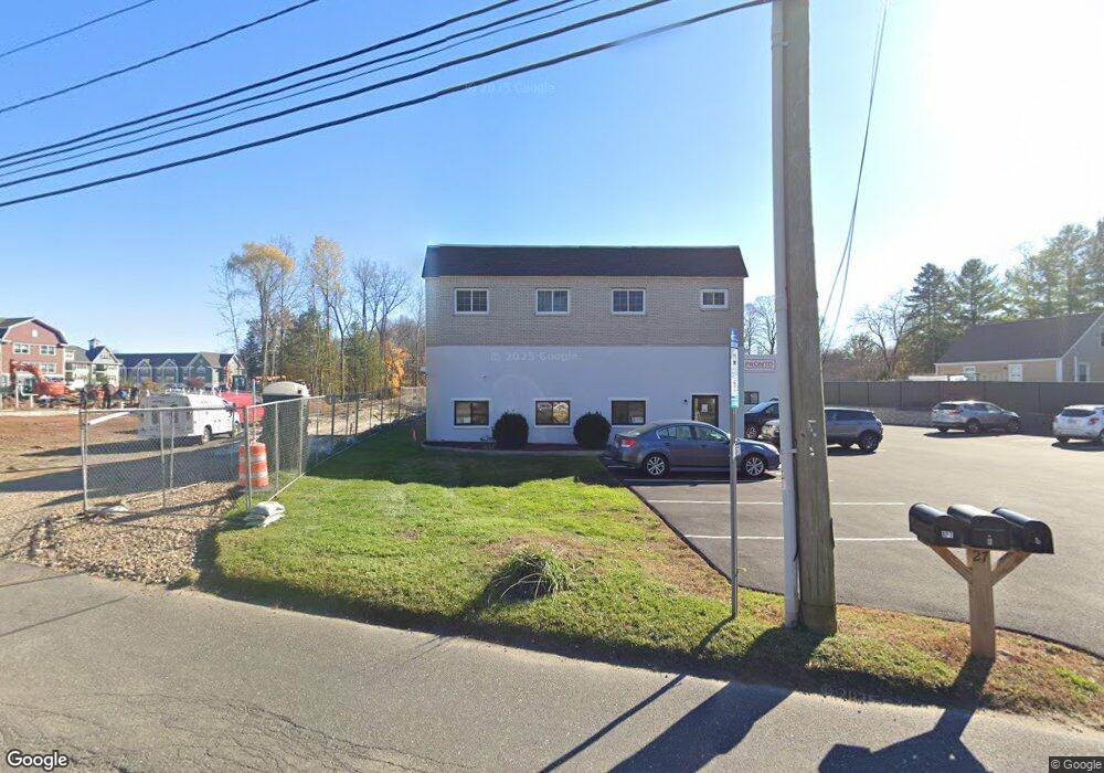
27 Station Rd Brookfield, CT 06804
Estimated Value: $683,303
3
Beds
3
Baths
7,961
Sq Ft
$86/Sq Ft
Est. Value
About This Home
This home is located at 27 Station Rd, Brookfield, CT 06804 and is currently estimated at $683,303, approximately $85 per square foot. 27 Station Rd is a home located in Fairfield County with nearby schools including Whisconier Middle School, Brookfield High School, and The Goddard School - Brookfield.
Ownership History
Date
Name
Owned For
Owner Type
Purchase Details
Closed on
Jan 3, 2019
Sold by
Ryan Bruce Llc
Bought by
27 Station Road Llc
Current Estimated Value
Purchase Details
Closed on
Nov 15, 2017
Sold by
Regional Ymca
Bought by
Ryan Bruce Llc
Purchase Details
Closed on
Jul 18, 2006
Sold by
Rbb Entertainment
Bought by
Ryan Bruce Llc
Home Financials for this Owner
Home Financials are based on the most recent Mortgage that was taken out on this home.
Original Mortgage
$380,000
Interest Rate
6.71%
Mortgage Type
Commercial
Purchase Details
Closed on
May 3, 2001
Sold by
Blessey Ray
Bought by
Blessey Ronad
Home Financials for this Owner
Home Financials are based on the most recent Mortgage that was taken out on this home.
Original Mortgage
$150,000
Interest Rate
7.5%
Mortgage Type
Commercial
Create a Home Valuation Report for This Property
The Home Valuation Report is an in-depth analysis detailing your home's value as well as a comparison with similar homes in the area
Home Values in the Area
Average Home Value in this Area
Purchase History
| Date | Buyer | Sale Price | Title Company |
|---|---|---|---|
| 27 Station Road Llc | $417,500 | -- | |
| 27 Station Road Llc | $417,500 | -- | |
| Ryan Bruce Llc | $8,000 | -- | |
| Ryan Bruce Llc | $8,000 | -- | |
| Ryan Bruce Llc | $500,000 | -- | |
| Ryan Bruce Llc | $500,000 | -- | |
| Blessey Ronad | $105,000 | -- | |
| Blessey Ronad | $105,000 | -- |
Source: Public Records
Mortgage History
| Date | Status | Borrower | Loan Amount |
|---|---|---|---|
| Previous Owner | Blessey Ronad | $380,000 | |
| Previous Owner | Blessey Ronad | $150,000 |
Source: Public Records
Tax History
| Year | Tax Paid | Tax Assessment Tax Assessment Total Assessment is a certain percentage of the fair market value that is determined by local assessors to be the total taxable value of land and additions on the property. | Land | Improvement |
|---|---|---|---|---|
| 2025 | $11,805 | $408,060 | $177,800 | $230,260 |
| 2024 | $11,385 | $408,060 | $177,800 | $230,260 |
| 2023 | $10,960 | $408,060 | $177,800 | $230,260 |
| 2022 | $10,561 | $408,060 | $177,800 | $230,260 |
| 2021 | $11,990 | $398,340 | $177,800 | $220,540 |
| 2020 | $11,811 | $398,340 | $177,800 | $220,540 |
| 2019 | $9,837 | $337,580 | $177,800 | $159,780 |
| 2018 | $9,319 | $328,830 | $169,050 | $159,780 |
| 2017 | $9,871 | $361,720 | $201,940 | $159,780 |
| 2016 | $9,841 | $372,780 | $213,000 | $159,780 |
| 2015 | $10,539 | $410,060 | $250,280 | $159,780 |
| 2014 | $10,539 | $410,060 | $250,280 | $159,780 |
Source: Public Records
Map
Nearby Homes
- 27 Riverview Ct
- 37 Old Route 7 Unit 3
- 9 Hillside Ct
- 24 Prospect Dr
- 20 Brookfield Meadows
- 215 Whisconier Rd
- 7 High Acres Rd
- 6 Hamlin Ct
- 109 Long Meadow Hill Rd
- 16 Candlewood Acres Rd
- 279 Candlewood Lake Rd
- 18 N Lake Shore Dr
- 20 N Lake Shore Dr
- 38 N Lake Shore Dr
- 44 N Lake Shore Dr
- 26 Clearview Dr
- 3 Bramble Way Unit Homesite 77
- 5 Bramble Way Unit Homesite 76
- 7 Bramble Way Unit Homesite 75
- 3 Elmwood Ct
- 27 Station Rd Unit B
- 91 Laurel Hill Rd
- 89 Laurel Hill Rd
- 87 Laurel Hill Rd
- 20 Station Rd
- 20 Station Rd
- 85 Laurel Hill Rd
- 95 Laurel Hill Rd
- 15 Station Rd
- 86 Laurel Hill Rd
- 83 Laurel Hill Rd
- 13 Station Rd Unit 1
- 84 Laurel Hill Rd
- 97 Laurel Hill Rd
- 10 Station Rd
- 7 Station Rd
- 7 Station Rd Unit 1
- 81 Laurel Hill Rd
- 94 Laurel Hill Rd
- 82 Laurel Hill Rd
Your Personal Tour Guide
Ask me questions while you tour the home.