
Seller's Agent in 2025
Craig Celli
Century 21 North East
(781) 820-9347
1 in this area
88 Total Sales
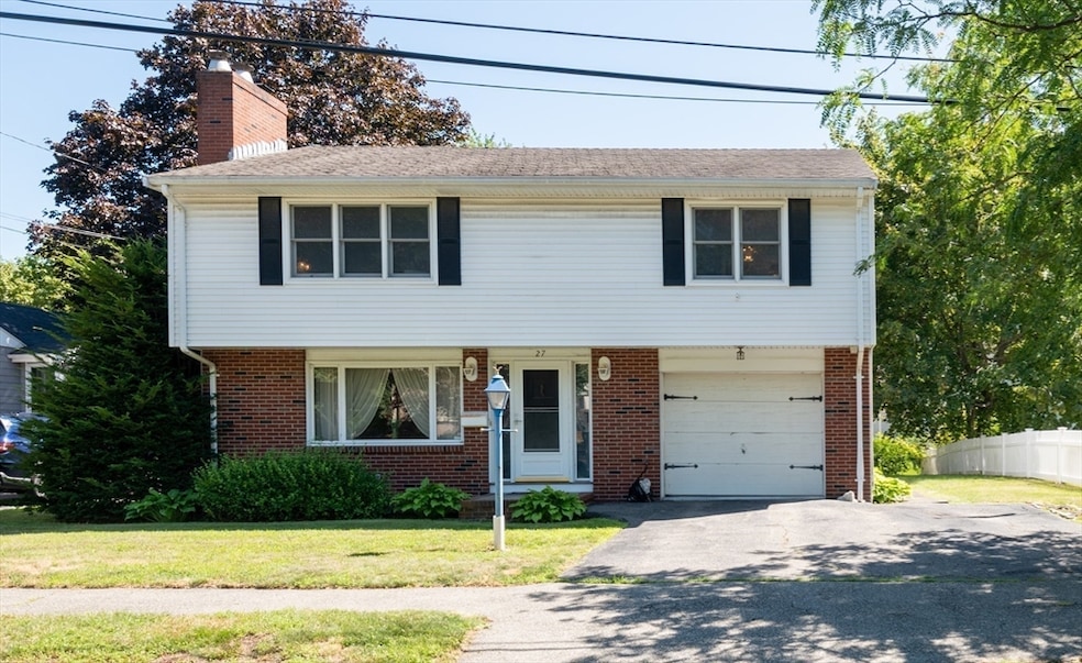
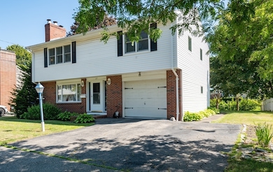
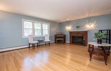
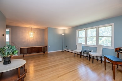
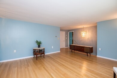
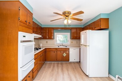
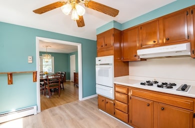
Nestled on a peaceful cul-de-sac in Salem's most coveted neighborhood bordering Swampscott...Welcome to 27 Station Road. A warm and inviting Colonial-style raised ranch in a conveniently located neighborhood in Salem. This spacious home offers 2 bedrooms (1 of the bedrooms has been converted to a dining room), 2 full bathrooms, and a flexible layout. Two fireplaces add charm and coziness to the main living space and lower-level family room. A bonus sunroom overlooking the spacious private backyard provides the perfect sun-filled spot to relax. Lower level includes a wet bar, second fireplace, dedicated laundry room, and full bath — ideal for entertaining or extended guest space. The attached garage adds convenience and extra storage. Outside enjoy a level yard on a quiet residential street, just minutes from, beaches, commuter rail, shops, parks, and vibrant downtown Salem. Don't miss this opportunity for a fantastic location in a safe and family friendly neighborhood in Salem!
| Date | Type | Sale Price | Title Company |
|---|---|---|---|
| Quit Claim Deed | $550,000 | -- | |
| Deed | $140,000 | -- |
| Date | Status | Loan Amount | Loan Type |
|---|---|---|---|
| Open | $485,000 | New Conventional | |
| Previous Owner | $136,100 | No Value Available | |
| Previous Owner | $142,100 | No Value Available | |
| Previous Owner | $72,000 | No Value Available |
| Date | Event | Price | List to Sale | Price per Sq Ft |
|---|---|---|---|---|
| 09/19/2025 09/19/25 | Sold | $550,000 | -8.2% | $316 / Sq Ft |
| 08/19/2025 08/19/25 | Pending | -- | -- | -- |
| 08/12/2025 08/12/25 | Price Changed | $599,000 | -3.2% | $345 / Sq Ft |
| 07/24/2025 07/24/25 | For Sale | $619,000 | -- | $356 / Sq Ft |
| Year | Tax Paid | Tax Assessment Tax Assessment Total Assessment is a certain percentage of the fair market value that is determined by local assessors to be the total taxable value of land and additions on the property. | Land | Improvement |
|---|---|---|---|---|
| 2025 | $6,568 | $579,200 | $213,900 | $365,300 |
| 2024 | $6,308 | $542,900 | $201,900 | $341,000 |
| 2023 | $6,117 | $489,000 | $183,800 | $305,200 |
| 2022 | $5,871 | $443,100 | $168,700 | $274,400 |
| 2021 | $5,542 | $401,600 | $156,700 | $244,900 |
| 2020 | $5,725 | $396,200 | $153,700 | $242,500 |
| 2019 | $5,696 | $377,200 | $144,600 | $232,600 |
| 2018 | $5,325 | $346,200 | $135,000 | $211,200 |
| 2017 | $5,096 | $321,300 | $126,500 | $194,800 |
| 2016 | $5,035 | $321,300 | $126,500 | $194,800 |
| 2015 | $4,759 | $290,000 | $111,500 | $178,500 |
Seller's Agent in 2025
Craig Celli
Century 21 North East
(781) 820-9347
1 in this area
88 Total Sales
Buyer's Agent in 2025
Eileen Jonah
Century 21 North East
(781) 718-7665
2 in this area
102 Total Sales
Source: MLS Property Information Network (MLS PIN)
MLS Number: 73408860
APN: SALE-000022-000000-000067
Disclaimer: Certain information contained herein is derived from information provided by parties other than Homes.com. All information provided is deemed reliable, but is not guaranteed to be accurate and should be independently verified.
![]() The property listing data and information, or the Images, set forth herein were provided to MLS Property Information Network, Inc. from third party sources, including sellers, lessors and public records, and were compiled by MLS Property Information Network, Inc. The property listing data and information, and the Images, are for the personal, non-commercial use of consumers having a good faith interest in purchasing or leasing listed properties of the type displayed to them and may not be used for any purpose other than to identify prospective properties which such consumers may have a good faith interest in purchasing or leasing. MLS Property Information Network, Inc. and its subscribers disclaim any and all representations and warranties as to the accuracy of the property listing data and information, or as to the accuracy of any of the Images, set forth herein.
The property listing data and information, or the Images, set forth herein were provided to MLS Property Information Network, Inc. from third party sources, including sellers, lessors and public records, and were compiled by MLS Property Information Network, Inc. The property listing data and information, and the Images, are for the personal, non-commercial use of consumers having a good faith interest in purchasing or leasing listed properties of the type displayed to them and may not be used for any purpose other than to identify prospective properties which such consumers may have a good faith interest in purchasing or leasing. MLS Property Information Network, Inc. and its subscribers disclaim any and all representations and warranties as to the accuracy of the property listing data and information, or as to the accuracy of any of the Images, set forth herein.
Ask me questions while you tour the home.