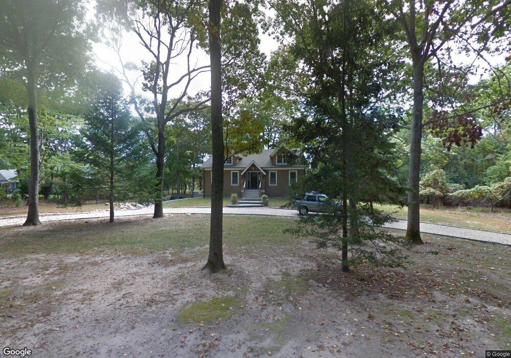
27 Stock Farm Ln Sag Harbor, NY 11963
Estimated Value: $3,160,000 - $3,893,000
3
Beds
4
Baths
1,748
Sq Ft
$2,041/Sq Ft
Est. Value
About This Home
This home is located at 27 Stock Farm Ln, Sag Harbor, NY 11963 and is currently estimated at $3,567,771, approximately $2,041 per square foot. 27 Stock Farm Ln is a home located in Suffolk County with nearby schools including Sag Harbor Elementary School and Pierson Middle/High School.
Ownership History
Date
Name
Owned For
Owner Type
Purchase Details
Closed on
Dec 1, 2017
Sold by
Ehrlich Brian H
Bought by
Caan William J and Caan Monica S
Current Estimated Value
Home Financials for this Owner
Home Financials are based on the most recent Mortgage that was taken out on this home.
Original Mortgage
$1,600,000
Interest Rate
3.94%
Mortgage Type
Stand Alone Refi Refinance Of Original Loan
Purchase Details
Closed on
Apr 12, 2001
Sold by
Featherman David L and Featherman Jo Anna M
Bought by
Ehrlich Brian H
Home Financials for this Owner
Home Financials are based on the most recent Mortgage that was taken out on this home.
Original Mortgage
$550,000
Interest Rate
6.87%
Mortgage Type
Purchase Money Mortgage
Create a Home Valuation Report for This Property
The Home Valuation Report is an in-depth analysis detailing your home's value as well as a comparison with similar homes in the area
Home Values in the Area
Average Home Value in this Area
Purchase History
| Date | Buyer | Sale Price | Title Company |
|---|---|---|---|
| Caan William J | $2,003,875 | -- | |
| Caan William J | $2,003,875 | -- | |
| Caan William J | $2,003,875 | -- | |
| Caan William J | $2,003,875 | -- | |
| Ehrlich Brian H | $695,000 | Ticor Title Insurance Compan | |
| Ehrlich Brian H | $695,000 | Ticor Title Insurance Compan |
Source: Public Records
Mortgage History
| Date | Status | Borrower | Loan Amount |
|---|---|---|---|
| Previous Owner | Caan William J | $1,600,000 | |
| Previous Owner | Ehrlich Brian H | $550,000 |
Source: Public Records
Tax History Compared to Growth
Tax History
| Year | Tax Paid | Tax Assessment Tax Assessment Total Assessment is a certain percentage of the fair market value that is determined by local assessors to be the total taxable value of land and additions on the property. | Land | Improvement |
|---|---|---|---|---|
| 2024 | $1,937 | $1,910,000 | $1,286,500 | $623,500 |
| 2023 | $12,609 | $1,910,000 | $1,286,500 | $623,500 |
| 2022 | $9,619 | $1,910,000 | $1,286,500 | $623,500 |
| 2021 | $9,619 | $1,966,700 | $1,286,500 | $680,200 |
| 2020 | $12,704 | $1,966,700 | $1,286,500 | $680,200 |
| 2019 | $12,509 | $0 | $0 | $0 |
| 2018 | -- | $1,830,700 | $1,286,500 | $544,200 |
| 2017 | $8,855 | $1,396,600 | $966,500 | $430,100 |
| 2016 | $9,186 | $1,396,600 | $966,500 | $430,100 |
| 2015 | -- | $1,235,600 | $805,500 | $430,100 |
| 2014 | -- | $1,235,600 | $805,500 | $430,100 |
Source: Public Records
Map
Nearby Homes
- 8 Widow Coopers Path
- 3 N Haven Way
- 27 Gardiners Path
- 9 Seaponack Dr
- 12 N Haven Way
- 26 Mashomuck Dr
- 32 Mashomuck Dr
- 24 On the Bluffs
- 33 Mashomuck Dr
- 31 Bayberry Ln
- 18 Sunset Rd
- 115 S Ferry Rd
- 2 Sunset Rd
- 9 & 7 Westmoreland Dr
- 15A / 15 & 13 S Menantic Rd
- 21 Thompson Rd
- 166 Ferry Rd
- 15 Maunakea St
- 27 Fresh Pond Rd
- 100 S Ferry Rd