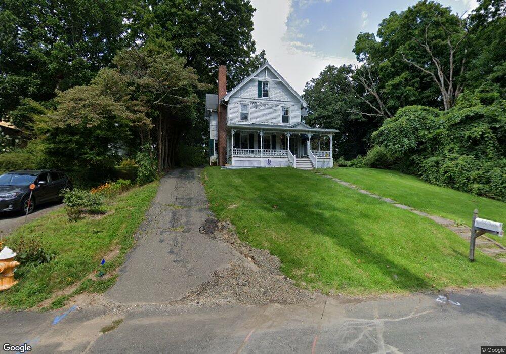
27 Summitt St Ivoryton, CT 06442
Estimated Value: $581,000 - $638,000
4
Beds
3
Baths
1,958
Sq Ft
$310/Sq Ft
Est. Value
About This Home
This home is located at 27 Summitt St, Ivoryton, CT 06442 and is currently estimated at $606,324, approximately $309 per square foot. 27 Summitt St is a home located in Middlesex County with nearby schools including Valley Regional High School.
Ownership History
Date
Name
Owned For
Owner Type
Purchase Details
Closed on
Aug 31, 2018
Sold by
Sarette Builders Llc
Bought by
Bowers Patrick M and Bowers Carol L
Current Estimated Value
Home Financials for this Owner
Home Financials are based on the most recent Mortgage that was taken out on this home.
Original Mortgage
$356,385
Outstanding Balance
$310,149
Interest Rate
4.5%
Mortgage Type
VA
Estimated Equity
$296,175
Create a Home Valuation Report for This Property
The Home Valuation Report is an in-depth analysis detailing your home's value as well as a comparison with similar homes in the area
Home Values in the Area
Average Home Value in this Area
Purchase History
| Date | Buyer | Sale Price | Title Company |
|---|---|---|---|
| Bowers Patrick M | $345,000 | -- | |
| Bowers Patrick M | $345,000 | -- |
Source: Public Records
Mortgage History
| Date | Status | Borrower | Loan Amount |
|---|---|---|---|
| Open | Bowers Patrick M | $356,385 | |
| Closed | Bowers Patrick M | $356,385 |
Source: Public Records
Tax History
| Year | Tax Paid | Tax Assessment Tax Assessment Total Assessment is a certain percentage of the fair market value that is determined by local assessors to be the total taxable value of land and additions on the property. | Land | Improvement |
|---|---|---|---|---|
| 2025 | $6,332 | $339,900 | $61,300 | $278,600 |
| 2024 | $6,135 | $339,900 | $61,300 | $278,600 |
| 2023 | $5,557 | $246,000 | $54,300 | $191,700 |
| 2022 | $5,572 | $246,000 | $54,300 | $191,700 |
| 2021 | $5,518 | $246,000 | $54,300 | $191,700 |
| 2020 | $5,365 | $246,000 | $54,300 | $191,700 |
| 2019 | $5,326 | $246,000 | $54,300 | $191,700 |
| 2018 | $1,250 | $57,200 | $57,200 | $0 |
| 2017 | $1,188 | $54,100 | $54,100 | $0 |
| 2016 | $1,167 | $54,100 | $54,100 | $0 |
Source: Public Records
Map
Nearby Homes
- 22 Ebony Ln
- 29 Mitchel Terrace
- 41 Bushy Hill Rd
- 120 Warsaw St
- 214 Kelsey Hill Rd
- 33 Deep River Rd
- 151 Bushy Hill Rd
- 97 Bushy Hill Rd
- 1 Lake Louise Dr
- 130 Dennison Rd
- 46 Hemlock Dr
- 113 Winthrop Rd
- 0 Glen Grove Rd
- 195 Bokum Rd
- 209 Main St
- 89 Book Hill Rd
- 207 Pettipaug Rd
- 35 Prospect St
- 163 Main St
- 112 Cedar Swamp Rd