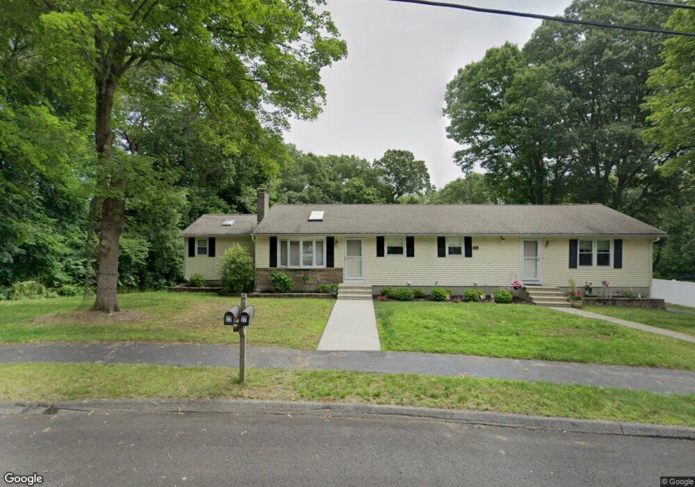
27 Tanager Dr Shrewsbury, MA 01545
Estimated Value: $656,000 - $754,000
4
Beds
3
Baths
1,952
Sq Ft
$361/Sq Ft
Est. Value
About This Home
This home is located at 27 Tanager Dr, Shrewsbury, MA 01545 and is currently estimated at $705,344, approximately $361 per square foot. 27 Tanager Dr is a home located in Worcester County with nearby schools including Calvin Coolidge Elementary School, Sherwood Middle School, and Oak Middle School.
Ownership History
Date
Name
Owned For
Owner Type
Purchase Details
Closed on
Jun 10, 2013
Sold by
Duhamel George A and Duhamel Mary A
Bought by
Duhamel Ft and Monopoli
Current Estimated Value
Purchase Details
Closed on
Apr 1, 1974
Bought by
Duhamel Ft
Create a Home Valuation Report for This Property
The Home Valuation Report is an in-depth analysis detailing your home's value as well as a comparison with similar homes in the area
Home Values in the Area
Average Home Value in this Area
Purchase History
| Date | Buyer | Sale Price | Title Company |
|---|---|---|---|
| Duhamel Ft | -- | -- | |
| Duhamel Ft | -- | -- | |
| Duhamel Ft | -- | -- | |
| Duhamel Ft | $31,500 | -- |
Source: Public Records
Mortgage History
| Date | Status | Borrower | Loan Amount |
|---|---|---|---|
| Previous Owner | Duhamel Ft | $53,000 | |
| Previous Owner | Duhamel Ft | $120,000 | |
| Previous Owner | Duhamel Ft | $40,000 |
Source: Public Records
Tax History Compared to Growth
Tax History
| Year | Tax Paid | Tax Assessment Tax Assessment Total Assessment is a certain percentage of the fair market value that is determined by local assessors to be the total taxable value of land and additions on the property. | Land | Improvement |
|---|---|---|---|---|
| 2025 | $79 | $658,700 | $311,000 | $347,700 |
| 2024 | $7,136 | $576,400 | $296,100 | $280,300 |
| 2023 | $7,114 | $542,200 | $296,100 | $246,100 |
| 2022 | $7,289 | $516,600 | $296,100 | $220,500 |
| 2021 | $5,851 | $443,600 | $236,900 | $206,700 |
| 2020 | $5,428 | $435,300 | $236,900 | $198,400 |
| 2019 | $5,232 | $416,200 | $223,900 | $192,300 |
| 2018 | $4,959 | $391,700 | $214,700 | $177,000 |
| 2017 | $4,642 | $361,800 | $184,800 | $177,000 |
| 2016 | $4,614 | $354,900 | $183,000 | $171,900 |
| 2015 | $4,521 | $342,500 | $168,600 | $173,900 |
Source: Public Records
Map
Nearby Homes
- 1 Dorianna Cir
- 259 S Quinsigamond Ave
- 190 S Quinsigamond Ave Unit 102
- 16 Nelson Point Rd
- 6 Meadowsweet Rd
- 76 Grove St
- 105 S Quinsigamond Ave
- 76 Hillside Dr
- 26 Browne Rd
- 7 Thoreau Cir
- 73 S Quinsigamond Ave
- 342 Lake Ave
- 10 Gleason Rd
- 241 Lake Ave
- 334 Bridle Path
- 40 Shrewsbury Green Dr Unit A
- 44 Ayrshire Rd
- 175 Oak St
- 23 Canna Dr
- 22 Shrewsbury Green Dr Unit C