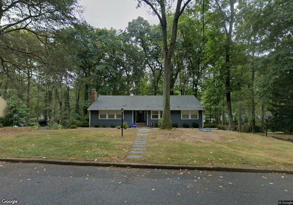
27 Tatum Dr Middletown, NJ 07748
New Monmouth NeighborhoodEstimated Value: $830,940 - $1,038,000
3
Beds
3
Baths
1,540
Sq Ft
$594/Sq Ft
Est. Value
About This Home
This home is located at 27 Tatum Dr, Middletown, NJ 07748 and is currently estimated at $914,985, approximately $594 per square foot. 27 Tatum Dr is a home located in Monmouth County with nearby schools including Nut Swamp Elementary School, Thompson Middle School, and Middletown - South High School.
Ownership History
Date
Name
Owned For
Owner Type
Purchase Details
Closed on
Jul 13, 2017
Sold by
Meyer Meyer C and Meyer Christina
Bought by
Tor Kevin L and Tor Loly G
Current Estimated Value
Create a Home Valuation Report for This Property
The Home Valuation Report is an in-depth analysis detailing your home's value as well as a comparison with similar homes in the area
Home Values in the Area
Average Home Value in this Area
Purchase History
| Date | Buyer | Sale Price | Title Company |
|---|---|---|---|
| Tor Kevin L | $575,000 | Allahead Title |
Source: Public Records
Tax History Compared to Growth
Tax History
| Year | Tax Paid | Tax Assessment Tax Assessment Total Assessment is a certain percentage of the fair market value that is determined by local assessors to be the total taxable value of land and additions on the property. | Land | Improvement |
|---|---|---|---|---|
| 2025 | $10,574 | $780,800 | $546,900 | $233,900 |
| 2024 | $10,524 | $642,800 | $413,200 | $229,600 |
| 2023 | $10,524 | $605,500 | $381,300 | $224,200 |
| 2022 | $10,928 | $563,400 | $327,500 | $235,900 |
| 2021 | $10,928 | $525,400 | $315,600 | $209,800 |
| 2020 | $11,094 | $518,900 | $310,600 | $208,300 |
| 2019 | $10,934 | $517,700 | $310,600 | $207,100 |
| 2018 | $10,651 | $491,500 | $303,800 | $187,700 |
| 2017 | $10,318 | $485,800 | $303,800 | $182,000 |
| 2016 | $9,321 | $437,400 | $268,800 | $168,600 |
| 2015 | $8,892 | $416,300 | $248,800 | $167,500 |
| 2014 | $8,579 | $391,900 | $238,800 | $153,100 |
Source: Public Records
Map
Nearby Homes
- 7 Cormorant Dr
- 83 Green Meadow Blvd
- 20 Cormorant Dr
- 234 Borden Rd
- 911 Middletown Lincroft Rd
- 185 Ballantine Rd
- 17 Terry Ln
- 74 Fish Hawk Dr
- 93 Wallace Rd
- 11 Mayflower Dr
- 246 Sunnyside Rd
- 111 Crawfords Corner Rd
- 45 Galloping Hill Cir
- 164 Heights Terrace
- 7 Boxwood Terrace Unit 250
- 86 Stillwell Rd
- 1476 W Front St
- 30 Winchester Ln
- 33 Winchester Ln
- 1497 W Front St