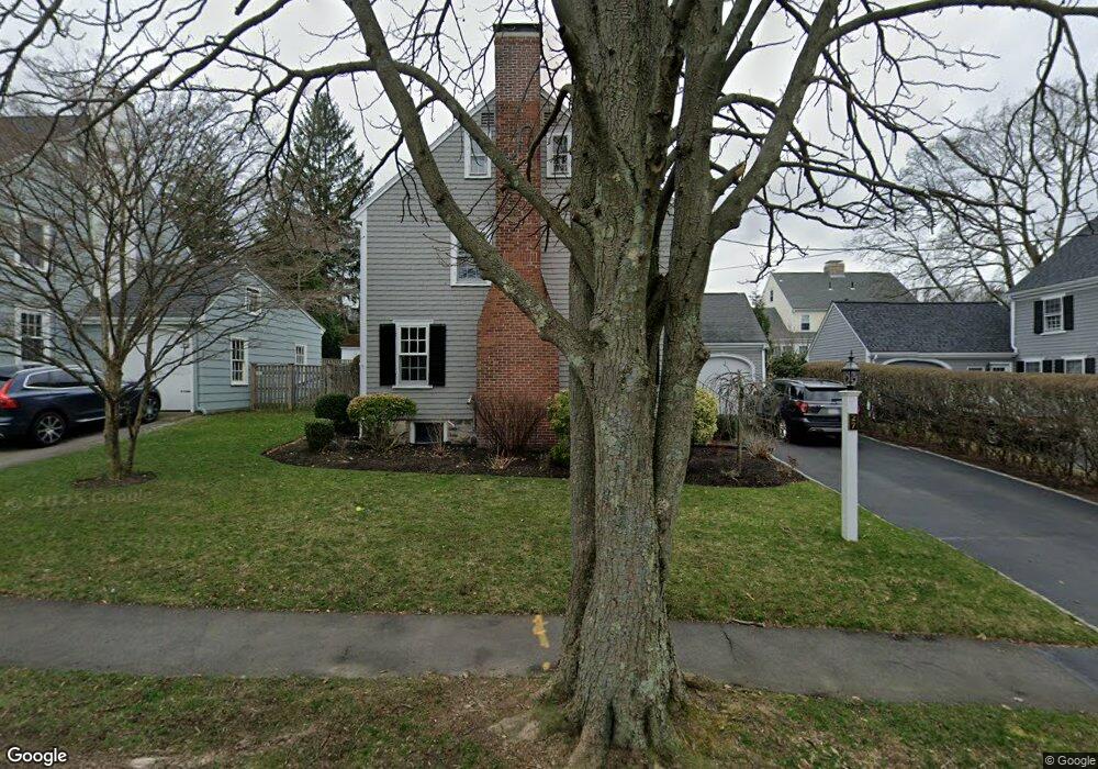
27 Thompson Ln Milton, MA 02186
Milton Center NeighborhoodEstimated Value: $1,109,919 - $1,254,000
3
Beds
2
Baths
1,687
Sq Ft
$703/Sq Ft
Est. Value
About This Home
This home is located at 27 Thompson Ln, Milton, MA 02186 and is currently estimated at $1,186,230, approximately $703 per square foot. 27 Thompson Ln is a home located in Norfolk County with nearby schools including Milton High School, St. Mary of the Hills School, and Milton Academy.
Ownership History
Date
Name
Owned For
Owner Type
Purchase Details
Closed on
Aug 15, 2008
Sold by
Bloom Terrie
Bought by
Mccarthy Stephen R and Mccarthy Tara C
Current Estimated Value
Home Financials for this Owner
Home Financials are based on the most recent Mortgage that was taken out on this home.
Original Mortgage
$417,000
Outstanding Balance
$274,627
Interest Rate
6.4%
Mortgage Type
Purchase Money Mortgage
Estimated Equity
$911,603
Purchase Details
Closed on
Oct 1, 2004
Sold by
Klw Thompson Nt
Bought by
Bloom Terrie
Purchase Details
Closed on
Nov 29, 1996
Sold by
Fandetti Brian P and Fandetti Cynthia A
Bought by
Disterhoft Kathleen L
Home Financials for this Owner
Home Financials are based on the most recent Mortgage that was taken out on this home.
Original Mortgage
$163,500
Interest Rate
7.82%
Mortgage Type
Purchase Money Mortgage
Purchase Details
Closed on
Jun 21, 1994
Sold by
Sullivan David G and Sullivan Susan C
Bought by
Fandetti Brian P and Fandetti Cynthia A
Purchase Details
Closed on
May 28, 1987
Sold by
Delany Richard M
Bought by
Sullivan David G
Create a Home Valuation Report for This Property
The Home Valuation Report is an in-depth analysis detailing your home's value as well as a comparison with similar homes in the area
Home Values in the Area
Average Home Value in this Area
Purchase History
| Date | Buyer | Sale Price | Title Company |
|---|---|---|---|
| Mccarthy Stephen R | $553,270 | -- | |
| Bloom Terrie | $605,000 | -- | |
| Disterhoft Kathleen L | $218,000 | -- | |
| Fandetti Brian P | $232,000 | -- | |
| Sullivan David G | $225,000 | -- |
Source: Public Records
Mortgage History
| Date | Status | Borrower | Loan Amount |
|---|---|---|---|
| Open | Mccarthy Stephen R | $417,000 | |
| Previous Owner | Sullivan David G | $200,000 | |
| Previous Owner | Sullivan David G | $162,000 | |
| Previous Owner | Sullivan David G | $163,500 |
Source: Public Records
Tax History Compared to Growth
Tax History
| Year | Tax Paid | Tax Assessment Tax Assessment Total Assessment is a certain percentage of the fair market value that is determined by local assessors to be the total taxable value of land and additions on the property. | Land | Improvement |
|---|---|---|---|---|
| 2025 | $11,133 | $1,003,900 | $540,200 | $463,700 |
| 2024 | $10,683 | $978,300 | $514,600 | $463,700 |
| 2023 | $9,941 | $872,000 | $457,400 | $414,600 |
| 2022 | $9,677 | $776,000 | $457,400 | $318,600 |
| 2021 | $9,769 | $744,000 | $440,600 | $303,400 |
| 2020 | $9,626 | $733,700 | $436,300 | $297,400 |
| 2019 | $9,388 | $712,300 | $423,600 | $288,700 |
| 2018 | $8,471 | $613,400 | $329,500 | $283,900 |
| 2017 | $7,926 | $584,500 | $313,800 | $270,700 |
| 2016 | $8,165 | $604,800 | $340,000 | $264,800 |
| 2015 | $7,544 | $541,200 | $292,900 | $248,300 |
Source: Public Records
Map
Nearby Homes
- 19 Lantern Ln
- 390 Central Ave
- 438 Central Ave Unit 2
- 290 Central Ave
- 54 Elm St
- 20 Herrick Dr
- 651 Canton Ave
- 137 Thacher St Unit 137
- 1 Chilton Park
- 96 Houston Ave
- 70 Warren Ave
- 32 Columbine Rd
- 10 Weston St
- 214 Brook Rd
- 15 Fairfax Rd
- 795 Brook Rd
- 333 Eliot St
- 27 Hawthorn Rd
- 29 Maitland St
- 128 Blue Hills Pkwy
- 23 Thompson Ln
- 46 Reedsdale Rd
- 42 Reedsdale Rd
- 15 Thompson Ln
- 37 Thompson Ln
- 30 Thompson Ln
- 26 Thompson Ln
- 1 Thompson Ln
- 34 Thompson Ln
- 22 Thompson Ln
- 36 Reedsdale Rd
- 38 Thompson Ln
- 41 Thompson Ln
- 32 Reedsdale Rd
- 6 Lantern Ln
- 42 Thompson Ln
- 27 Frothingham St
- 31 Frothingham St
- 23 Frothingham St
- 12 Thompson Ln